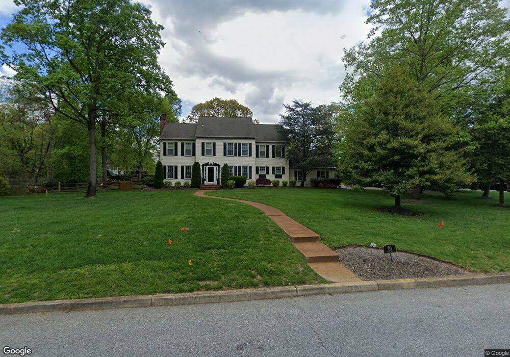
10 Cove Rd Moorestown, NJ 08057
Estimated Value: $973,000 - $1,088,000
5
Beds
3
Baths
2,823
Sq Ft
$364/Sq Ft
Est. Value
About This Home
This home is located at 10 Cove Rd, Moorestown, NJ 08057 and is currently estimated at $1,027,634, approximately $364 per square foot. 10 Cove Rd is a home located in Burlington County with nearby schools including South Valley Elementary School, Moorestown Upper Elementary School, and William Allen Middle School.
Ownership History
Date
Name
Owned For
Owner Type
Purchase Details
Closed on
Jun 13, 2008
Sold by
Bertino Kenneth and Bertino Nicholle
Bought by
Thul Frederick W and Thul Lindsey C
Current Estimated Value
Home Financials for this Owner
Home Financials are based on the most recent Mortgage that was taken out on this home.
Original Mortgage
$600,000
Outstanding Balance
$379,071
Interest Rate
5.75%
Mortgage Type
Purchase Money Mortgage
Estimated Equity
$648,563
Purchase Details
Closed on
Sep 30, 2003
Sold by
Smith Marie F
Bought by
Bertino Kenneth and Bertino Nicholle
Home Financials for this Owner
Home Financials are based on the most recent Mortgage that was taken out on this home.
Original Mortgage
$93,925
Interest Rate
6.05%
Mortgage Type
Credit Line Revolving
Create a Home Valuation Report for This Property
The Home Valuation Report is an in-depth analysis detailing your home's value as well as a comparison with similar homes in the area
Home Values in the Area
Average Home Value in this Area
Purchase History
| Date | Buyer | Sale Price | Title Company |
|---|---|---|---|
| Thul Frederick W | $670,000 | Integrity Title Agency Inc | |
| Bertino Kenneth | $599,500 | -- |
Source: Public Records
Mortgage History
| Date | Status | Borrower | Loan Amount |
|---|---|---|---|
| Open | Thul Frederick W | $600,000 | |
| Previous Owner | Bertino Kenneth | $93,925 | |
| Previous Owner | Bertino Kenneth | $475,600 |
Source: Public Records
Tax History Compared to Growth
Tax History
| Year | Tax Paid | Tax Assessment Tax Assessment Total Assessment is a certain percentage of the fair market value that is determined by local assessors to be the total taxable value of land and additions on the property. | Land | Improvement |
|---|---|---|---|---|
| 2025 | $15,388 | $542,400 | $208,300 | $334,100 |
| 2024 | $14,921 | $542,400 | $208,300 | $334,100 |
| 2023 | $14,921 | $542,400 | $208,300 | $334,100 |
| 2022 | $14,574 | $542,400 | $208,300 | $334,100 |
| 2021 | $14,574 | $542,400 | $208,300 | $334,100 |
| 2020 | $14,482 | $542,400 | $208,300 | $334,100 |
| 2019 | $14,227 | $542,400 | $208,300 | $334,100 |
| 2018 | $13,842 | $542,400 | $208,300 | $334,100 |
| 2017 | $13,961 | $542,400 | $208,300 | $334,100 |
| 2016 | $13,913 | $542,400 | $208,300 | $334,100 |
| 2015 | $13,744 | $542,400 | $208,300 | $334,100 |
| 2014 | $13,050 | $542,400 | $208,300 | $334,100 |
Source: Public Records
Map
Nearby Homes
- 12 Cove Rd
- 950 Bortons Landing Rd
- 42 Landing Ct
- 127 Oakmont Dr
- 14 Baltusrol Terrace
- 21 Beechnut Ln
- 8 Catalpa Ln
- 901 Mcelwee Rd
- 79 Tiffany Ln
- 101 Tiffany Ln
- 206 Club House Dr
- 5 Thornleigh Place
- 17 Thornleigh Place
- 40 Crestview Dr
- 150 Country Club Rd
- 359 Creek Rd
- 10 Tucker Ct
- 90 Torrington Ln
- 163 Tiffany Ln
- 218 Starboard Way