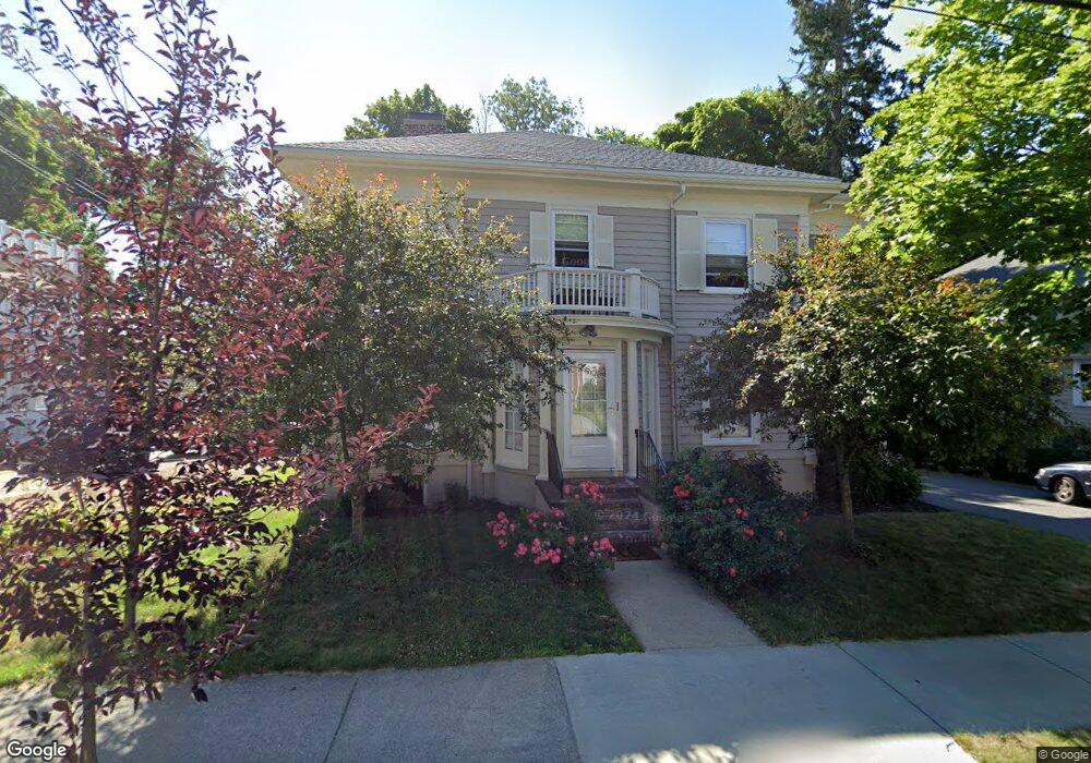
10 Crosby Rd Unit 12 Chestnut Hill, MA 02467
Chestnut Hill NeighborhoodEstimated Value: $1,584,000 - $2,524,000
6
Beds
4
Baths
3,132
Sq Ft
$678/Sq Ft
Est. Value
About This Home
This home is located at 10 Crosby Rd Unit 12, Chestnut Hill, MA 02467 and is currently estimated at $2,122,008, approximately $677 per square foot. 10 Crosby Rd Unit 12 is a home located in Middlesex County with nearby schools including Ward Elementary School, Bigelow Middle School, and Newton North High School.
Ownership History
Date
Name
Owned For
Owner Type
Purchase Details
Closed on
May 24, 2021
Sold by
Hartog Esther
Bought by
Hartog Esther and Hartog Michelle
Current Estimated Value
Home Financials for this Owner
Home Financials are based on the most recent Mortgage that was taken out on this home.
Original Mortgage
$490,000
Outstanding Balance
$440,725
Interest Rate
2.9%
Mortgage Type
New Conventional
Estimated Equity
$1,681,283
Purchase Details
Closed on
May 9, 1997
Sold by
Levey Robert L
Bought by
Levey Charlotte N
Create a Home Valuation Report for This Property
The Home Valuation Report is an in-depth analysis detailing your home's value as well as a comparison with similar homes in the area
Home Values in the Area
Average Home Value in this Area
Purchase History
| Date | Buyer | Sale Price | Title Company |
|---|---|---|---|
| Hartog Esther | -- | None Available | |
| Levey Charlotte N | $31,759 | -- |
Source: Public Records
Mortgage History
| Date | Status | Borrower | Loan Amount |
|---|---|---|---|
| Open | Hartog Esther | $490,000 |
Source: Public Records
Tax History Compared to Growth
Tax History
| Year | Tax Paid | Tax Assessment Tax Assessment Total Assessment is a certain percentage of the fair market value that is determined by local assessors to be the total taxable value of land and additions on the property. | Land | Improvement |
|---|---|---|---|---|
| 2025 | $14,054 | $1,434,100 | $1,150,400 | $283,700 |
| 2024 | $12,970 | $1,328,900 | $1,116,900 | $212,000 |
| 2023 | $12,415 | $1,219,500 | $898,900 | $320,600 |
| 2022 | $11,879 | $1,129,200 | $832,300 | $296,900 |
| 2021 | $11,147 | $1,036,000 | $763,600 | $272,400 |
| 2020 | $10,816 | $1,036,000 | $763,600 | $272,400 |
| 2019 | $10,118 | $968,200 | $713,600 | $254,600 |
| 2018 | $10,231 | $945,600 | $675,100 | $270,500 |
| 2017 | $9,647 | $867,500 | $619,400 | $248,100 |
| 2016 | $9,057 | $795,900 | $568,300 | $227,600 |
| 2015 | $8,636 | $743,800 | $531,100 | $212,700 |
Source: Public Records
Map
Nearby Homes
- 5 Hammond St
- 5 Merrill Rd
- 104 Woodchester Dr
- 67 Algonquin Rd
- 27-29 Commonwealth Ave Unit 5
- 154 Lake Shore Rd Unit 4
- 85 Gate House Rd
- 116 Lake Shore Rd Unit 4
- 9 The Ledges Rd
- 108 Lake Shore Rd Unit 4
- 142 Kenrick St Unit 36
- 23 Francis St Unit 23-1
- 21 Francis St Unit 21A
- 88 Essex Rd
- 44 Irving St
- 31 W Boulevard Rd
- 32-34 Larch St
- 32 Larch St Unit 34
- 34 Larch St Unit 34
- 2021 Commonwealth Ave Unit B
- 10 Crosby Rd Unit 2
- 20 Crosby Rd Unit 1
- 18 Crosby Rd Unit 20
- 18 Crosby Rd Unit 18
- 18 Crosby Rd Unit 1
- 200 Commonwealth Ave
- 200 Commonwealth Ave Unit 1
- 200 Commonwealth Ave Unit uni1 5-bed 2.5-bath
- 200 Commonwealth Ave
- 200 Commonwealth Ave Unit 1A
- 200 Commonwealth Ave Unit 1
- 200 Commonwealth Ave Unit U
- 200 Commonwealth Ave Unit 3
- 24 Crosby Rd Unit 24
- 194 Commonwealth Ave
- 22 Crosby Rd Unit 24
- 11 Crosby Rd Unit 15
- 15 Crosby Rd Unit 1
- 15 Crosby Rd
- 19 Priscilla Rd