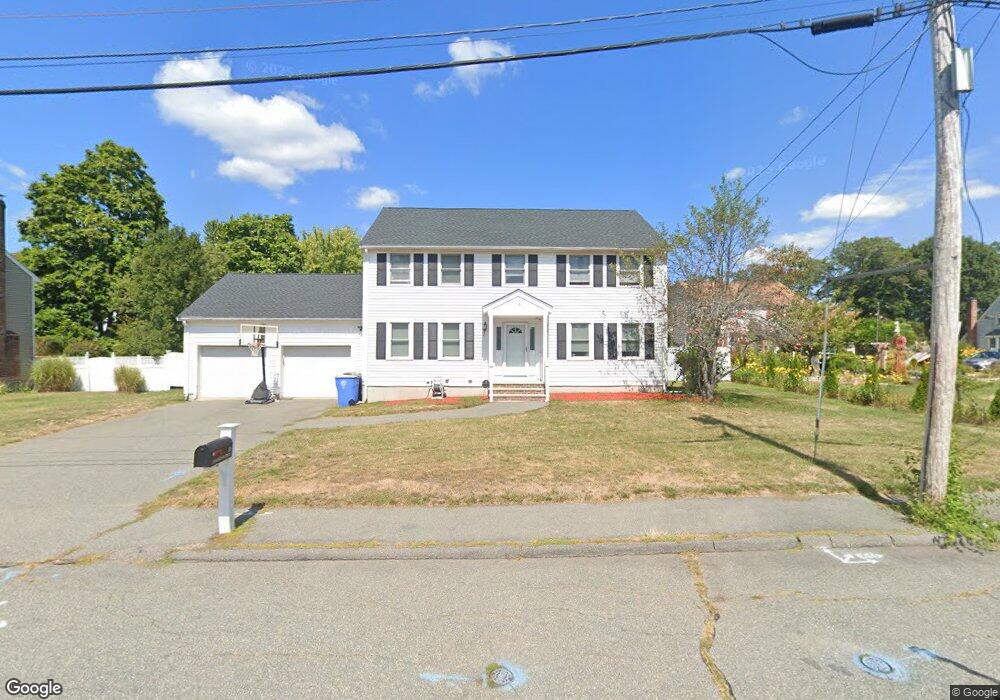
10 Cunningham Cir Randolph, MA 02368
North Randolph NeighborhoodEstimated Value: $749,000 - $894,000
4
Beds
3
Baths
2,149
Sq Ft
$373/Sq Ft
Est. Value
About This Home
This home is located at 10 Cunningham Cir, Randolph, MA 02368 and is currently estimated at $801,578, approximately $373 per square foot. 10 Cunningham Cir is a home located in Norfolk County with nearby schools including Randolph High School.
Ownership History
Date
Name
Owned For
Owner Type
Purchase Details
Closed on
Jan 10, 2014
Sold by
Young-Hong David and Young-Hong Sarah
Bought by
Ward Kami L
Current Estimated Value
Home Financials for this Owner
Home Financials are based on the most recent Mortgage that was taken out on this home.
Original Mortgage
$346,000
Outstanding Balance
$258,642
Interest Rate
4.29%
Mortgage Type
New Conventional
Estimated Equity
$542,936
Purchase Details
Closed on
Nov 24, 2008
Sold by
Wong Wing W and Wong Yan C
Bought by
Young-Hong David
Purchase Details
Closed on
Jul 18, 1997
Sold by
West Point Dev Co Inc
Bought by
Wong Yan C and Wong Wing W
Create a Home Valuation Report for This Property
The Home Valuation Report is an in-depth analysis detailing your home's value as well as a comparison with similar homes in the area
Home Values in the Area
Average Home Value in this Area
Purchase History
| Date | Buyer | Sale Price | Title Company |
|---|---|---|---|
| Ward Kami L | $390,000 | -- | |
| Young-Hong David | $360,000 | -- | |
| Wong Yan C | $204,693 | -- |
Source: Public Records
Mortgage History
| Date | Status | Borrower | Loan Amount |
|---|---|---|---|
| Open | Wong Yan C | $346,000 | |
| Previous Owner | Wong Yan C | $285,000 | |
| Previous Owner | Wong Yan C | $17,000 |
Source: Public Records
Tax History
| Year | Tax Paid | Tax Assessment Tax Assessment Total Assessment is a certain percentage of the fair market value that is determined by local assessors to be the total taxable value of land and additions on the property. | Land | Improvement |
|---|---|---|---|---|
| 2025 | $8,026 | $691,300 | $253,400 | $437,900 |
| 2024 | $7,659 | $668,900 | $248,500 | $420,400 |
| 2023 | $7,580 | $627,500 | $226,000 | $401,500 |
| 2022 | $7,204 | $529,700 | $188,300 | $341,400 |
| 2021 | $7,016 | $474,700 | $156,800 | $317,900 |
| 2020 | $6,818 | $457,300 | $156,800 | $300,500 |
| 2019 | $6,462 | $431,400 | $149,400 | $282,000 |
| 2018 | $6,654 | $419,000 | $135,800 | $283,200 |
| 2017 | $6,878 | $425,100 | $129,300 | $295,800 |
| 2016 | $6,759 | $388,700 | $117,600 | $271,100 |
| 2015 | $6,440 | $355,800 | $111,900 | $243,900 |
Source: Public Records
Map
Nearby Homes
- 10 Michael Rd
- 232 Canton St Unit 308
- 232 Canton St Unit 104
- 4 Franklin Square Unit 4F
- 902 Irving Rd Unit 902
- 51 Himoor Cir
- 195 High St
- 72 Canton St
- 23 Old St
- 9 Royal Crest Dr Unit 12
- 79 Gold St
- 875 N Main St
- 43 Emily Jeffers Rd
- 20 Simmonds Blvd Unit 20
- 18 Simmonds Blvd Unit 18
- 8 Simmonds Blvd Unit 8
- 22 Simmonds Blvd Unit 22
- 10 Simmonds Blvd Unit 10
- 24 Simmonds Blvd Unit 24
- 6 Simmonds Blvd Unit 6
- 12 Cunningham Cir
- 6 Cunningham Cir
- 84 Concetta Sass Dr
- 8 Concetta Sass Dr
- 18 Cunningham Cir
- 81 Concetta Sass Dr
- 9 Oconnell St
- 192 Canton St
- 12 Concetta Sass Dr
- 10 Oconnell St
- 80 Concetta Sass Dr
- 19 Cunningham Cir
- 22 Cunningham Cir
- 9 Concetta Sass Dr
- 18 Concetta Sass Dr
- 182 Canton St
- 178 Canton St Unit A1
- 178 Canton St
- 194 Canton St
- 3 Michael Rd
Your Personal Tour Guide
Ask me questions while you tour the home.