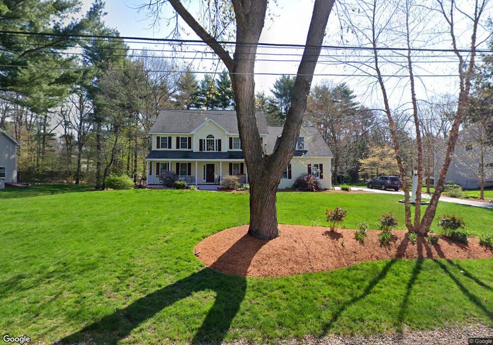
10 Curry Ln Sudbury, MA 01776
Estimated Value: $1,332,000 - $1,757,000
4
Beds
4
Baths
2,967
Sq Ft
$509/Sq Ft
Est. Value
About This Home
This home is located at 10 Curry Ln, Sudbury, MA 01776 and is currently estimated at $1,508,772, approximately $508 per square foot. 10 Curry Ln is a home located in Middlesex County with nearby schools including Josiah Haynes Elementary School, Ephraim Curtis Middle School, and Lincoln-Sudbury Regional High School.
Ownership History
Date
Name
Owned For
Owner Type
Purchase Details
Closed on
Jul 5, 2001
Sold by
Maillet& Sons Inc
Bought by
Gyory J Richard and Cornacchia Elizabeth
Current Estimated Value
Home Financials for this Owner
Home Financials are based on the most recent Mortgage that was taken out on this home.
Original Mortgage
$425,000
Outstanding Balance
$164,617
Interest Rate
7.21%
Mortgage Type
Purchase Money Mortgage
Estimated Equity
$1,344,155
Purchase Details
Closed on
Oct 18, 2000
Sold by
Spallone Richard J
Bought by
Maillet & Son Inc
Purchase Details
Closed on
Nov 30, 1998
Sold by
Grandstaff Steven R and Grandstaff Lisa M
Bought by
Spallone Richard J
Purchase Details
Closed on
Apr 12, 1995
Sold by
Davis Walter E and Davis Charlotte M
Bought by
Grandstaff Steven R and Grandstaff Lisa M
Create a Home Valuation Report for This Property
The Home Valuation Report is an in-depth analysis detailing your home's value as well as a comparison with similar homes in the area
Home Values in the Area
Average Home Value in this Area
Purchase History
| Date | Buyer | Sale Price | Title Company |
|---|---|---|---|
| Gyory J Richard | $775,900 | -- | |
| Maillet & Son Inc | $285,000 | -- | |
| Spallone Richard J | $223,000 | -- | |
| Grandstaff Steven R | $148,000 | -- |
Source: Public Records
Mortgage History
| Date | Status | Borrower | Loan Amount |
|---|---|---|---|
| Open | Grandstaff Steven R | $155,000 | |
| Open | Grandstaff Steven R | $425,000 |
Source: Public Records
Tax History Compared to Growth
Tax History
| Year | Tax Paid | Tax Assessment Tax Assessment Total Assessment is a certain percentage of the fair market value that is determined by local assessors to be the total taxable value of land and additions on the property. | Land | Improvement |
|---|---|---|---|---|
| 2025 | $19,667 | $1,343,400 | $361,900 | $981,500 |
| 2024 | $18,908 | $1,294,200 | $351,200 | $943,000 |
| 2023 | $17,792 | $1,128,200 | $337,500 | $790,700 |
| 2022 | $17,003 | $942,000 | $309,800 | $632,200 |
| 2021 | $16,175 | $859,000 | $309,800 | $549,200 |
| 2020 | $15,849 | $859,000 | $309,800 | $549,200 |
| 2019 | $15,385 | $859,000 | $309,800 | $549,200 |
| 2018 | $14,389 | $802,500 | $300,300 | $502,200 |
| 2017 | $14,098 | $794,700 | $297,200 | $497,500 |
| 2016 | $13,692 | $769,200 | $285,800 | $483,400 |
| 2015 | $12,941 | $735,300 | $261,300 | $474,000 |
| 2014 | $12,949 | $718,200 | $253,600 | $464,600 |
Source: Public Records
Map
Nearby Homes
- 11 Fox Hill Dr
- 371 Willis Rd
- 14 Buckmaster Dr
- 8 Oscars Way
- 104 Maynard Farm Rd
- 5 Taintor Dr
- 4 Willard Grant Rd
- 104 Mossman Rd
- 9 Anthony Dr
- 2 Hayes St Unit 2
- 6 Deer Path Unit 3
- 15 Deer Path Unit 3
- 15 Arthur St Unit 15
- 13 Arthur St Unit 15
- 369 Border Rd
- 28 Waltham St Unit B
- 22 Garfield Ave
- 22-26 Waltham St
- 11 Barnet Rd
- 69 Powder Mill Rd