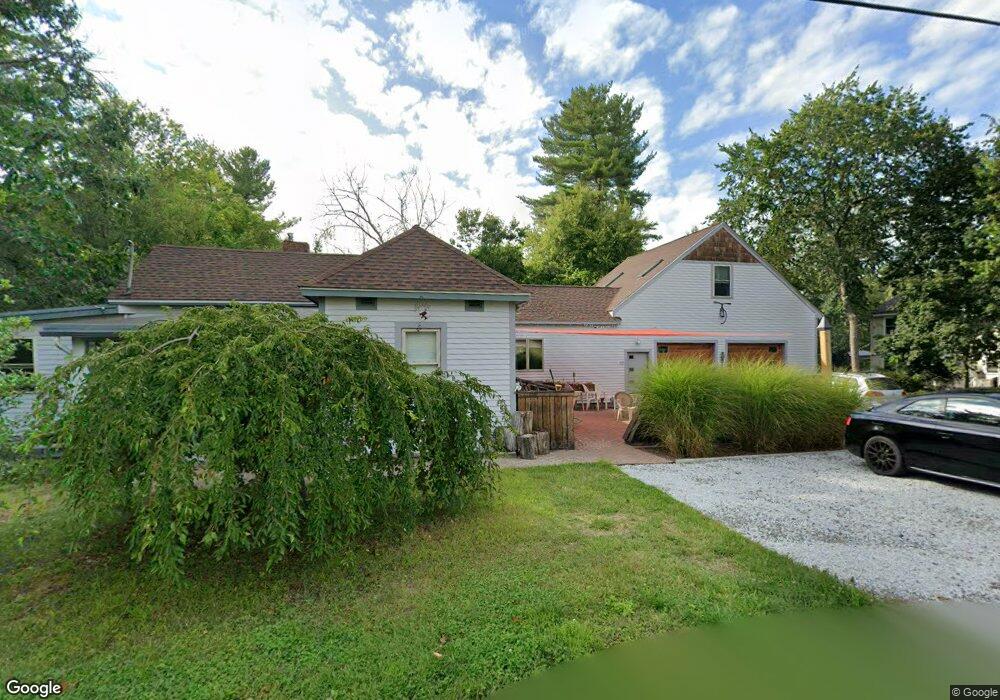
10 Cypress Rd Groton, MA 01450
Estimated Value: $314,000 - $413,000
2
Beds
1
Bath
972
Sq Ft
$386/Sq Ft
Est. Value
About This Home
This home is located at 10 Cypress Rd, Groton, MA 01450 and is currently estimated at $375,282, approximately $386 per square foot. 10 Cypress Rd is a home located in Middlesex County with nearby schools including Groton Dunstable Regional High School, Groton Community School, and Seven Hills At Groton.
Ownership History
Date
Name
Owned For
Owner Type
Purchase Details
Closed on
Feb 22, 2013
Sold by
Seira John
Bought by
Whittemore Gary P
Current Estimated Value
Purchase Details
Closed on
Jun 10, 2002
Sold by
Memont Paul R and Memont Maura C
Bought by
Whittenmore Gary T
Home Financials for this Owner
Home Financials are based on the most recent Mortgage that was taken out on this home.
Original Mortgage
$100,000
Interest Rate
6.9%
Mortgage Type
Purchase Money Mortgage
Create a Home Valuation Report for This Property
The Home Valuation Report is an in-depth analysis detailing your home's value as well as a comparison with similar homes in the area
Home Values in the Area
Average Home Value in this Area
Purchase History
| Date | Buyer | Sale Price | Title Company |
|---|---|---|---|
| Whittemore Gary P | $25,000 | -- | |
| Whittemore Gary P | $25,000 | -- | |
| Whittenmore Gary T | $145,000 | -- | |
| Whittenmore Gary T | $145,000 | -- |
Source: Public Records
Mortgage History
| Date | Status | Borrower | Loan Amount |
|---|---|---|---|
| Previous Owner | Whittenmore Gary T | $100,000 |
Source: Public Records
Tax History
| Year | Tax Paid | Tax Assessment Tax Assessment Total Assessment is a certain percentage of the fair market value that is determined by local assessors to be the total taxable value of land and additions on the property. | Land | Improvement |
|---|---|---|---|---|
| 2025 | $5,040 | $330,500 | $133,500 | $197,000 |
| 2024 | $4,507 | $298,700 | $133,500 | $165,200 |
| 2023 | $4,339 | $277,400 | $133,500 | $143,900 |
| 2022 | $4,141 | $240,900 | $117,300 | $123,600 |
| 2021 | $3,883 | $220,600 | $110,500 | $110,100 |
| 2020 | $3,351 | $192,800 | $103,100 | $89,700 |
| 2019 | $3,187 | $176,000 | $103,100 | $72,900 |
| 2018 | $3,314 | $174,800 | $110,500 | $64,300 |
| 2017 | $3,148 | $172,400 | $104,200 | $68,200 |
| 2016 | $3,183 | $169,500 | $105,200 | $64,300 |
| 2015 | $3,097 | $169,500 | $105,200 | $64,300 |
Source: Public Records
Map
Nearby Homes
- 52 Allens Trail
- 12 Oriole Dr
- 14 Island Rd
- 3-5 Roxanne Rd
- 176 Whiley Rd
- 227 Boston Rd
- 34 Shattuck St
- 95 Hummingbird Ln Unit 22
- 15 Oriole Dr
- 797 Boston Rd
- 23 Orion Way
- 0 Old Dunstable Rd
- 210 Indian Hill Rd
- 21 Blacksmith Row Unit 21
- 91 Chicopee Row
- Lot 13 Monarch Path
- Lot 2 Monarch Path
- Lot 12 Monarch Path
- Lot 1 Monarch Path
- Lot 6 Noble Path
- 12 Cypress Rd
- 8 Cypress Rd
- 14 Cypress Rd
- 15 Rhodenda Rd
- 9 Cypress Rd
- 9 Cypress Rd Unit single fam
- 11 Cypress Rd
- 11 Rhodenda Rd
- 5 Cypress Rd
- 0 Lost Lake Dr
- 19 Cypress Rd
- 0 Hemlock Rd Unit 72216471
- 0 Hemlock Rd
- 20 Cypress Rd
- 174 Lost Lake Dr
- 14 Whitewood Rd
- 23 Cypress Rd
- 159 Lost Lake Dr
- 176 Lost Lake Dr
- 148 Lost Lake Dr
Your Personal Tour Guide
Ask me questions while you tour the home.