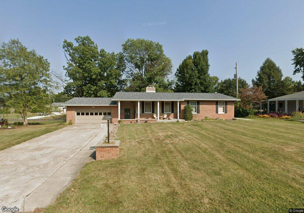
10 Davis Dr Jerseyville, IL 62052
Estimated Value: $217,005 - $304,000
--
Bed
--
Bath
1,482
Sq Ft
$166/Sq Ft
Est. Value
About This Home
This home is located at 10 Davis Dr, Jerseyville, IL 62052 and is currently estimated at $246,001, approximately $165 per square foot. 10 Davis Dr is a home located in Jersey County with nearby schools including Jersey Community High School, St Francis/Holy Ghost Catholic School, and Victory Baptist School.
Ownership History
Date
Name
Owned For
Owner Type
Purchase Details
Closed on
Apr 21, 2020
Sold by
David L Perdun Ret
Bought by
Russell Derek M and Russell Emily A
Current Estimated Value
Home Financials for this Owner
Home Financials are based on the most recent Mortgage that was taken out on this home.
Original Mortgage
$138,000
Outstanding Balance
$121,308
Interest Rate
3%
Mortgage Type
Purchase Money Mortgage
Estimated Equity
$124,693
Create a Home Valuation Report for This Property
The Home Valuation Report is an in-depth analysis detailing your home's value as well as a comparison with similar homes in the area
Home Values in the Area
Average Home Value in this Area
Purchase History
| Date | Buyer | Sale Price | Title Company |
|---|---|---|---|
| Russell Derek M | $57,500 | None Available |
Source: Public Records
Mortgage History
| Date | Status | Borrower | Loan Amount |
|---|---|---|---|
| Open | Russell Derek M | $138,000 |
Source: Public Records
Tax History Compared to Growth
Tax History
| Year | Tax Paid | Tax Assessment Tax Assessment Total Assessment is a certain percentage of the fair market value that is determined by local assessors to be the total taxable value of land and additions on the property. | Land | Improvement |
|---|---|---|---|---|
| 2024 | $4,938 | $69,780 | $11,775 | $58,005 |
| 2023 | $4,704 | $65,215 | $11,005 | $54,210 |
| 2022 | $4,513 | $60,950 | $10,285 | $50,665 |
| 2021 | $4,326 | $57,775 | $9,750 | $48,025 |
| 2020 | $3,458 | $55,555 | $9,375 | $46,180 |
| 2019 | $3,458 | $54,200 | $9,145 | $45,055 |
| 2018 | $3,523 | $53,795 | $9,075 | $44,720 |
| 2017 | $3,454 | $53,390 | $9,005 | $44,385 |
| 2016 | $3,445 | $53,765 | $9,070 | $44,695 |
| 2015 | -- | $54,585 | $9,210 | $45,375 |
| 2014 | -- | $54,670 | $9,225 | $45,445 |
Source: Public Records
Map
Nearby Homes
- 402 Minard St
- 809 N Giddings Ave
- 36 Witt Mill Rd
- 40 Witt Mill Rd
- 46 Witt Mill Rd
- 34 Witt Mill Rd
- 38 Witt Mill Rd
- 42 Witt Mill Rd
- 33 Witt Mill Rd
- 48 Witt Mill Rd
- 44 Witt Mill Rd
- 50 Witt Mill Rd
- 1137 Warren St
- 713 N State St
- 1141 Warren St
- 502 Snedeker St
- 405 Pleasant St
- 820 N Liberty St
- 418 Short St
- 105 Hollow Ave