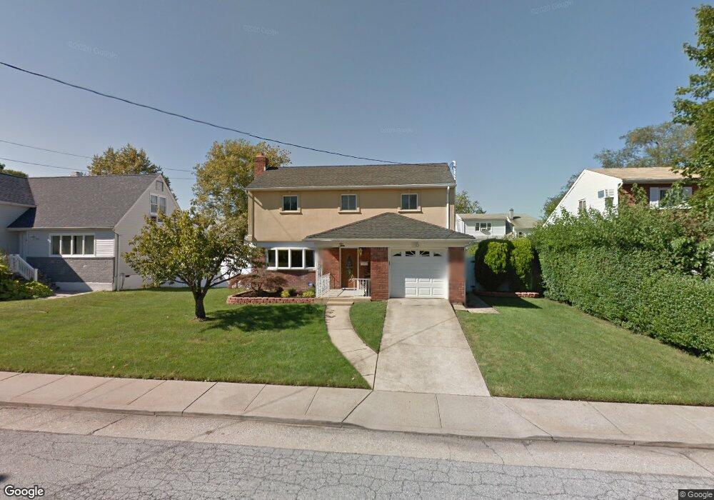
10 Davison Place Freeport, NY 11520
Estimated Value: $598,915 - $632,000
--
Bed
2
Baths
1,220
Sq Ft
$504/Sq Ft
Est. Value
About This Home
This home is located at 10 Davison Place, Freeport, NY 11520 and is currently estimated at $615,458, approximately $504 per square foot. 10 Davison Place is a home located in Nassau County with nearby schools including Columbus Avenue School, Caroline G. Atkinson Intermediate School, and John W Dodd Middle School.
Ownership History
Date
Name
Owned For
Owner Type
Purchase Details
Closed on
Jun 26, 2012
Sold by
Pollard Dexter and Pollard Janis
Bought by
Pollard Dexter and Pollard Janis
Current Estimated Value
Home Financials for this Owner
Home Financials are based on the most recent Mortgage that was taken out on this home.
Original Mortgage
$40,302
Outstanding Balance
$25,625
Interest Rate
3.76%
Estimated Equity
$589,833
Purchase Details
Closed on
May 22, 2002
Sold by
Walsh Loretta
Bought by
Pollard Dexter
Purchase Details
Closed on
Dec 8, 2001
Create a Home Valuation Report for This Property
The Home Valuation Report is an in-depth analysis detailing your home's value as well as a comparison with similar homes in the area
Home Values in the Area
Average Home Value in this Area
Purchase History
| Date | Buyer | Sale Price | Title Company |
|---|---|---|---|
| Pollard Dexter | -- | -- | |
| Pollard Dexter | $260,000 | -- | |
| -- | -- | -- |
Source: Public Records
Mortgage History
| Date | Status | Borrower | Loan Amount |
|---|---|---|---|
| Open | Pollard Dexter | $40,302 |
Source: Public Records
Tax History Compared to Growth
Tax History
| Year | Tax Paid | Tax Assessment Tax Assessment Total Assessment is a certain percentage of the fair market value that is determined by local assessors to be the total taxable value of land and additions on the property. | Land | Improvement |
|---|---|---|---|---|
| 2025 | $6,521 | $344 | $143 | $201 |
| 2024 | $769 | $362 | $151 | $211 |
| 2023 | $5,729 | $362 | $151 | $211 |
| 2022 | $5,729 | $362 | $151 | $211 |
| 2021 | $5,410 | $362 | $151 | $211 |
| 2020 | $2,615 | $487 | $439 | $48 |
| 2019 | $5,828 | $522 | $441 | $81 |
| 2018 | $6,122 | $557 | $0 | $0 |
| 2017 | $7,626 | $750 | $471 | $279 |
| 2016 | $8,752 | $750 | $471 | $279 |
| 2015 | $1,083 | $750 | $471 | $279 |
| 2014 | $1,083 | $750 | $471 | $279 |
| 2013 | $1,024 | $750 | $471 | $279 |
Source: Public Records
Map
Nearby Homes
- 159 Branch Ave
- 587 S Bayview Ave
- 171 Westside Ave
- 226 Westside Ave Unit B
- 214 Westend Ave Unit 6c
- 210 Westend Ave Unit 8B
- 153 Westend Ave
- 28 Florence Ave
- 31 Casino St Unit PH
- 8 Florence Ave Unit 16C
- 16 Johnson Place
- 173 Cedar St
- 77 Hampton Place
- 292 Westside Ave
- 59 Hampton Place Unit 20D
- 119 S Bay Ave
- 437 Ray St
- 300 Branch Ave
- 479 Roosevelt Ave
- 232 Nassau Ave
- 18 Davison Place
- 4 Davison Place
- 9 Noon Place
- 13 Noon Place
- 3 Noon Place
- 22 Davison Place
- 7 Davison Place
- 0 Branch Ave Unit 2962403
- 0 Branch Ave Unit 2819497
- 0 Branch Ave Unit 2849792
- 0 Branch Ave Unit 3163892
- 23 Davison Place
- 3 Davison Place
- 23 Noon Place
- 28 Davison Place
- 555 S Bayview Ave
- 137 Branch Ave
- 143 Branch Ave
- 135 Branch Ave
- 543 S Bayview Ave