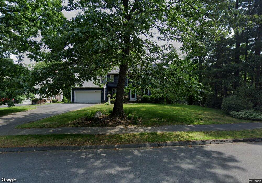
10 Deergrass Rd Shrewsbury, MA 01545
Estimated Value: $611,000 - $790,000
3
Beds
3
Baths
1,986
Sq Ft
$352/Sq Ft
Est. Value
About This Home
This home is located at 10 Deergrass Rd, Shrewsbury, MA 01545 and is currently estimated at $698,209, approximately $351 per square foot. 10 Deergrass Rd is a home located in Worcester County with nearby schools including Walter J. Paton Elementary School, Sherwood Middle School, and Oak Middle School.
Ownership History
Date
Name
Owned For
Owner Type
Purchase Details
Closed on
Apr 1, 2019
Sold by
Tonelli David A and Bank New York Mellon Tr
Bought by
Bank New York Mellon Tr
Current Estimated Value
Purchase Details
Closed on
Apr 15, 1992
Sold by
F N Murphy Properties
Bought by
Tonelli David A and Tonelli Marilyn
Home Financials for this Owner
Home Financials are based on the most recent Mortgage that was taken out on this home.
Original Mortgage
$180,450
Interest Rate
8.75%
Mortgage Type
Purchase Money Mortgage
Create a Home Valuation Report for This Property
The Home Valuation Report is an in-depth analysis detailing your home's value as well as a comparison with similar homes in the area
Home Values in the Area
Average Home Value in this Area
Purchase History
| Date | Buyer | Sale Price | Title Company |
|---|---|---|---|
| Bank New York Mellon Tr | $781,212 | -- | |
| Bank New York Mellon Tr | $781,212 | -- | |
| Bank New York Mellon Tr | $781,212 | -- | |
| Tonelli David A | $194,000 | -- | |
| Tonelli David A | $194,000 | -- |
Source: Public Records
Mortgage History
| Date | Status | Borrower | Loan Amount |
|---|---|---|---|
| Previous Owner | Tonelli David A | $284,000 | |
| Previous Owner | Tonelli David A | $235,000 | |
| Previous Owner | Tonelli David A | $180,450 |
Source: Public Records
Tax History Compared to Growth
Tax History
| Year | Tax Paid | Tax Assessment Tax Assessment Total Assessment is a certain percentage of the fair market value that is determined by local assessors to be the total taxable value of land and additions on the property. | Land | Improvement |
|---|---|---|---|---|
| 2025 | $8,769 | $728,300 | $285,600 | $442,700 |
| 2024 | $8,626 | $696,800 | $272,000 | $424,800 |
| 2023 | $8,116 | $618,600 | $272,000 | $346,600 |
| 2022 | $7,096 | $502,900 | $213,700 | $289,200 |
| 2021 | $6,358 | $482,000 | $213,700 | $268,300 |
| 2020 | $6,052 | $485,300 | $213,700 | $271,600 |
| 2019 | $5,765 | $458,600 | $198,800 | $259,800 |
| 2018 | $5,673 | $448,100 | $185,600 | $262,500 |
| 2017 | $5,412 | $421,800 | $168,100 | $253,700 |
| 2016 | $5,413 | $416,400 | $157,100 | $259,300 |
| 2015 | $5,221 | $395,500 | $141,800 | $253,700 |
Source: Public Records
Map
Nearby Homes
- 56 Ireta Rd
- 307 Main St
- 1 Temple Ct
- 10 Crane Cir
- 14 Minuteman Way
- 7 Tern Dr
- 15 Eagle Dr
- 40 Phillips Ave
- 5A Wigwam Hill Dr Unit A
- 655 Plantation St Unit 17 Bldg B
- 15 Eaglehead Terrace Unit 2
- 15 Eaglehead Terrace Unit 5
- 5 Fyrbeck Ave
- 19 Eaglehead Terrace Unit 2
- 19 Eaglehead Terrace Unit 4
- 163 N Lake Ave Unit A
- 163 N Lake Ave
- 6 Selina St
- 64 Wauwinet Rd
- 22 Ridge Rd