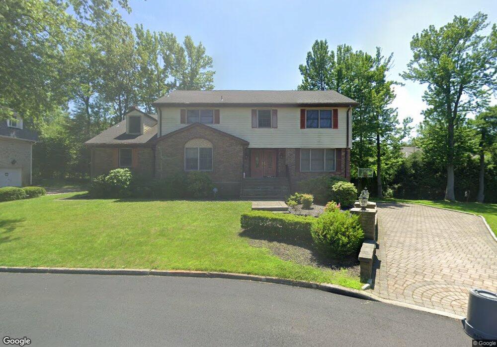
10 Demarest Ct Englewood Cliffs, NJ 07632
Estimated Value: $1,816,712 - $2,143,000
--
Bed
--
Bath
3,404
Sq Ft
$590/Sq Ft
Est. Value
About This Home
This home is located at 10 Demarest Ct, Englewood Cliffs, NJ 07632 and is currently estimated at $2,008,678, approximately $590 per square foot. 10 Demarest Ct is a home located in Bergen County with nearby schools including North Cliff Elementary School, Upper School Elementary School, and Dwight-Englewood School.
Ownership History
Date
Name
Owned For
Owner Type
Purchase Details
Closed on
Sep 9, 2002
Sold by
Rosenberg Michael E
Bought by
Lee Robert B and Lee Wendy
Current Estimated Value
Home Financials for this Owner
Home Financials are based on the most recent Mortgage that was taken out on this home.
Original Mortgage
$575,000
Outstanding Balance
$240,372
Interest Rate
6.25%
Mortgage Type
Purchase Money Mortgage
Estimated Equity
$1,768,306
Purchase Details
Closed on
Jun 30, 1998
Sold by
Cordero James and Cordero Consolacion
Bought by
Rosenberg Michael E and Rosenberg Suzanne
Create a Home Valuation Report for This Property
The Home Valuation Report is an in-depth analysis detailing your home's value as well as a comparison with similar homes in the area
Home Values in the Area
Average Home Value in this Area
Purchase History
| Date | Buyer | Sale Price | Title Company |
|---|---|---|---|
| Lee Robert B | $875,000 | -- | |
| Rosenberg Michael E | $724,000 | Chicago Title Insurance Co |
Source: Public Records
Mortgage History
| Date | Status | Borrower | Loan Amount |
|---|---|---|---|
| Open | Lee Robert B | $575,000 |
Source: Public Records
Tax History Compared to Growth
Tax History
| Year | Tax Paid | Tax Assessment Tax Assessment Total Assessment is a certain percentage of the fair market value that is determined by local assessors to be the total taxable value of land and additions on the property. | Land | Improvement |
|---|---|---|---|---|
| 2025 | $15,219 | $1,317,700 | $991,500 | $326,200 |
| 2024 | $15,035 | $1,317,700 | $991,500 | $326,200 |
| 2023 | $14,798 | $1,317,700 | $991,500 | $326,200 |
| 2022 | $14,798 | $1,317,700 | $991,500 | $326,200 |
| 2021 | $14,811 | $1,317,700 | $991,500 | $326,200 |
| 2020 | $15,167 | $1,317,700 | $991,500 | $326,200 |
| 2019 | $14,244 | $1,317,700 | $991,500 | $326,200 |
| 2018 | $13,744 | $1,317,700 | $991,500 | $326,200 |
| 2017 | $13,151 | $1,317,700 | $991,500 | $326,200 |
| 2016 | $12,900 | $1,317,700 | $991,500 | $326,200 |
| 2015 | $12,255 | $1,317,700 | $991,500 | $326,200 |
| 2014 | $11,464 | $1,317,700 | $991,500 | $326,200 |
Source: Public Records
Map
Nearby Homes
- 148 Demarest Ave
- 2 Maple St
- 45 Marjorie Terrace
- 30 Reiner Place
- 519 E Palisade Ave
- 577 Floyd St
- 645 Summit St
- 244 Fairview Ave
- 12 Kira Ln
- 48 S Woodland St
- 231 N Woodland St
- 48 Cambridge Place
- 277 Walnut St
- 320 Mountain Rd
- 379 Mauro Rd
- 2 Connor Dr
- 285 Maple St
- 14 Allison Dr
- 294 Oakwood Rd
- 185 E Palisade Ave Unit A4B