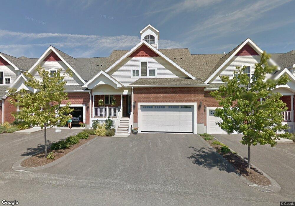
10 Dexter Rd Foxboro, MA 02035
Estimated Value: $728,000 - $789,000
2
Beds
3
Baths
2,084
Sq Ft
$370/Sq Ft
Est. Value
About This Home
This home is located at 10 Dexter Rd, Foxboro, MA 02035 and is currently estimated at $771,034, approximately $369 per square foot. 10 Dexter Rd is a home located in Norfolk County with nearby schools including Foxborough High School, Foxborough Regional Charter School, and The Sage School.
Ownership History
Date
Name
Owned For
Owner Type
Purchase Details
Closed on
Oct 27, 2024
Sold by
Manigault George W and Manigault Catherine
Bought by
George & C Manigault Ft and Manigault
Current Estimated Value
Purchase Details
Closed on
Dec 6, 2016
Sold by
King Douglas A
Bought by
Manigault George W and Manigault Catherine
Home Financials for this Owner
Home Financials are based on the most recent Mortgage that was taken out on this home.
Original Mortgage
$516,500
Interest Rate
3.52%
Mortgage Type
VA
Purchase Details
Closed on
Dec 3, 2010
Sold by
Decoste Richard P and Decoste Joyce M
Bought by
King Douglas A
Purchase Details
Closed on
Dec 16, 2008
Sold by
King & Foxboro Llc
Bought by
Decoste Richard P and Decoste Joyce M
Create a Home Valuation Report for This Property
The Home Valuation Report is an in-depth analysis detailing your home's value as well as a comparison with similar homes in the area
Home Values in the Area
Average Home Value in this Area
Purchase History
| Date | Buyer | Sale Price | Title Company |
|---|---|---|---|
| George & C Manigault Ft | -- | None Available | |
| Manigault George W | $500,000 | -- | |
| King Douglas A | $436,400 | -- | |
| Decoste Richard P | $439,000 | -- |
Source: Public Records
Mortgage History
| Date | Status | Borrower | Loan Amount |
|---|---|---|---|
| Previous Owner | Manigault George W | $516,500 |
Source: Public Records
Tax History
| Year | Tax Paid | Tax Assessment Tax Assessment Total Assessment is a certain percentage of the fair market value that is determined by local assessors to be the total taxable value of land and additions on the property. | Land | Improvement |
|---|---|---|---|---|
| 2025 | $7,911 | $598,400 | $0 | $598,400 |
| 2024 | $7,462 | $552,300 | $0 | $552,300 |
| 2023 | $7,770 | $546,800 | $0 | $546,800 |
| 2022 | $7,511 | $517,300 | $0 | $517,300 |
| 2021 | $7,100 | $481,700 | $0 | $481,700 |
| 2020 | $7,018 | $481,700 | $0 | $481,700 |
| 2019 | $7,075 | $481,300 | $0 | $481,300 |
| 2018 | $6,721 | $461,300 | $0 | $461,300 |
| 2017 | $6,333 | $421,100 | $0 | $421,100 |
| 2016 | $6,310 | $425,800 | $0 | $425,800 |
| 2015 | $6,178 | $406,700 | $0 | $406,700 |
| 2014 | $6,096 | $406,700 | $0 | $406,700 |
Source: Public Records
Map
Nearby Homes
- 54 Main St Unit A
- 5 Post Rd
- 14 Baker St
- 73 Ridge Rd
- 26 Fuller Rd Unit 6
- 147 Chestnut St Unit A
- 147 Chestnut St Unit B
- 67 Carpenter St
- 8 Conway Ln
- 165 Chestnut St Unit 2
- 13 Summerville Rd Unit 13
- 131 Washington St Unit 42
- 131 Washington St Unit 50
- 120 Beach St
- 65 Foxboro Rd
- 75 Foxboro Rd
- 157 Central St
- 155 South St
- 260 Summer St
- 1 Maura Elizabeth Ln
- 4 Dexter Rd Unit 4
- 7 Capone Rd Unit 7
- 5 Capone Rd Unit 5
- 4 Dexter Rd Unit 5-2
- 4 Dexter Rd Unit 2-4
- 8 Dexter Rd
- 4 Dexter Rd
- 3 Capone Rd Unit 3
- 11 Capone Rd Unit 11
- 12 Capone Rd Unit 12
- 1 Capone Rd Unit 1
- 8 Dexter Rd Unit 8
- 1 Capone Rd
- 6 Capone Rd
- 10 Capone Rd Unit 2-10
- 18 Capone Rd Unit 18
- 18 Capone Rd Unit 6-18
- 20 Capone Rd Unit 6-20
- 8 Dexter Rd Unit 5-4
- 6 Capone Rd Unit 6
Your Personal Tour Guide
Ask me questions while you tour the home.