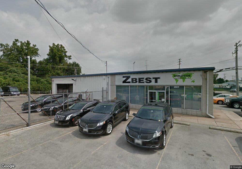
10 Dover Rd NE Glen Burnie, MD 21060
Estimated Value: $2,002,880
--
Bed
--
Bath
3,200
Sq Ft
$626/Sq Ft
Est. Value
About This Home
This home is located at 10 Dover Rd NE, Glen Burnie, MD 21060 and is currently priced at $2,002,880, approximately $625 per square foot. 10 Dover Rd NE is a home located in Anne Arundel County with nearby schools including North Glen Elementary School, Lindale Middle School, and North County High School.
Ownership History
Date
Name
Owned For
Owner Type
Purchase Details
Closed on
Mar 14, 2025
Sold by
Tate Veterans Highway Llc and Tate Holdings Llc
Bought by
Acorn Dover Road Glen Burnie Llc
Current Estimated Value
Purchase Details
Closed on
Jan 29, 2021
Sold by
Onal Brothers Partnership
Bought by
Tate Veterans Highway Llc
Purchase Details
Closed on
Jun 27, 1991
Sold by
Johnson Sandra W
Bought by
Onal Brothers Ptnshp
Home Financials for this Owner
Home Financials are based on the most recent Mortgage that was taken out on this home.
Original Mortgage
$350,000
Interest Rate
9.65%
Create a Home Valuation Report for This Property
The Home Valuation Report is an in-depth analysis detailing your home's value as well as a comparison with similar homes in the area
Home Values in the Area
Average Home Value in this Area
Purchase History
| Date | Buyer | Sale Price | Title Company |
|---|---|---|---|
| Acorn Dover Road Glen Burnie Llc | $12,000,000 | Chicago Title | |
| Acorn Dover Road Glen Burnie Llc | $12,000,000 | Chicago Title | |
| Tate Veterans Highway Llc | $1,700,000 | Eagle Title Llc | |
| Onal Brothers Ptnshp | $400,000 | -- |
Source: Public Records
Mortgage History
| Date | Status | Borrower | Loan Amount |
|---|---|---|---|
| Previous Owner | Onal Brothers Ptnshp | $350,000 |
Source: Public Records
Tax History Compared to Growth
Tax History
| Year | Tax Paid | Tax Assessment Tax Assessment Total Assessment is a certain percentage of the fair market value that is determined by local assessors to be the total taxable value of land and additions on the property. | Land | Improvement |
|---|---|---|---|---|
| 2025 | $18,080 | $1,566,400 | $654,500 | $911,900 |
| 2024 | $18,080 | $1,499,300 | $0 | $0 |
| 2023 | $17,200 | $1,432,200 | $0 | $0 |
| 2022 | $15,751 | $1,365,100 | $654,500 | $710,600 |
| 2021 | $31,480 | $1,364,067 | $0 | $0 |
| 2020 | $15,752 | $1,363,033 | $0 | $0 |
| 2019 | $28,982 | $1,362,000 | $595,000 | $767,000 |
| 2018 | $11,762 | $1,159,967 | $0 | $0 |
| 2017 | $8,705 | $957,933 | $0 | $0 |
| 2016 | -- | $755,900 | $0 | $0 |
| 2015 | -- | $753,567 | $0 | $0 |
| 2014 | -- | $751,133 | $0 | $0 |
Source: Public Records
Map
Nearby Homes
- 28 W Furnace Branch Rd
- 104 Wellham Ave NW
- 103 Janelin Dr
- 307 Shipley Ave
- 1203 Branch Ln
- 6800 White Water Way Unit 203
- 6801 White Water Way Unit 301
- 413 Glenwood Ave
- 933 Andrews Rd
- 202 Juneberry Way Unit 2C
- 6608 Rapid Water Way Unit 102
- 308 Blue Water Ct Unit 102
- 6528 Clear Drop Ct Unit 203
- 302 Juneberry Way Unit 1D
- 6603 Rapid Water Way Unit 203
- 105 Water Fountain Way Unit 203
- 6515 Polynesian Ln
- 6503 Home Water Way Unit 302
- 1611 Tieman Dr
- 6609 Fable Ct
- 6815 Ritchie Hwy
- 6811 Ritchie Hwy
- 6807 Ritchie Hwy
- 6901 Ritchie Hwy
- 65 Dover Rd NE
- 99 Holsum Way
- 6816 Ritchie Hwy
- 6814 Ritchie Hwy
- 1417 Crain Hwy N
- 6902 Ritchie Hwy
- 101 Holsum Way Unit D
- 101 Holsum Way
- 6801 Ritchie Hwy
- 6905 Ritchie Hwy
- 6906 Ritchie Hwy
- 6909 Ritchie Hwy
- 1410 Crain Hwy S Unit 3BPH
- 1410 Crain Hwy S Unit 2B
- 1410 Crain Hwy S Unit 2B PH
- 1410 Crain Hwy S Unit 4-5-6B
