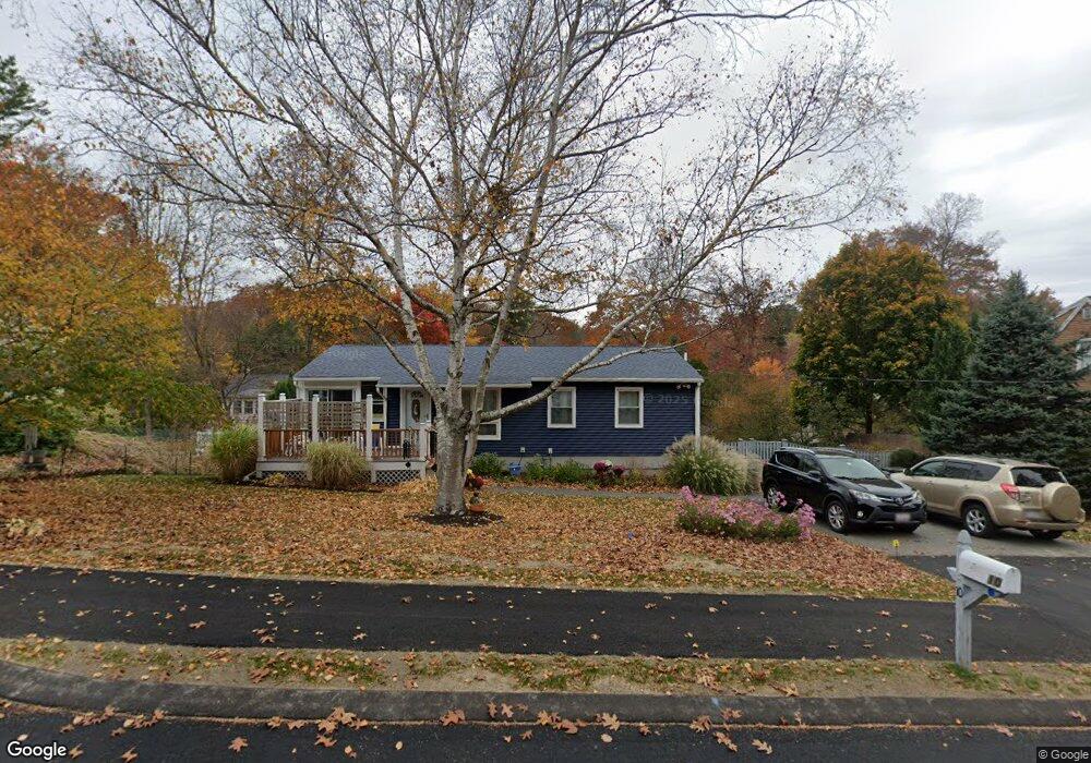
10 Drew St Newburyport, MA 01950
Estimated Value: $683,000 - $894,000
3
Beds
2
Baths
1,600
Sq Ft
$483/Sq Ft
Est. Value
About This Home
This home is located at 10 Drew St, Newburyport, MA 01950 and is currently estimated at $773,125, approximately $483 per square foot. 10 Drew St is a home located in Essex County with nearby schools including Francis T. Bresnahan Elementary School, Edward G. Molin Elementary School, and Rupert A. Nock Middle School.
Ownership History
Date
Name
Owned For
Owner Type
Purchase Details
Closed on
Jul 29, 2011
Sold by
Senter Sharron
Bought by
Davison Valerie J
Current Estimated Value
Purchase Details
Closed on
Aug 22, 2007
Sold by
Dowling James C and Dowling Kimberly M
Bought by
Senter Sharron L
Purchase Details
Closed on
Jun 30, 2003
Sold by
Arnold Erik P and Arnold Julie
Bought by
Dowling James C
Purchase Details
Closed on
Feb 12, 1999
Sold by
Keilty Christopher F and Keilty Susan F
Bought by
Arnold Erik P and Arnold Julie
Create a Home Valuation Report for This Property
The Home Valuation Report is an in-depth analysis detailing your home's value as well as a comparison with similar homes in the area
Home Values in the Area
Average Home Value in this Area
Purchase History
| Date | Buyer | Sale Price | Title Company |
|---|---|---|---|
| Davison Valerie J | $325,000 | -- | |
| Senter Sharron L | $360,000 | -- | |
| Dowling James C | $335,000 | -- | |
| Arnold Erik P | $155,500 | -- |
Source: Public Records
Mortgage History
| Date | Status | Borrower | Loan Amount |
|---|---|---|---|
| Open | Arnold Erik P | $258,500 | |
| Closed | Arnold Erik P | $259,000 |
Source: Public Records
Tax History Compared to Growth
Tax History
| Year | Tax Paid | Tax Assessment Tax Assessment Total Assessment is a certain percentage of the fair market value that is determined by local assessors to be the total taxable value of land and additions on the property. | Land | Improvement |
|---|---|---|---|---|
| 2025 | $6,212 | $648,400 | $401,300 | $247,100 |
| 2024 | $6,010 | $602,800 | $364,800 | $238,000 |
| 2023 | $5,623 | $523,600 | $317,200 | $206,400 |
| 2022 | $5,233 | $435,700 | $264,300 | $171,400 |
| 2021 | $4,927 | $389,800 | $240,300 | $149,500 |
| 2020 | $4,887 | $380,600 | $240,300 | $140,300 |
| 2019 | $4,789 | $366,100 | $240,300 | $125,800 |
| 2018 | $4,673 | $352,400 | $228,900 | $123,500 |
| 2017 | $4,593 | $341,500 | $218,000 | $123,500 |
| 2016 | $4,405 | $329,000 | $207,600 | $121,400 |
| 2015 | $4,227 | $316,900 | $207,600 | $109,300 |
Source: Public Records
Map
Nearby Homes
- 7 Frances Dr
- 232 Low St Unit 7
- 8 Brown Ave
- 8 Hart Rd
- 61 Spofford St
- 17 Alberta Ave
- 42 Myrtle Ave
- 6 Storey Ave
- 28 Beacon St
- 572 Merrimac St
- 510 Merrimac St Unit 512
- 60 Merrimac St Unit 604
- 8 Riverview Heights
- 19 Cutter Ln Unit 19
- 492 Merrimac St
- 138 Low St
- 47 Cutter Ln Unit 47
- 13 Bailey Pond Ln Unit 13
- 110 Low St
- 35 Merrimac St