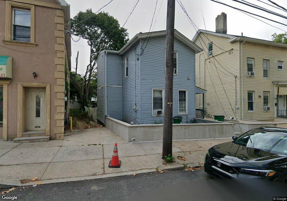
10 Drift St Unit 1 New Brunswick, NJ 08901
Estimated Value: $321,000 - $383,101
4
Beds
2
Baths
1,402
Sq Ft
$254/Sq Ft
Est. Value
About This Home
This home is located at 10 Drift St Unit 1, New Brunswick, NJ 08901 and is currently estimated at $356,025, approximately $253 per square foot. 10 Drift St Unit 1 is a home located in Middlesex County with nearby schools including New Brunswick High School and Central Jersey College Prep Charter School.
Ownership History
Date
Name
Owned For
Owner Type
Purchase Details
Closed on
Feb 14, 2024
Sold by
Spisso Stephen and Spisso Jennifer Grace
Bought by
Sukkah Realty Llc
Current Estimated Value
Purchase Details
Closed on
Oct 6, 2005
Sold by
10 Drift Street Llc
Bought by
Spisso Stephen and Gebbia Jennifer Grace
Home Financials for this Owner
Home Financials are based on the most recent Mortgage that was taken out on this home.
Original Mortgage
$165,200
Interest Rate
6.06%
Purchase Details
Closed on
Oct 12, 2001
Sold by
Dev Dabas
Bought by
10 Drift St Llc
Purchase Details
Closed on
Jul 2, 1997
Sold by
Hale Reid
Bought by
Dev Dabas and Dabas Sumedha
Create a Home Valuation Report for This Property
The Home Valuation Report is an in-depth analysis detailing your home's value as well as a comparison with similar homes in the area
Home Values in the Area
Average Home Value in this Area
Purchase History
| Date | Buyer | Sale Price | Title Company |
|---|---|---|---|
| Sukkah Realty Llc | $279,000 | Meister Abstract | |
| Spisso Stephen | $206,500 | -- | |
| 10 Drift St Llc | -- | -- | |
| Dev Dabas | $13,000 | -- |
Source: Public Records
Mortgage History
| Date | Status | Borrower | Loan Amount |
|---|---|---|---|
| Previous Owner | Spisso Stephen | $165,200 |
Source: Public Records
Tax History Compared to Growth
Tax History
| Year | Tax Paid | Tax Assessment Tax Assessment Total Assessment is a certain percentage of the fair market value that is determined by local assessors to be the total taxable value of land and additions on the property. | Land | Improvement |
|---|---|---|---|---|
| 2025 | $4,486 | $171,300 | $84,300 | $87,000 |
| 2024 | $4,356 | $171,300 | $84,300 | $87,000 |
| 2023 | $4,356 | $171,300 | $84,300 | $87,000 |
| 2022 | $4,264 | $171,300 | $84,300 | $87,000 |
| 2021 | $3,163 | $171,300 | $84,300 | $87,000 |
| 2020 | $4,231 | $171,300 | $84,300 | $87,000 |
| 2019 | $4,151 | $171,300 | $84,300 | $87,000 |
| 2018 | $4,056 | $171,300 | $84,300 | $87,000 |
| 2017 | $3,895 | $171,300 | $84,300 | $87,000 |
| 2016 | $5,567 | $94,900 | $27,400 | $67,500 |
| 2015 | $5,434 | $94,900 | $27,400 | $67,500 |
| 2014 | $5,337 | $94,900 | $27,400 | $67,500 |
Source: Public Records
Map
Nearby Homes
- 20 Livingston Ave Unit 601
- 290 Redmond St
- 214 Redmond St
- 74 Welton St
- 1 Spring St Unit 2403
- 1 Spring St Unit 2305
- 1 Spring St Unit 1806
- 68 Welton St
- 1806 One Spring St Unit 1806
- 34 Lee Ave
- 378 George St
- 186 Townsend St
- 168 Redmond St
- 264 Seaman St
- 267 Handy St
- 73 Remsen Ave
- 110 Somerset St Unit 2114
- 216 Handy St
- 73 Carman St
- 114 Joyce Kilmer Ave
- 12 Drift St
- 10 Drift St
- 8 Drift St
- 118 New St
- 116 New St
- 141 Welton St
- 71 Livingston Ave Unit 6
- 71 Livingston Ave
- 61 Livingston Ave Unit 3rd
- 61 Livingston Ave Unit 2R
- 61 Livingston Ave
- 67 Livingston Ave Unit 3
- 145 Welton St
- 136 Welton St
- 73 Livingston Ave
- 159 New St
- 77 Livingston Ave
- 161 New St
- 148 Welton St
- 148 Welton St Unit 5