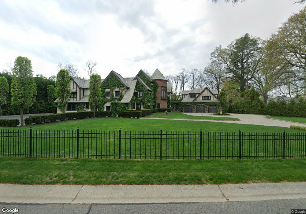
10 E High Rd Port Washington, NY 11050
Estimated Value: $3,166,000 - $3,584,282
Studio
5
Baths
5,636
Sq Ft
$599/Sq Ft
Est. Value
About This Home
This home is located at 10 E High Rd, Port Washington, NY 11050 and is currently estimated at $3,375,141, approximately $598 per square foot. 10 E High Rd is a home located in Nassau County with nearby schools including South Salem Elementary School, Carrie Palmer Weber Middle School, and Paul D. Schreiber Senior High School.
Ownership History
Date
Name
Owned For
Owner Type
Purchase Details
Closed on
Aug 14, 2007
Sold by
East High Road Corp
Bought by
Eoanidis Jason
Current Estimated Value
Purchase Details
Closed on
Oct 12, 2006
Sold by
Zarabi Isaac
Purchase Details
Closed on
Jul 24, 2005
Sold by
Zarabi Isaac
Purchase Details
Closed on
Mar 4, 2005
Sold by
Danic Group Ltd
Bought by
Zarabi Isaac
Purchase Details
Closed on
Mar 20, 1997
Sold by
Johnston Robert E
Bought by
Soviero Robert and Soviero Lori
Create a Home Valuation Report for This Property
The Home Valuation Report is an in-depth analysis detailing your home's value as well as a comparison with similar homes in the area
Home Values in the Area
Average Home Value in this Area
Purchase History
| Date | Buyer | Sale Price | Title Company |
|---|---|---|---|
| Eoanidis Jason | $1,810,000 | -- | |
| Eoanidis Jason | $1,810,000 | -- | |
| -- | -- | -- | |
| -- | -- | -- | |
| -- | -- | -- | |
| -- | -- | -- | |
| Zarabi Isaac | $600,000 | -- | |
| Zarabi Isaac | $600,000 | -- | |
| Soviero Robert | $819,500 | -- | |
| Soviero Robert | $819,500 | -- |
Source: Public Records
Tax History
| Year | Tax Paid | Tax Assessment Tax Assessment Total Assessment is a certain percentage of the fair market value that is determined by local assessors to be the total taxable value of land and additions on the property. | Land | Improvement |
|---|---|---|---|---|
| 2025 | $51,794 | $2,581 | $1,213 | $1,368 |
| 2024 | $8,646 | $2,435 | $1,047 | $1,388 |
Source: Public Records
Map
Nearby Homes
- 225 Port Washington Blvd
- 97 Crabapple Rd
- 499 Stonytown Rd
- 38 Hewlett Ln
- 220 Elderfields Rd
- 265 Northwoods Rd
- 40 Hewlett Ln
- 126 Northwoods Rd
- 60 Wakefield Ave
- 191 Elderfields Rd
- 84 Middle Neck Rd
- 32 Barnard Place
- 448 Abbey Rd N
- 13 Chanticlare Dr
- 26 Birchdale Ln
- 30 Bonnie Heights Rd
- 12 Knollwood Rd
- 409 Abbey Rd
- 539 Manhasset Woods Rd
- 16 Cliff Way
- 8 E High Rd
- 21 Country Club Dr
- 3 E View Ct
- 6 E High Rd
- 19 Country Club Dr
- 2 E View Ct
- 33 Country Club Dr
- 9 E High Rd
- 4 E High Rd
- 4 E View Ct
- 11 Country Club Dr
- 7 E High Rd
- 1 E View Ct
- 28 Country Club Dr
- 26 Country Club Dr
- 30 Country Club Dr
- 2 E High Rd
- 38 Country Club Dr
- 9 Country Club Dr
- 22 Country Club Dr
Your Personal Tour Guide
Ask me questions while you tour the home.