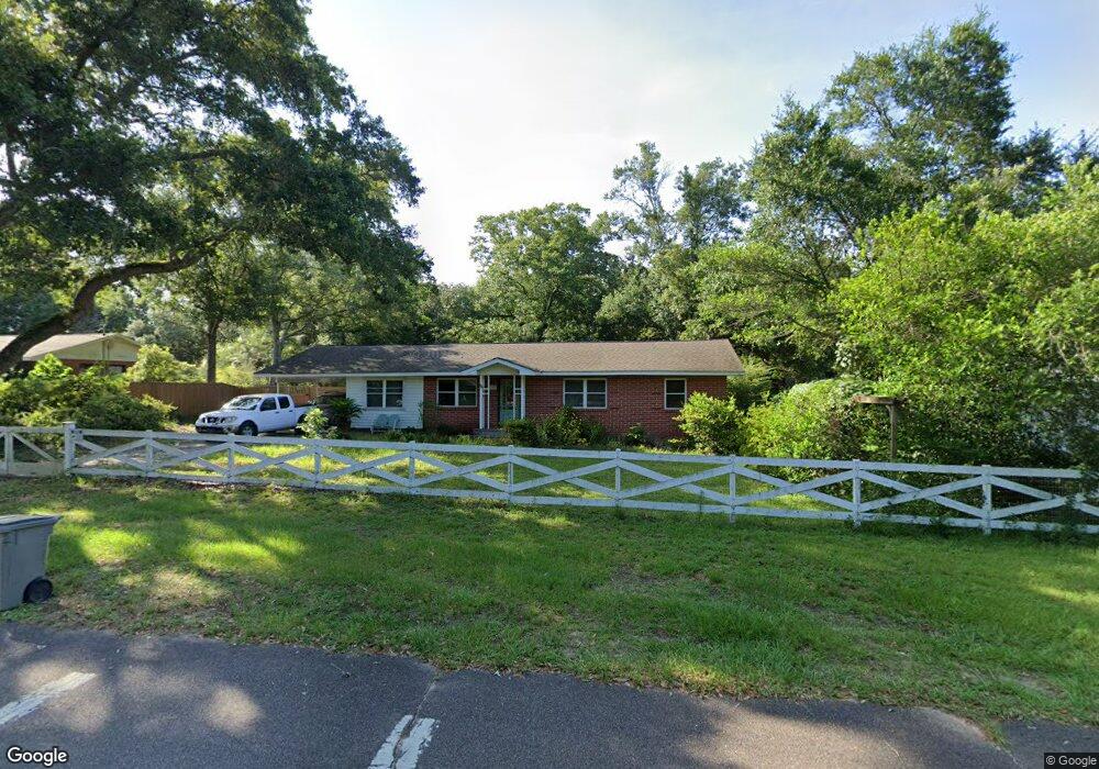
10 E Pinestead Rd Pensacola, FL 32503
Estimated Value: $168,508 - $207,000
Studio
2
Baths
1,566
Sq Ft
$123/Sq Ft
Est. Value
About This Home
This home is located at 10 E Pinestead Rd, Pensacola, FL 32503 and is currently estimated at $192,127, approximately $122 per square foot. 10 E Pinestead Rd is a home located in Escambia County with nearby schools including Ensley Elementary School, Ferry Pass Middle School, and Pine Forest High School.
Ownership History
Date
Name
Owned For
Owner Type
Purchase Details
Closed on
May 16, 2001
Sold by
Callas Michael Joseph
Bought by
Michael Joseph Callas Living Tr
Current Estimated Value
Purchase Details
Closed on
Mar 31, 1999
Sold by
Lea Charles D and Tait Leonard D
Bought by
Callas Michael J
Home Financials for this Owner
Home Financials are based on the most recent Mortgage that was taken out on this home.
Original Mortgage
$68,400
Interest Rate
6.85%
Create a Home Valuation Report for This Property
The Home Valuation Report is an in-depth analysis detailing your home's value as well as a comparison with similar homes in the area
Home Values in the Area
Average Home Value in this Area
Purchase History
| Date | Buyer | Sale Price | Title Company |
|---|---|---|---|
| Michael Joseph Callas Living Tr | -- | -- | |
| Callas Michael J | $72,000 | -- |
Source: Public Records
Mortgage History
| Date | Status | Borrower | Loan Amount |
|---|---|---|---|
| Previous Owner | Callas Michael J | $68,400 |
Source: Public Records
Tax History
| Year | Tax Paid | Tax Assessment Tax Assessment Total Assessment is a certain percentage of the fair market value that is determined by local assessors to be the total taxable value of land and additions on the property. | Land | Improvement |
|---|---|---|---|---|
| 2025 | $558 | $74,651 | -- | -- |
| 2024 | $562 | $72,548 | -- | -- |
| 2023 | $562 | $70,435 | $0 | $0 |
| 2022 | $557 | $68,384 | $0 | $0 |
| 2021 | $564 | $66,393 | $0 | $0 |
| 2020 | $558 | $65,477 | $0 | $0 |
| 2019 | $553 | $64,005 | $0 | $0 |
| 2018 | $557 | $62,812 | $0 | $0 |
| 2017 | $560 | $61,521 | $0 | $0 |
| 2016 | $560 | $60,256 | $0 | $0 |
| 2015 | $540 | $59,838 | $0 | $0 |
| 2014 | $529 | $59,364 | $0 | $0 |
Source: Public Records
Map
Nearby Homes
- 6208 Brosnaham Ave
- 50 Fulton Ave Unit F
- 7116 Dale St
- 7117 Dale St
- 6206 Lucy St
- 6970 Woodley Dr
- 415 Rhoda St
- 00 Kenmore Rd
- 112 Redbreast Ln
- 6235 Confederate Dr
- 40 Arthur Ln
- 118 Czar Ln
- 5921 Count Rd
- 117 Monarch Ln
- 6002 Sarah Dr
- 125 Dodge Dr
- 5910 Sarah Dr
- 7712 Deborah Dr
- 6315 White Oak Dr
- 6702 White Oak Dr
- 12 E Pinestead Rd
- 8 E Pinestead Rd
- E E Pinestead Rd
- 7000 N Palafox St
- 6936 N Palafox St
- 5 E Pinestead Rd
- 45 Fulton Ave
- 100 W Pinestead Rd
- 103 Fulton Ave
- 20 E Pinestead Rd
- 6868 N Palafox St
- 0 Fulton Ave Unit D15 589343
- 0 Fulton Ave Unit D15 614242
- 0 Fulton Ave Unit D 397459
- 0 Fulton Ave Unit D 400242
- 0 Fulton Ave Unit D16 403646
- 0 Fulton Ave Unit D13 404305
- 0 Fulton Ave Unit D15 437557
- 0 Fulton Ave Unit 20 512073
- 0 Fulton Ave Unit D-14 512551