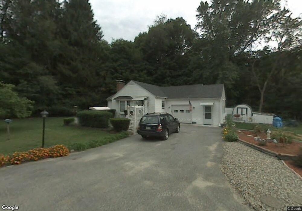
10 Elm Cir Wilbraham, MA 01095
Estimated Value: $270,305 - $380,000
2
Beds
1
Bath
928
Sq Ft
$349/Sq Ft
Est. Value
About This Home
This home is located at 10 Elm Cir, Wilbraham, MA 01095 and is currently estimated at $323,826, approximately $348 per square foot. 10 Elm Cir is a home located in Hampden County with nearby schools including Minnechaug Regional High School, Springfield International Charter School, and Wilbraham & Monson Academy.
Ownership History
Date
Name
Owned For
Owner Type
Purchase Details
Closed on
Mar 29, 2010
Sold by
Paulin Adele M
Bought by
Paulin Adele M and Phipps Kathleen
Current Estimated Value
Purchase Details
Closed on
Dec 28, 1993
Sold by
Moore Thomas A
Bought by
Paulin Adele M
Home Financials for this Owner
Home Financials are based on the most recent Mortgage that was taken out on this home.
Original Mortgage
$97,500
Interest Rate
7%
Mortgage Type
Purchase Money Mortgage
Create a Home Valuation Report for This Property
The Home Valuation Report is an in-depth analysis detailing your home's value as well as a comparison with similar homes in the area
Home Values in the Area
Average Home Value in this Area
Purchase History
| Date | Buyer | Sale Price | Title Company |
|---|---|---|---|
| Paulin Adele M | -- | -- | |
| Paulin Adele M | $110,000 | -- |
Source: Public Records
Mortgage History
| Date | Status | Borrower | Loan Amount |
|---|---|---|---|
| Previous Owner | Paulin Adele M | $10,000 | |
| Previous Owner | Paulin Adele M | $97,500 |
Source: Public Records
Tax History Compared to Growth
Tax History
| Year | Tax Paid | Tax Assessment Tax Assessment Total Assessment is a certain percentage of the fair market value that is determined by local assessors to be the total taxable value of land and additions on the property. | Land | Improvement |
|---|---|---|---|---|
| 2025 | $4,164 | $232,900 | $91,700 | $141,200 |
| 2024 | $3,990 | $215,700 | $91,700 | $124,000 |
| 2023 | $3,983 | $216,400 | $82,500 | $133,900 |
| 2022 | $3,983 | $194,400 | $82,500 | $111,900 |
| 2021 | $4,018 | $175,000 | $86,800 | $88,200 |
| 2020 | $3,917 | $175,000 | $86,800 | $88,200 |
| 2019 | $3,815 | $175,000 | $86,800 | $88,200 |
| 2018 | $3,654 | $161,400 | $86,800 | $74,600 |
| 2017 | $3,551 | $161,400 | $86,800 | $74,600 |
| 2016 | $3,445 | $159,500 | $92,300 | $67,200 |
| 2015 | $3,330 | $159,500 | $92,300 | $67,200 |
Source: Public Records
Map
Nearby Homes
- 79 High Pine Cir
- 69 High Pine Cir
- 54 High Pine Cir
- 28 Decorie Dr
- 2 Vista Rd
- 20 Old Orchard Rd
- 35 Lake Dr
- 2 Bayberry Dr Unit 51
- 4 Hillcrest Dr
- 46 Washington Rd
- 474 Mountain Rd
- 474-480 Mountain Rd
- 8 Patriot Ridge Ln
- 182 Mountain Rd
- 6 Hilltop Park
- 6 Teak Terrace Unit 24
- 99 Sandalwood Dr Unit site 00
- 103 Sandalwood Dr Unit site 00
- 19 Linwood Dr
- 57 Sandalwood Dr Unit site 61
- 5 Elm Cir
- 9 Elm Cir
- 207 Main St
- 211 Main St
- 201 Main St
- 13 Elm Cir
- 221 Main St Unit C
- 221 Main St Unit 223
- 221 Main St Unit A
- 221 Main St Unit 2
- 221 Main St Unit A
- 221 Main St Unit B
- 199 Main St
- 3 Delmor Ave
- 225 Main St
- 5 Delmor Ave
- 195 Main St
- 154 Lodge Ln Unit 154
- 152 Lodge Ln Unit 152
- 150 Lodge Ln