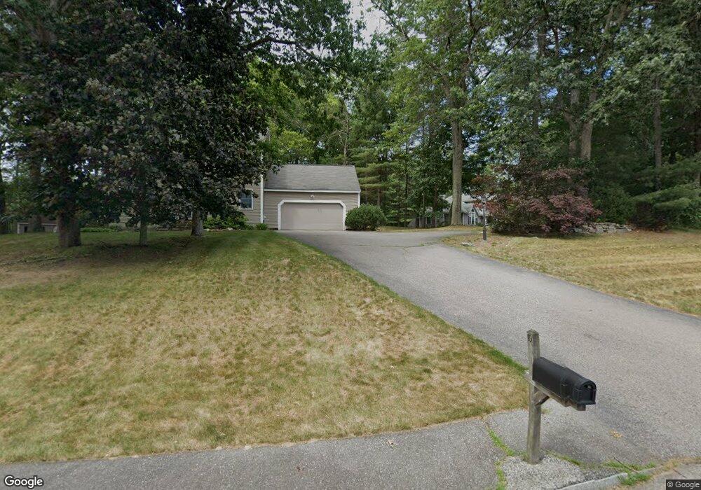
10 Emerald St Tyngsboro, MA 01879
Estimated Value: $733,000 - $920,000
3
Beds
2
Baths
2,421
Sq Ft
$324/Sq Ft
Est. Value
About This Home
This home is located at 10 Emerald St, Tyngsboro, MA 01879 and is currently estimated at $783,760, approximately $323 per square foot. 10 Emerald St is a home located in Middlesex County with nearby schools including Tyngsborough Elementary School, Tyngsborough Middle School, and Tyngsborough High School.
Ownership History
Date
Name
Owned For
Owner Type
Purchase Details
Closed on
Oct 23, 2014
Sold by
Dilello Sharon M and Dilello Peter M
Bought by
Dilello Sharon M
Current Estimated Value
Home Financials for this Owner
Home Financials are based on the most recent Mortgage that was taken out on this home.
Original Mortgage
$234,000
Outstanding Balance
$179,395
Interest Rate
4.1%
Mortgage Type
New Conventional
Estimated Equity
$604,365
Purchase Details
Closed on
Mar 26, 1999
Sold by
Applewood Const
Bought by
Dilello Sharon M and Dilello Peter M
Home Financials for this Owner
Home Financials are based on the most recent Mortgage that was taken out on this home.
Original Mortgage
$177,300
Interest Rate
6.78%
Mortgage Type
Purchase Money Mortgage
Create a Home Valuation Report for This Property
The Home Valuation Report is an in-depth analysis detailing your home's value as well as a comparison with similar homes in the area
Home Values in the Area
Average Home Value in this Area
Purchase History
| Date | Buyer | Sale Price | Title Company |
|---|---|---|---|
| Dilello Sharon M | -- | -- | |
| Dilello Sharon M | $221,650 | -- |
Source: Public Records
Mortgage History
| Date | Status | Borrower | Loan Amount |
|---|---|---|---|
| Open | Dilello Sharon M | $234,000 | |
| Previous Owner | Dilello Sharon M | $245,800 | |
| Previous Owner | Dilello Sharon M | $177,300 |
Source: Public Records
Tax History
| Year | Tax Paid | Tax Assessment Tax Assessment Total Assessment is a certain percentage of the fair market value that is determined by local assessors to be the total taxable value of land and additions on the property. | Land | Improvement |
|---|---|---|---|---|
| 2025 | $81 | $658,100 | $290,600 | $367,500 |
| 2024 | $8,129 | $639,100 | $280,000 | $359,100 |
| 2023 | $7,712 | $545,400 | $233,700 | $311,700 |
| 2022 | $7,391 | $494,700 | $204,200 | $290,500 |
| 2021 | $7,236 | $450,300 | $185,300 | $265,000 |
| 2020 | $7,274 | $447,600 | $185,300 | $262,300 |
| 2019 | $6,972 | $411,800 | $172,700 | $239,100 |
| 2018 | $13,321 | $403,200 | $172,700 | $230,500 |
| 2017 | $6,694 | $390,100 | $172,700 | $217,400 |
| 2016 | $6,583 | $374,900 | $172,700 | $202,200 |
| 2015 | $6,072 | $358,000 | $155,800 | $202,200 |
Source: Public Records
Map
Nearby Homes
- 160 Westford Rd
- 41 Chestnut Rd
- 0 Dunstable Rd
- 0 Lowell St
- 102 Russells Way
- 76 Tenney Rd
- 11 Big Rock Trail
- 13 Grace Way
- 3 Bridgeview Cir Unit 53
- 4 Bridgeview Cir Unit 36
- 1 Appian Way
- E41 Scotty Hollow Dr Unit E41
- 427 Groton Rd
- 13 Long Rd
- 180 Tyngsboro Rd Unit 17
- 5 Mission Rd Unit 107
- 17 Forrest Rd
- 57 French Ct
- 3 Pailet Dr Unit 7
- 12 Dunshire Dr
Your Personal Tour Guide
Ask me questions while you tour the home.