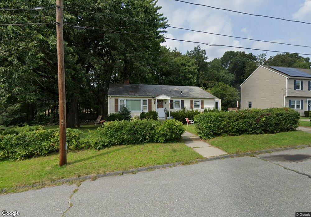
10 Eustis St Worcester, MA 01606
Burncoat NeighborhoodEstimated Value: $429,652 - $454,000
3
Beds
2
Baths
1,120
Sq Ft
$392/Sq Ft
Est. Value
About This Home
This home is located at 10 Eustis St, Worcester, MA 01606 and is currently estimated at $438,663, approximately $391 per square foot. 10 Eustis St is a home located in Worcester County with nearby schools including Norrback Avenue Elementary School, Jacob Hiatt Magnet School, and Chandler Magnet.
Create a Home Valuation Report for This Property
The Home Valuation Report is an in-depth analysis detailing your home's value as well as a comparison with similar homes in the area
Home Values in the Area
Average Home Value in this Area
Tax History
We collect this data history from publicly available records. To have your information removed, we recommend requesting removal directly through your county’s website.
| Year | Tax Paid | Tax Assessment Tax Assessment Total Assessment is a certain percentage of the fair market value that is determined by local assessors to be the total taxable value of land and additions on the property. | Land | Improvement |
|---|---|---|---|---|
| 2025 | $4,813 | $364,900 | $118,800 | $246,100 |
| 2024 | $4,718 | $343,100 | $118,800 | $224,300 |
| 2023 | $4,559 | $317,900 | $103,300 | $214,600 |
| 2022 | $4,043 | $265,800 | $82,700 | $183,100 |
| 2021 | $3,603 | $221,300 | $66,200 | $155,100 |
| 2020 | $3,470 | $204,100 | $66,100 | $138,000 |
| 2019 | $3,263 | $181,300 | $59,600 | $121,700 |
| 2018 | $3,177 | $168,000 | $59,600 | $108,400 |
| 2017 | $3,216 | $167,300 | $59,600 | $107,700 |
| 2016 | $3,112 | $151,000 | $44,000 | $107,000 |
| 2015 | $3,031 | $151,000 | $44,000 | $107,000 |
| 2014 | $2,951 | $151,000 | $44,000 | $107,000 |
Source: Public Records
Map
Nearby Homes
- 7 Darrow St
- 351 Maple St
- 670 Burncoat St Unit A
- 156 Hillside Village Dr
- 42 Wilbur St
- 16 Oxford St
- 42 Castine St Unit 1
- 42 Castine St
- 59 Castine St
- 28 Ladybank Rd
- 21 Arrowsic St
- 24 Park Villa Ave
- 14 Angell Brook Dr
- 85 Angell Brook Dr
- 25 Pheasant Hill Run
- 149 Woodland St
- 6 Idalla Ave
- 91 Bunkerhill Pkwy
- 87 Malden St
- 29R E Mountain St
Your Personal Tour Guide
Ask me questions while you tour the home.