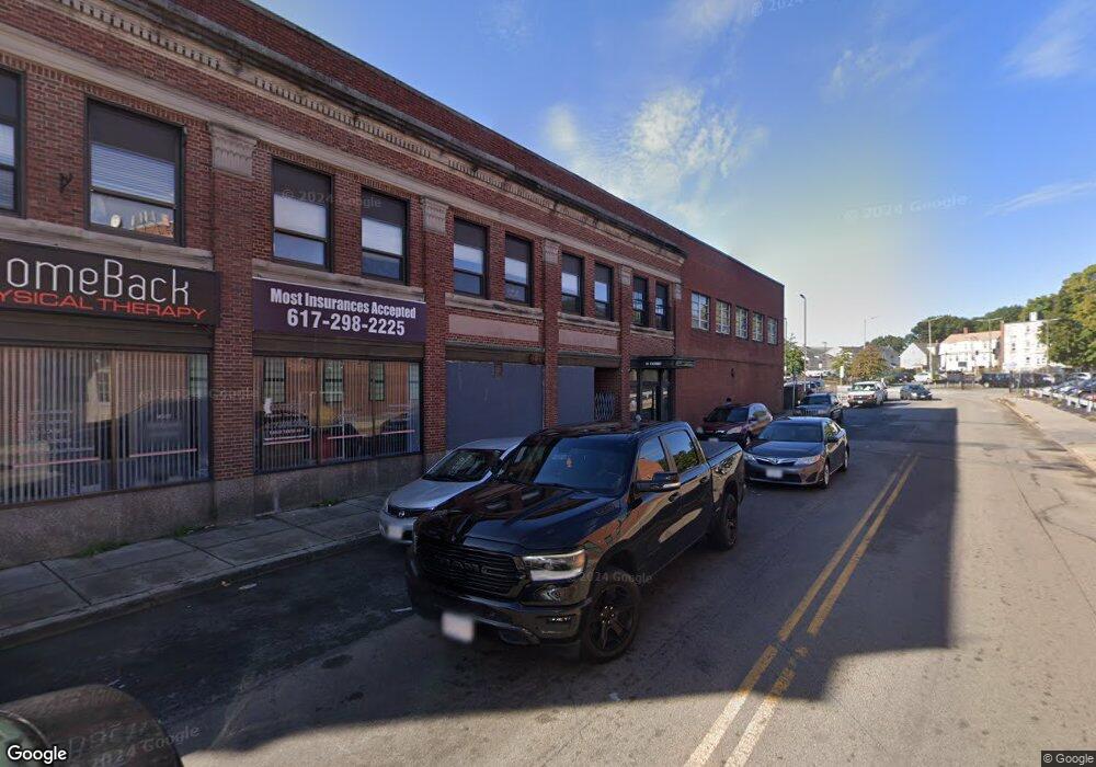
10 Fairway St Boston, MA 02126
Mattapan Square NeighborhoodEstimated Value: $4,223,041
--
Bed
--
Bath
1,250
Sq Ft
$3,378/Sq Ft
Est. Value
About This Home
This home is located at 10 Fairway St, Boston, MA 02126 and is currently estimated at $4,223,041, approximately $3,378 per square foot. 10 Fairway St is a home located in Suffolk County with nearby schools including KIPP Academy Boston Charter School, Berea Seventh-day Adventist Academy, and St. Mary of the Hills School.
Ownership History
Date
Name
Owned For
Owner Type
Purchase Details
Closed on
May 14, 2010
Sold by
Ptimpas Brothers T
Bought by
10 Fairway Llc
Current Estimated Value
Home Financials for this Owner
Home Financials are based on the most recent Mortgage that was taken out on this home.
Original Mortgage
$1,125,000
Outstanding Balance
$756,255
Interest Rate
5.11%
Mortgage Type
Commercial
Estimated Equity
$3,466,786
Create a Home Valuation Report for This Property
The Home Valuation Report is an in-depth analysis detailing your home's value as well as a comparison with similar homes in the area
Home Values in the Area
Average Home Value in this Area
Purchase History
| Date | Buyer | Sale Price | Title Company |
|---|---|---|---|
| 10 Fairway Llc | $1,861,500 | -- |
Source: Public Records
Mortgage History
| Date | Status | Borrower | Loan Amount |
|---|---|---|---|
| Open | 10 Fairway Llc | $1,125,000 |
Source: Public Records
Tax History Compared to Growth
Tax History
| Year | Tax Paid | Tax Assessment Tax Assessment Total Assessment is a certain percentage of the fair market value that is determined by local assessors to be the total taxable value of land and additions on the property. | Land | Improvement |
|---|---|---|---|---|
| 2025 | $66,517 | $2,562,300 | $906,300 | $1,656,000 |
| 2024 | $69,197 | $2,738,300 | $906,300 | $1,832,000 |
| 2023 | $68,287 | $2,766,900 | $906,300 | $1,860,600 |
| 2022 | $74,221 | $2,971,200 | $906,300 | $2,064,900 |
| 2021 | $73,466 | $2,992,500 | $849,700 | $2,142,800 |
| 2020 | $72,243 | $2,899,000 | $849,700 | $2,049,300 |
| 2019 | $72,475 | $2,899,000 | $849,700 | $2,049,300 |
| 2018 | $68,342 | $2,712,000 | $815,700 | $1,896,300 |
| 2017 | $64,782 | $2,553,500 | $781,700 | $1,771,800 |
| 2016 | $62,883 | $2,345,500 | $725,000 | $1,620,500 |
| 2015 | $61,254 | $2,075,000 | $645,700 | $1,429,300 |
| 2014 | $61,877 | $1,984,500 | $566,400 | $1,418,100 |
Source: Public Records
Map
Nearby Homes
- 95 Woodhaven St
- 48-50 Rockdale St
- 10 Brockton St
- 770 Cummins Hwy Unit 1
- 770 Cummins Hwy Unit 22
- 1465 Blue Hill Ave
- 24 Constitution Rd
- 90 Hollingsworth St
- 84 Blue Hills Pkwy
- 4 Crossman St Unit 4
- 16 Blue Hill Ave
- 11 French St
- 10 Briarcliff Terrace
- 645 River St
- 32 Violet St
- 23 Caton St
- 839-843 Cummins Hwy
- 128 Blue Hills Pkwy
- 12 Hiawatha Rd
- 20 Monterey Ave
- 1621 Blue Hill Ave
- 1629 Blue Hill Ave
- 1615 Blue Hill Ave
- 1613 Blue Hill Ave
- 1613 Blue Hill Ave Unit 302
- 1613 Blue Hill Ave Unit 301
- 1613 Blue Hill Ave Unit 304 306
- 1613 Blue Hill Ave Unit 304
- 1613 Blue Hill Ave Unit 300, 302
- 1613 Blue Hill Ave Unit 300
- 1613 Blue Hill Ave Unit 307
- 1613 Blue Hill Ave Unit 305
- 1613 Blue Hill Ave Unit 2ND FL
- 1651 Blue Hill Ave Unit 1
- 1651 Blue Hill Ave Unit 2
- 1634 Blue Hill Ave
- 1611 Blue Hill Ave
- 1595 Blue Hill Ave
- 1601 Blue Hill Ave Unit 2
- 1601 Blue Hill Ave Unit 1