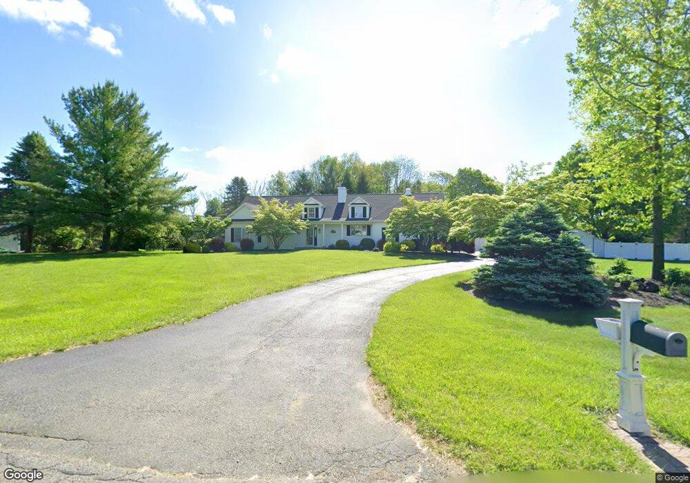
10 Fieldview Rd Andover, NJ 07821
Estimated Value: $581,000 - $642,000
--
Bed
--
Bath
1,977
Sq Ft
$306/Sq Ft
Est. Value
About This Home
This home is located at 10 Fieldview Rd, Andover, NJ 07821 and is currently estimated at $605,249, approximately $306 per square foot. 10 Fieldview Rd is a home located in Sussex County with nearby schools including Green Hills School and Tranquility Adventist School.
Ownership History
Date
Name
Owned For
Owner Type
Purchase Details
Closed on
Jul 13, 2021
Sold by
Ammon Dolores P
Bought by
Bott Bruce C and Hoff Amanda J
Current Estimated Value
Home Financials for this Owner
Home Financials are based on the most recent Mortgage that was taken out on this home.
Original Mortgage
$380,000
Interest Rate
3%
Mortgage Type
New Conventional
Purchase Details
Closed on
Jan 4, 2007
Sold by
Schumacher Michele C Nieroda and Schumacher Hans H
Bought by
Ammon Horst C
Purchase Details
Closed on
Oct 26, 1998
Sold by
Branch Millard and Branch Priscilla
Bought by
Nieroda Michele C
Home Financials for this Owner
Home Financials are based on the most recent Mortgage that was taken out on this home.
Original Mortgage
$218,500
Interest Rate
6.64%
Purchase Details
Closed on
Sep 30, 1994
Sold by
Tranquility Farms Inc
Bought by
Branch Millard
Create a Home Valuation Report for This Property
The Home Valuation Report is an in-depth analysis detailing your home's value as well as a comparison with similar homes in the area
Home Values in the Area
Average Home Value in this Area
Purchase History
| Date | Buyer | Sale Price | Title Company |
|---|---|---|---|
| Bott Bruce C | $475,000 | Palais Title Agency | |
| Ammon Horst C | $589,000 | Stewart Title Guaranty Co | |
| Nieroda Michele C | $251,500 | -- | |
| Branch Millard | $236,600 | -- |
Source: Public Records
Mortgage History
| Date | Status | Borrower | Loan Amount |
|---|---|---|---|
| Previous Owner | Bott Bruce C | $380,000 | |
| Previous Owner | Nieroda Michele C | $218,500 |
Source: Public Records
Tax History Compared to Growth
Tax History
| Year | Tax Paid | Tax Assessment Tax Assessment Total Assessment is a certain percentage of the fair market value that is determined by local assessors to be the total taxable value of land and additions on the property. | Land | Improvement |
|---|---|---|---|---|
| 2025 | $13,750 | $654,800 | $144,400 | $510,400 |
| 2024 | $13,652 | $353,300 | $105,300 | $248,000 |
| 2023 | $13,652 | $353,300 | $105,300 | $248,000 |
| 2022 | $12,987 | $353,300 | $105,300 | $248,000 |
| 2021 | $12,568 | $353,300 | $105,300 | $248,000 |
| 2020 | $12,507 | $353,300 | $105,300 | $248,000 |
| 2019 | $12,242 | $353,300 | $105,300 | $248,000 |
| 2018 | $12,885 | $353,300 | $105,300 | $248,000 |
| 2017 | $12,627 | $353,300 | $105,300 | $248,000 |
| 2016 | $12,006 | $353,300 | $105,300 | $248,000 |
| 2015 | $11,568 | $353,300 | $105,300 | $248,000 |
| 2014 | $11,246 | $353,300 | $105,300 | $248,000 |
Source: Public Records
Map
Nearby Homes
- 27 Mountainview Dr
- 0 Decker Pond Airport Rd Unit 3945534
- 8 Woodfield Rd
- 18 Spruce Dr
- 88 MacKerley Rd
- 111 Decker Pond Rd
- 75 Shore Rd
- 27 Scenic Dr
- 88 Kennedy Rd
- 78 Hillside Terrace
- 51 Scenic Dr
- 8 Limekiln Ct
- 73 Wolfs Corner Rd
- 34 Allamuchy Trail
- 2 Cabin Spring Trail
- 25 Prospect Ave
- 8 Hillcrest Trail
- 2 Side Hill Trail
- 7 Lakeview Trail
- 19 Division Ln