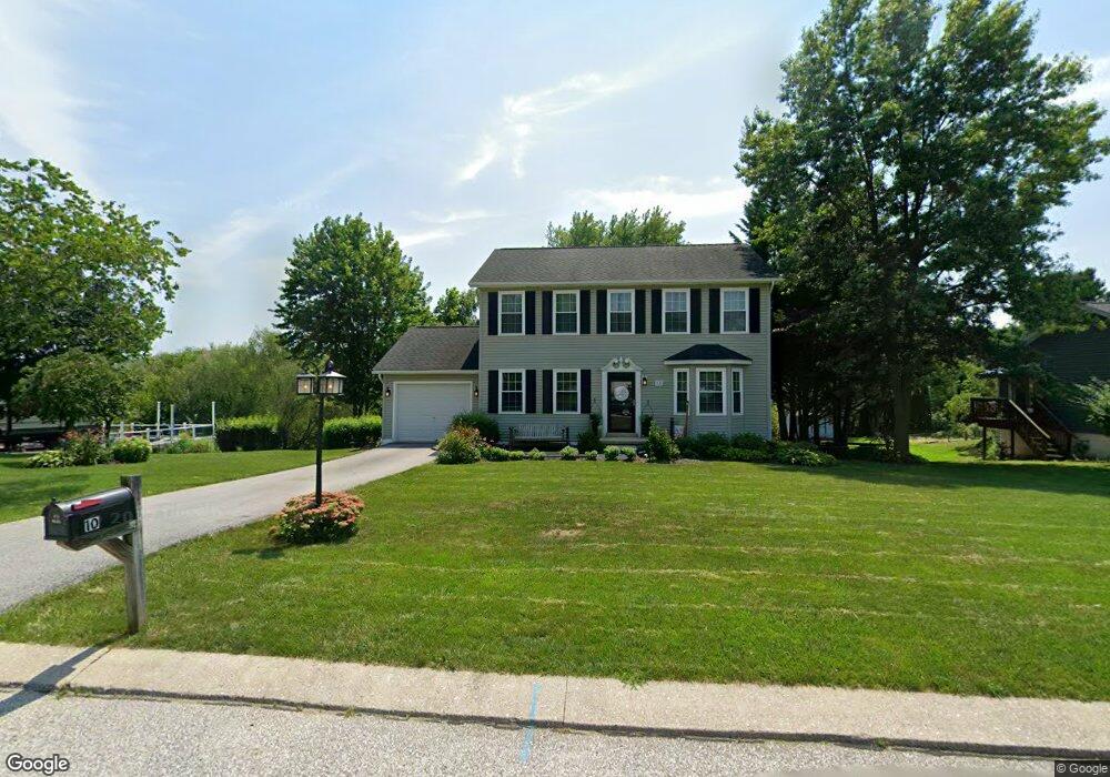
10 Firebox Ct Stewartstown, PA 17363
Estimated Value: $369,915 - $403,000
4
Beds
3
Baths
1,836
Sq Ft
$209/Sq Ft
Est. Value
About This Home
This home is located at 10 Firebox Ct, Stewartstown, PA 17363 and is currently estimated at $383,229, approximately $208 per square foot. 10 Firebox Ct is a home located in York County with nearby schools including South Eastern Intermediate School, South Eastern Middle School, and Kennard-Dale High School.
Ownership History
Date
Name
Owned For
Owner Type
Purchase Details
Closed on
Oct 18, 1996
Sold by
Parkent Timothy A and Parkent Wendy A
Bought by
Holle Wayne R and Holle Mary K
Current Estimated Value
Purchase Details
Closed on
Mar 17, 1994
Bought by
Parkent Timothy A and Parkent Wendy A
Create a Home Valuation Report for This Property
The Home Valuation Report is an in-depth analysis detailing your home's value as well as a comparison with similar homes in the area
Home Values in the Area
Average Home Value in this Area
Purchase History
| Date | Buyer | Sale Price | Title Company |
|---|---|---|---|
| Holle Wayne R | $140,000 | -- | |
| Parkent Timothy A | $137,500 | -- |
Source: Public Records
Tax History Compared to Growth
Tax History
| Year | Tax Paid | Tax Assessment Tax Assessment Total Assessment is a certain percentage of the fair market value that is determined by local assessors to be the total taxable value of land and additions on the property. | Land | Improvement |
|---|---|---|---|---|
| 2025 | $5,452 | $185,680 | $54,490 | $131,190 |
| 2024 | $5,452 | $185,680 | $54,490 | $131,190 |
| 2023 | $5,452 | $185,680 | $54,490 | $131,190 |
| 2022 | $5,452 | $185,680 | $54,490 | $131,190 |
| 2021 | $5,266 | $185,680 | $54,490 | $131,190 |
| 2020 | $5,266 | $185,680 | $54,490 | $131,190 |
| 2019 | $5,247 | $185,680 | $54,490 | $131,190 |
| 2018 | $5,247 | $185,680 | $54,490 | $131,190 |
| 2017 | $5,247 | $185,680 | $54,490 | $131,190 |
| 2016 | $0 | $185,680 | $54,490 | $131,190 |
| 2015 | -- | $185,680 | $54,490 | $131,190 |
| 2014 | -- | $185,680 | $54,490 | $131,190 |
Source: Public Records
Map
Nearby Homes
- 82 Piston Ct
- 94 Piston Ct
- 2 S Main St
- 9 W Pennsylvania Ave
- 17 Charles Ave
- 13 Baneberry St
- 18007 Dave Anne Cir
- 18010 Dave Anne Cir
- 103 Hershey Cir
- 10 Black Oak Ct
- 150 Patterson Dr Unit 47
- 231 Cool Spring Ln
- 160 Patterson Dr Unit 48
- 180 Patterson Dr Unit 50
- 4341 Forbes Dr
- 4303 Forbes Dr
- 18183 Piedmont Rd
- 8287 Pleasant Valley Rd
- 0 Bridgeview Rd Unit PAYK2080146
- 4389 Hess Rd
- 14 Firebox Ct
- 6 Firebox Ct
- 18 Firebox Ct
- 7 Firebox Ct
- 11 Firebox Ct
- 17 Firebox Ct
- 124 E Scarborough Fare
- 116 E Scarborough Fare
- 21 Firebox Ct
- 22 Firebox Ct
- 130 E Scarborough Fare
- 25 Firebox Ct
- 123 E Scarborough Fare
- 119 E Scarborough Fare
- 127 E Scarborough Fare
- 115 E Scarborough Fare
- 359 Hollow Rd
- 134 E Scarborough Fare
- 335 Hollow Rd
- 381 Hollow Rd