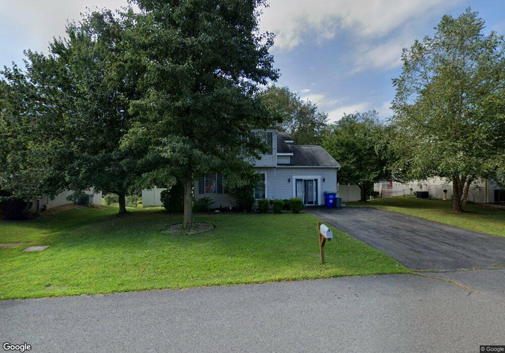
10 Foresman Dr New Columbia, PA 17856
Estimated Value: $234,059 - $275,000
3
Beds
1
Bath
1,410
Sq Ft
$186/Sq Ft
Est. Value
About This Home
This home is located at 10 Foresman Dr, New Columbia, PA 17856 and is currently estimated at $261,765, approximately $185 per square foot. 10 Foresman Dr is a home located in Union County with nearby schools including Milton High School, Meadowbrook Christian School, and Watsontown Christian Academy.
Ownership History
Date
Name
Owned For
Owner Type
Purchase Details
Closed on
Oct 19, 2016
Sold by
Shipe Ii Donald F and Shipe Tiara D
Bought by
Burger Renn Andrew D and Walter Kristen J
Current Estimated Value
Home Financials for this Owner
Home Financials are based on the most recent Mortgage that was taken out on this home.
Original Mortgage
$142,500
Outstanding Balance
$114,385
Interest Rate
3.5%
Mortgage Type
New Conventional
Estimated Equity
$147,380
Purchase Details
Closed on
Feb 23, 2011
Sold by
Phillips Ricky A and Phillips Karen L
Bought by
Shipe Ii Donald F and Shipe Tiara D
Home Financials for this Owner
Home Financials are based on the most recent Mortgage that was taken out on this home.
Original Mortgage
$13,600
Interest Rate
4.75%
Mortgage Type
Purchase Money Mortgage
Create a Home Valuation Report for This Property
The Home Valuation Report is an in-depth analysis detailing your home's value as well as a comparison with similar homes in the area
Home Values in the Area
Average Home Value in this Area
Purchase History
| Date | Buyer | Sale Price | Title Company |
|---|---|---|---|
| Burger Renn Andrew D | $150,000 | Attorney | |
| Shipe Ii Donald F | $136,000 | None Available |
Source: Public Records
Mortgage History
| Date | Status | Borrower | Loan Amount |
|---|---|---|---|
| Open | Burger Renn Andrew D | $142,500 | |
| Previous Owner | Shipe Ii Donald F | $13,600 |
Source: Public Records
Tax History Compared to Growth
Tax History
| Year | Tax Paid | Tax Assessment Tax Assessment Total Assessment is a certain percentage of the fair market value that is determined by local assessors to be the total taxable value of land and additions on the property. | Land | Improvement |
|---|---|---|---|---|
| 2025 | $2,332 | $103,700 | $19,900 | $83,800 |
| 2024 | $2,286 | $103,700 | $19,900 | $83,800 |
| 2023 | $2,366 | $103,700 | $19,900 | $83,800 |
| 2022 | $2,443 | $103,700 | $19,900 | $83,800 |
| 2021 | $2,405 | $103,700 | $19,900 | $83,800 |
| 2020 | $2,360 | $103,700 | $19,900 | $83,800 |
| 2019 | $2,319 | $103,700 | $19,900 | $83,800 |
| 2018 | $2,191 | $103,700 | $19,900 | $83,800 |
| 2017 | $1,930 | $95,600 | $19,900 | $75,700 |
| 2016 | $1,736 | $95,600 | $19,900 | $75,700 |
| 2015 | -- | $95,600 | $19,900 | $75,700 |
| 2014 | -- | $96,500 | $19,900 | $76,600 |
Source: Public Records
Map
Nearby Homes
- 452 Main St
- 10491 River Rd
- 243 Main St
- 1258 Old Route 15
- 142 Ridge Rd
- 106 Pentz Rd
- 159 Harveys Ln
- 229 Harvey's Ln
- 631 Old Route 15
- 5 Sylvan Ct
- 3 Sylvan Ct
- 105 Woodsedge Dr
- 4 Westfield Ct
- 24 Rolling Ridge Dr
- 000 Golf Course Rd
- 101 N Arch St
- WP Lot 001 Klinetob Rd
- 2469 New Columbia Rd
- 5 Wilson Cir
- 2590 New Columbia Rd
- 8 Foresman Dr
- 12 Foresman Dr
- 9 Foresman Dr
- 7 Foresman Dr
- 6 Foresman Dr
- 14 Foresman Dr
- 11 Foresman Dr
- 5 Foresman Dr
- 13 Foresman Dr
- 4 Foresman Dr
- 3 Foresman Dr
- 2 Foresman Dr
- 1 Foresman Dr
- 1701 Old Route 15
- 562 New Columbia Rd
- 518 New Columbia Rd
- 526 New Columbia Rd
- 558 New Columbia Rd
- 581 New Columbia Rd
- 587 New Columbia Rd