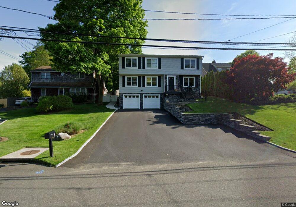
10 Forest Dr East Northport, NY 11731
Estimated Value: $625,000 - $759,000
--
Bed
--
Bath
--
Sq Ft
9,148
Sq Ft Lot
About This Home
This home is located at 10 Forest Dr, East Northport, NY 11731 and is currently estimated at $694,048. 10 Forest Dr is a home located in Suffolk County with nearby schools including Northport Senior High School, The School House, and Trinity Regional School-East Northport Campus.
Ownership History
Date
Name
Owned For
Owner Type
Purchase Details
Closed on
Sep 28, 2004
Sold by
Snyder Fred and Snyder Diane
Bought by
Snyder Eric D
Current Estimated Value
Purchase Details
Closed on
May 19, 2004
Sold by
Snyder Fred N and Snyder Diane
Bought by
Snyder Diane
Purchase Details
Closed on
Dec 20, 2000
Sold by
Snyder Fred N and Snyder Diane
Bought by
Snyder Fred and Snyder Fred N
Home Financials for this Owner
Home Financials are based on the most recent Mortgage that was taken out on this home.
Original Mortgage
$85,924
Interest Rate
7.69%
Mortgage Type
Purchase Money Mortgage
Purchase Details
Closed on
Sep 20, 1998
Sold by
Snyder Fred N
Bought by
Snyder Fred N and Snyder Diane
Purchase Details
Closed on
Aug 13, 1997
Sold by
Patterson Custom Homes Inc
Bought by
Snyder Fred
Purchase Details
Closed on
Apr 7, 1997
Sold by
Farr Ludwig
Bought by
Patterson Custom Homes Inc
Create a Home Valuation Report for This Property
The Home Valuation Report is an in-depth analysis detailing your home's value as well as a comparison with similar homes in the area
Home Values in the Area
Average Home Value in this Area
Purchase History
| Date | Buyer | Sale Price | Title Company |
|---|---|---|---|
| Snyder Eric D | $500,000 | -- | |
| Snyder Diane | -- | -- | |
| Snyder Fred | -- | Fidelity National Title Ins | |
| Snyder Fred N | -- | Safe Harbor Title Agency | |
| Snyder Fred | -- | First American Title Ins Co | |
| Patterson Custom Homes Inc | $55,000 | First American Title Ins Co |
Source: Public Records
Mortgage History
| Date | Status | Borrower | Loan Amount |
|---|---|---|---|
| Previous Owner | Snyder Fred | $85,924 |
Source: Public Records
Tax History Compared to Growth
Tax History
| Year | Tax Paid | Tax Assessment Tax Assessment Total Assessment is a certain percentage of the fair market value that is determined by local assessors to be the total taxable value of land and additions on the property. | Land | Improvement |
|---|---|---|---|---|
| 2024 | $14,853 | $4,350 | $200 | $4,150 |
| 2023 | $7,426 | $4,350 | $200 | $4,150 |
| 2022 | $14,241 | $4,350 | $200 | $4,150 |
| 2021 | $13,826 | $4,350 | $200 | $4,150 |
| 2020 | $13,619 | $4,350 | $200 | $4,150 |
| 2019 | $27,237 | $0 | $0 | $0 |
| 2018 | $12,916 | $4,350 | $200 | $4,150 |
| 2017 | $12,916 | $4,350 | $200 | $4,150 |
| 2016 | $12,705 | $4,350 | $200 | $4,150 |
| 2015 | -- | $4,350 | $200 | $4,150 |
| 2014 | -- | $4,350 | $200 | $4,150 |
Source: Public Records
Map
Nearby Homes
- 15 Crest Dr
- 18 Norton Dr
- 62 Forest Dr
- 40 Irving Johnson St
- 72 Upland Dr
- 167 Vernon Valley Rd
- 26 Irving Johnson St
- 96 Bellecrest Ave
- 66 Upland Dr
- 14 Heath Ln
- 54A Upland Dr
- 83 Bellerose Ave
- 84 Bellerose Ave
- 96 Soundview Ave
- 21 Cullen Dr
- 18 Dickinson Ave
- 812 3rd St
- 14 Sunrise Ct
- 1270 Pulaski Rd
- 5 Montrose Ln