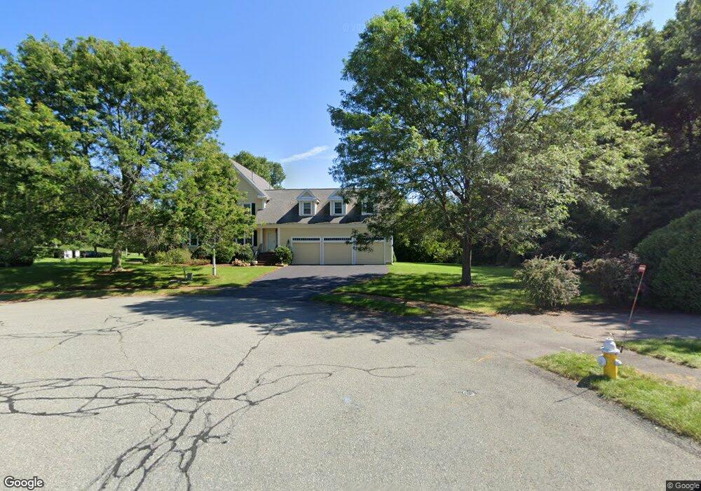
10 Fox Run Rd Wrentham, MA 02093
Estimated Value: $1,233,525 - $1,528,000
4
Beds
3
Baths
4,472
Sq Ft
$310/Sq Ft
Est. Value
About This Home
This home is located at 10 Fox Run Rd, Wrentham, MA 02093 and is currently estimated at $1,385,381, approximately $309 per square foot. 10 Fox Run Rd is a home located in Norfolk County with nearby schools including Delaney Elementary School, Charles E Roderick, and Foxborough Regional Charter School.
Ownership History
Date
Name
Owned For
Owner Type
Purchase Details
Closed on
Nov 3, 2021
Sold by
Karavasileiadis Michail and Karavasileiadis Michael
Bought by
Fox Run Irt
Current Estimated Value
Purchase Details
Closed on
Oct 3, 2003
Sold by
Jones Tebucky S and Jones Jannet
Bought by
Karavasileiadis Michael and Karavasileiadis Angeliki
Home Financials for this Owner
Home Financials are based on the most recent Mortgage that was taken out on this home.
Original Mortgage
$500,000
Interest Rate
6.25%
Mortgage Type
Purchase Money Mortgage
Create a Home Valuation Report for This Property
The Home Valuation Report is an in-depth analysis detailing your home's value as well as a comparison with similar homes in the area
Purchase History
| Date | Buyer | Sale Price | Title Company |
|---|---|---|---|
| Fox Run Irt | -- | None Available | |
| Karavasileiadis Michael | $715,000 | -- |
Source: Public Records
Mortgage History
| Date | Status | Borrower | Loan Amount |
|---|---|---|---|
| Previous Owner | Karavasileiadis Michael | $335,000 | |
| Previous Owner | Karavasileiadis Michael | $500,000 | |
| Previous Owner | Karavasileiadis Michael | $65,000 |
Source: Public Records
Tax History
| Year | Tax Paid | Tax Assessment Tax Assessment Total Assessment is a certain percentage of the fair market value that is determined by local assessors to be the total taxable value of land and additions on the property. | Land | Improvement |
|---|---|---|---|---|
| 2025 | $13,138 | $1,133,600 | $338,000 | $795,600 |
| 2024 | $12,457 | $1,038,100 | $338,000 | $700,100 |
| 2023 | $12,787 | $1,013,200 | $307,300 | $705,900 |
| 2022 | $11,926 | $872,400 | $279,200 | $593,200 |
| 2021 | $11,596 | $824,200 | $279,200 | $545,000 |
| 2020 | $11,860 | $832,300 | $229,600 | $602,700 |
| 2019 | $11,358 | $804,400 | $229,600 | $574,800 |
| 2018 | $10,878 | $763,900 | $229,600 | $534,300 |
| 2017 | $10,787 | $757,000 | $225,200 | $531,800 |
| 2016 | $10,570 | $740,200 | $218,700 | $521,500 |
| 2015 | $10,708 | $714,800 | $210,200 | $504,600 |
| 2014 | $10,530 | $687,800 | $202,200 | $485,600 |
Source: Public Records
Map
Nearby Homes
- 282 Thurston St
- 10 Nature View Dr
- 15 Nature View Dr
- 483 Thurston St
- 576 Dedham St
- 135 Creek St Unit 2
- 3 Earle Stewart Ln
- 2 Earle Stewart Ln
- 12 Earle Stewart Ln
- 10 Earle Stewart Ln Unit Lot 5
- 1 Weber Farm Rd Unit 1
- 25 Foxboro Rd
- 11 Weber Farm Rd Unit 11
- 8 Weber Farm Rd Unit 8
- 30 Weber Farm Rd Unit 30
- 131 Washington St Unit 42
- 131 Washington St Unit 50
- 500 Franklin St
- 75 Foxboro Rd
- 65 Foxboro Rd
- 20 Fox Run Rd
- 5 Lot 5 Fox Run Rd
- 30 Hidden Meadows Ln
- 5 Hidden Meadows Ln
- 20 Hidden Meadows Ln
- 20 Hidden Meadows Ln Unit LANE
- 105 Clark Rd
- 95 Clark Rd
- 105 Clark Rd Unit 105
- 105 Clark Rd Unit 105 ,105
- 65 Cobb Rd
- 65 Cobb Rd Unit 65
- 55 Cobb Rd Unit 55
- 55 Cobb Rd Unit B
- 55 Cobb Rd
- 45 Cobb Rd
- 45 Cobb Rd Unit 45
- 115 Clark Rd
- 115 Clark Rd Unit 115
- 30 Fox Run Rd
Your Personal Tour Guide
Ask me questions while you tour the home.