
Seller's Agent in 2025
Monica Falciani
A J Falciani Realty
(609) 247-8650
2 in this area
255 Total Sales
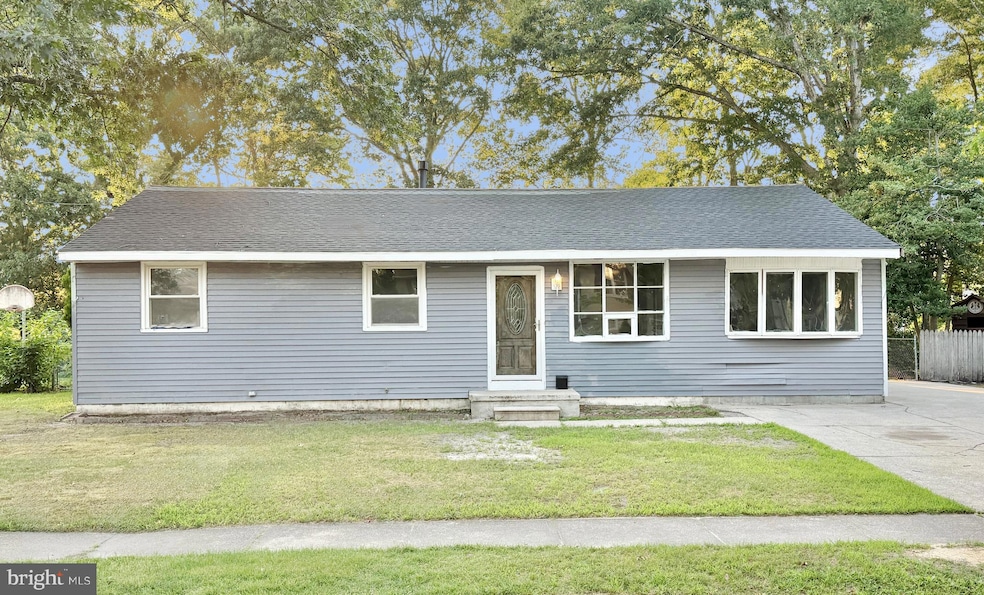
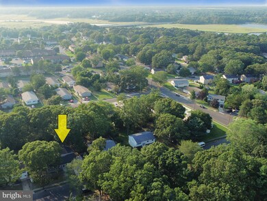
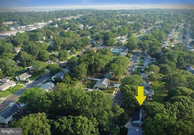
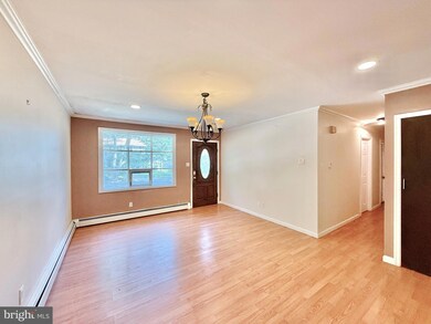
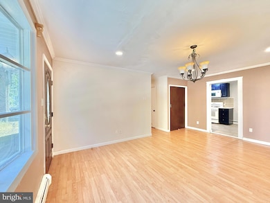
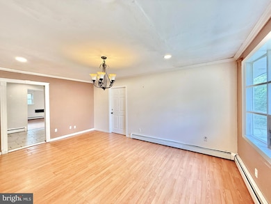
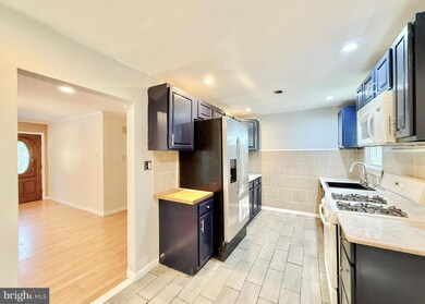
Welcome to this spacious 4-bedroom, 1.5-bath home located in desirable Somers Point! This property features a comfortable living room, a functional kitchen, a cozy den perfect for relaxing or entertaining, and a dedicated laundry room for added convenience. Situated just minutes from Route 9, the Garden State Parkway, and a variety of local shops, restaurants, and amenities, this home offers both comfort and convenience. Don’t miss your opportunity to own in this charming coastal community! Property is being sold As-Is condition. Buyer is responsible for all certifications. Seller never occupied. Neither the seller or listing agent make any representation as to the accuracy of any information contained herein. Buyer must conduct their own due diligence, verification, research and inspections and are relying solely on the results thereof.
Last Agent to Sell the Property
(609) 247-8650 info@ajfalcianirealty.com A J Falciani Realty License #0014018 Listed on: 08/01/2025
Last Buyer's Agent
datacorrect@brightmls.com Non Subscribing Office License #0225194075
| Date | Type | Sale Price | Title Company |
|---|---|---|---|
| Sheriffs Deed | $3,509 | None Listed On Document | |
| Deed | $140,000 | -- | |
| Deed | $140,000 | Lawyers Title Insurance Corp |
| Date | Status | Loan Amount | Loan Type |
|---|---|---|---|
| Previous Owner | $112,000 | Purchase Money Mortgage |
| Date | Event | Price | List to Sale | Price per Sq Ft |
|---|---|---|---|---|
| 10/17/2025 10/17/25 | Sold | $290,000 | +5.5% | $179 / Sq Ft |
| 09/09/2025 09/09/25 | Pending | -- | -- | -- |
| 09/02/2025 09/02/25 | For Sale | $274,900 | 0.0% | $169 / Sq Ft |
| 08/19/2025 08/19/25 | Pending | -- | -- | -- |
| 08/01/2025 08/01/25 | For Sale | $274,900 | -- | $169 / Sq Ft |
| Year | Tax Paid | Tax Assessment Tax Assessment Total Assessment is a certain percentage of the fair market value that is determined by local assessors to be the total taxable value of land and additions on the property. | Land | Improvement |
|---|---|---|---|---|
| 2025 | $6,552 | $190,200 | $68,100 | $122,100 |
| 2024 | $6,552 | $190,200 | $68,100 | $122,100 |
| 2023 | $6,105 | $190,200 | $68,100 | $122,100 |
| 2022 | $6,105 | $190,200 | $68,100 | $122,100 |
| 2021 | $6,009 | $190,200 | $68,100 | $122,100 |
| 2020 | $5,882 | $190,200 | $68,100 | $122,100 |
| 2019 | $5,709 | $190,200 | $68,100 | $122,100 |
| 2018 | $5,679 | $193,300 | $68,100 | $125,200 |
| 2017 | $5,466 | $193,300 | $68,100 | $125,200 |
| 2016 | $5,207 | $193,300 | $68,100 | $125,200 |
| 2015 | $5,151 | $193,300 | $68,100 | $125,200 |
| 2014 | $4,969 | $193,300 | $68,100 | $125,200 |
Seller's Agent in 2025
Monica Falciani
A J Falciani Realty
(609) 247-8650
2 in this area
255 Total Sales
d
Buyer's Agent in 2025
datacorrect BrightMLS
Non Subscribing Office
Source: Bright MLS
MLS Number: NJAC2020000
APN: 21-00722-0000-00005
Disclaimer: Certain information contained herein is derived from information provided by parties other than Homes.com. All information provided is deemed reliable, but is not guaranteed to be accurate and should be independently verified.
![]() The data relating to real estate for sale on this website appears in part through the BRIGHT Internet Data Exchange program, a voluntary cooperative exchange of property listing data between licensed real estate brokerage firms, and is provided by BRIGHT through a licensing agreement.
The data relating to real estate for sale on this website appears in part through the BRIGHT Internet Data Exchange program, a voluntary cooperative exchange of property listing data between licensed real estate brokerage firms, and is provided by BRIGHT through a licensing agreement.
Listing information is from various brokers who participate in the Bright MLS IDX program and not all listings may be visible on the site.
The property information being provided on or through the website is for the personal, non-commercial use of consumers and such information may not be used for any purpose other than to identify prospective properties consumers may be interested in purchasing.
Some properties which appear for sale on the website may no longer be available because they are for instance, under contract, sold or are no longer being offered for sale.
Property information displayed is deemed reliable but is not guaranteed.
Copyright 2025 Bright MLS, Inc.