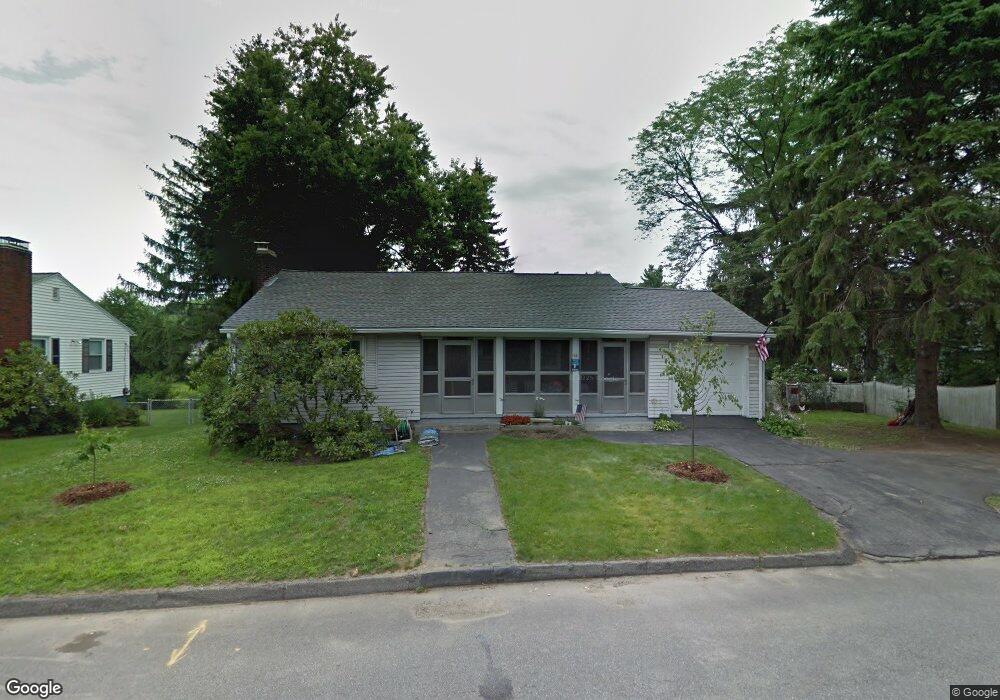
10 Frothingham Rd Worcester, MA 01605
Brittan Square NeighborhoodEstimated Value: $397,000 - $422,000
2
Beds
2
Baths
1,200
Sq Ft
$340/Sq Ft
Est. Value
About This Home
This home is located at 10 Frothingham Rd, Worcester, MA 01605 and is currently estimated at $408,335, approximately $340 per square foot. 10 Frothingham Rd is a home located in Worcester County with nearby schools including Jacob Hiatt Magnet School, Chandler Magnet, and Wawecus Road School.
Ownership History
Date
Name
Owned For
Owner Type
Purchase Details
Closed on
Jan 30, 2013
Sold by
Sullivan Frederick J
Bought by
Boylan Kathi M
Current Estimated Value
Home Financials for this Owner
Home Financials are based on the most recent Mortgage that was taken out on this home.
Original Mortgage
$139,500
Outstanding Balance
$97,518
Interest Rate
3.41%
Mortgage Type
New Conventional
Estimated Equity
$310,817
Create a Home Valuation Report for This Property
The Home Valuation Report is an in-depth analysis detailing your home's value as well as a comparison with similar homes in the area
Home Values in the Area
Average Home Value in this Area
Purchase History
| Date | Buyer | Sale Price | Title Company |
|---|---|---|---|
| Boylan Kathi M | $155,000 | -- | |
| Boylan Kathi M | $155,000 | -- |
Source: Public Records
Mortgage History
| Date | Status | Borrower | Loan Amount |
|---|---|---|---|
| Open | Boylan Kathi M | $139,500 | |
| Closed | Boylan Kathi M | $139,500 |
Source: Public Records
Tax History
| Year | Tax Paid | Tax Assessment Tax Assessment Total Assessment is a certain percentage of the fair market value that is determined by local assessors to be the total taxable value of land and additions on the property. | Land | Improvement |
|---|---|---|---|---|
| 2025 | $4,831 | $366,300 | $118,700 | $247,600 |
| 2024 | $4,731 | $344,100 | $118,700 | $225,400 |
| 2023 | $4,570 | $318,700 | $103,200 | $215,500 |
| 2022 | $4,046 | $266,000 | $82,600 | $183,400 |
| 2021 | $3,930 | $241,400 | $66,100 | $175,300 |
| 2020 | $3,774 | $222,000 | $66,100 | $155,900 |
| 2019 | $3,247 | $180,400 | $59,500 | $120,900 |
| 2018 | $3,162 | $167,200 | $59,500 | $107,700 |
| 2017 | $3,214 | $167,200 | $59,500 | $107,700 |
| 2016 | $3,104 | $150,600 | $43,600 | $107,000 |
| 2015 | $3,023 | $150,600 | $43,600 | $107,000 |
| 2014 | $2,943 | $150,600 | $43,600 | $107,000 |
Source: Public Records
Map
Nearby Homes
- 5 Wakefield St
- 30 Melrose St
- 2 Selden St
- 33 Denmark St
- 249 Lincoln St
- 100 Burncoat St
- 25 Kenwood Ave
- 27 Harlow St
- 6 Ashburnham Rd
- 78 Green Hill Pkwy
- 74 Green Hill Pkwy
- 176 Lincoln St Unit 4
- 26 Orne St
- 32 Hemans St
- 110 Beverly Rd
- 3 Perkins St
- 20B Edgeworth St
- 139 Lincoln St
- 63 North St Unit D
- 63 North St Unit C
- 12 Frothingham Rd
- 320 Lincoln St
- 326 Lincoln St
- 316 Lincoln St
- 14 Frothingham Rd
- 328 Lincoln St
- 11 Frothingham Rd
- 15 Frothingham Rd
- 7 Frothingham Rd
- 16 Frothingham Rd
- 330 Lincoln St
- 17 Frothingham Rd
- 31 Oran St Unit B
- 31 Oran St Unit A
- 20 Frothingham Rd
- 20 Frothingham Rd Unit 1
- 5 Frothingham Rd
- 1 Buckingham St
- 1 Buckingham Rd
- 33 Oran St
Your Personal Tour Guide
Ask me questions while you tour the home.