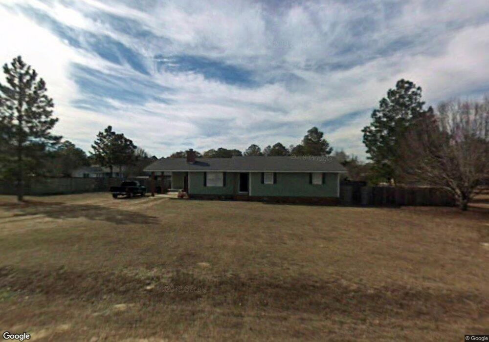
10 Gail Cir Tifton, GA 31793
Estimated Value: $191,000 - $280,000
3
Beds
2
Baths
1,316
Sq Ft
$165/Sq Ft
Est. Value
About This Home
This home is located at 10 Gail Cir, Tifton, GA 31793 and is currently estimated at $216,776, approximately $164 per square foot. 10 Gail Cir is a home located in Tift County with nearby schools including Annie Belle Clark Primary School, Matt Wilson Elementary School, and J.T. Reddick School.
Ownership History
Date
Name
Owned For
Owner Type
Purchase Details
Closed on
Mar 18, 2005
Sold by
Mitcham Timothy A
Bought by
Driggers Michael W and Driggers Amanda M
Current Estimated Value
Home Financials for this Owner
Home Financials are based on the most recent Mortgage that was taken out on this home.
Original Mortgage
$85,000
Outstanding Balance
$42,978
Interest Rate
5.57%
Mortgage Type
New Conventional
Estimated Equity
$173,798
Purchase Details
Closed on
Jun 1, 1987
Sold by
Chestnutt Eric Drew and Chestnutt Kathy S
Bought by
Mitcham Timothy A and Mitcham Kathy
Create a Home Valuation Report for This Property
The Home Valuation Report is an in-depth analysis detailing your home's value as well as a comparison with similar homes in the area
Home Values in the Area
Average Home Value in this Area
Purchase History
| Date | Buyer | Sale Price | Title Company |
|---|---|---|---|
| Driggers Michael W | $85,000 | -- | |
| Mitcham Timothy A | $44,600 | -- | |
| Chestnutt Eric Drew | $44,600 | -- |
Source: Public Records
Mortgage History
| Date | Status | Borrower | Loan Amount |
|---|---|---|---|
| Open | Driggers Michael W | $85,000 |
Source: Public Records
Tax History Compared to Growth
Tax History
| Year | Tax Paid | Tax Assessment Tax Assessment Total Assessment is a certain percentage of the fair market value that is determined by local assessors to be the total taxable value of land and additions on the property. | Land | Improvement |
|---|---|---|---|---|
| 2024 | $1,179 | $56,055 | $6,000 | $50,055 |
| 2023 | $1,281 | $30,340 | $2,800 | $27,540 |
| 2022 | $841 | $30,340 | $2,800 | $27,540 |
| 2021 | $846 | $30,340 | $2,800 | $27,540 |
| 2020 | $862 | $30,340 | $2,800 | $27,540 |
| 2019 | $861 | $30,340 | $2,800 | $27,540 |
| 2018 | $894 | $31,497 | $2,800 | $28,697 |
| 2017 | $899 | $31,497 | $2,800 | $28,697 |
| 2016 | $899 | $31,497 | $2,800 | $28,697 |
| 2015 | $900 | $31,497 | $2,800 | $28,697 |
| 2014 | $902 | $31,497 | $2,800 | $28,697 |
| 2013 | -- | $31,496 | $2,800 | $28,696 |
Source: Public Records
Map
Nearby Homes
- 14 Faye Ct
- 7 Deborah Dr
- 31 Henry Way
- 26 Alan Ln
- 0 W Hutchinson Rd
- 2008 Rutland Rd Unit 10
- 2008 Rutland Rd
- 1808 Rutland Rd
- 100 Elizabeth Dr
- W Hutchinson Rd
- Tract 1 Whiddon Mill Rd
- 131 Oak Point Ave
- 577 Zion Hope Rd
- 106 Mill Ridge Cir
- 51 Logan Dr
- 0 Carpenter Rd N
- 21 Willow Way
- 11 Ridgewood Dr
- 20 Ray Taylor Rd
- 9 Country Club Place