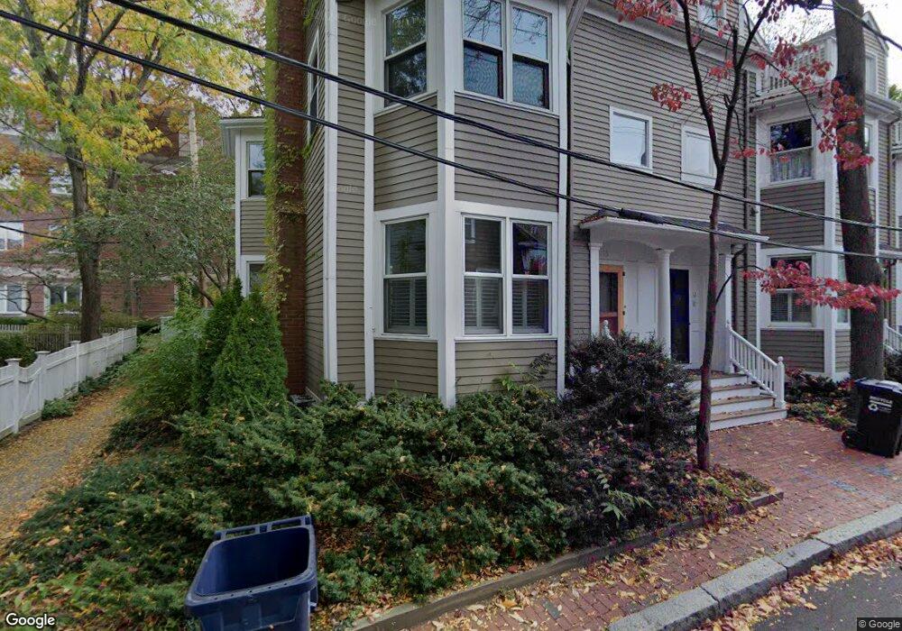
10 Gerry St Unit 14 Cambridge, MA 02138
West Cambridge NeighborhoodEstimated Value: $2,767,000 - $4,311,000
3
Beds
3
Baths
2,338
Sq Ft
$1,367/Sq Ft
Est. Value
About This Home
This home is located at 10 Gerry St Unit 14, Cambridge, MA 02138 and is currently estimated at $3,197,017, approximately $1,367 per square foot. 10 Gerry St Unit 14 is a home located in Middlesex County with nearby schools including St Peter School, Buckingham Browne & Nichols School, and Saint Paul's Choir School.
Ownership History
Date
Name
Owned For
Owner Type
Purchase Details
Closed on
Jun 29, 2007
Sold by
Damico Donald J and Sippel Kimberly C
Bought by
Porter Nancy G and Plumb Richard A
Current Estimated Value
Home Financials for this Owner
Home Financials are based on the most recent Mortgage that was taken out on this home.
Original Mortgage
$300,000
Outstanding Balance
$184,948
Interest Rate
6.24%
Mortgage Type
Purchase Money Mortgage
Estimated Equity
$3,012,069
Purchase Details
Closed on
Jun 22, 2004
Sold by
Barlow-Roosevelt Jae
Bought by
Amico Donald J and Sippel Kimberly C
Home Financials for this Owner
Home Financials are based on the most recent Mortgage that was taken out on this home.
Original Mortgage
$892,500
Interest Rate
6.12%
Mortgage Type
Purchase Money Mortgage
Create a Home Valuation Report for This Property
The Home Valuation Report is an in-depth analysis detailing your home's value as well as a comparison with similar homes in the area
Home Values in the Area
Average Home Value in this Area
Purchase History
| Date | Buyer | Sale Price | Title Company |
|---|---|---|---|
| Porter Nancy G | $1,175,000 | -- | |
| Porter Nancy G | $1,175,000 | -- | |
| Amico Donald J | $1,190,000 | -- | |
| Amico Donald J | $1,190,000 | -- |
Source: Public Records
Mortgage History
| Date | Status | Borrower | Loan Amount |
|---|---|---|---|
| Open | Porter Nancy G | $300,000 | |
| Closed | Amico Donald J | $300,000 | |
| Previous Owner | Amico Donald J | $892,500 |
Source: Public Records
Tax History Compared to Growth
Tax History
| Year | Tax Paid | Tax Assessment Tax Assessment Total Assessment is a certain percentage of the fair market value that is determined by local assessors to be the total taxable value of land and additions on the property. | Land | Improvement |
|---|---|---|---|---|
| 2025 | $16,161 | $2,545,100 | $0 | $2,545,100 |
| 2024 | $15,177 | $2,563,600 | $0 | $2,563,600 |
| 2023 | $13,675 | $2,333,700 | $0 | $2,333,700 |
| 2022 | $13,156 | $2,222,300 | $0 | $2,222,300 |
| 2021 | $12,600 | $2,153,900 | $0 | $2,153,900 |
| 2020 | $11,532 | $2,005,600 | $0 | $2,005,600 |
| 2019 | $11,066 | $1,862,900 | $0 | $1,862,900 |
| 2018 | $10,770 | $1,712,300 | $0 | $1,712,300 |
| 2017 | $10,697 | $1,648,300 | $0 | $1,648,300 |
| 2016 | $10,428 | $1,491,800 | $0 | $1,491,800 |
| 2015 | $10,350 | $1,323,500 | $0 | $1,323,500 |
| 2014 | $10,215 | $1,219,000 | $0 | $1,219,000 |
Source: Public Records
Map
Nearby Homes
- 986 Memorial Dr Unit 404
- 988 Memorial Dr Unit 386
- 983 Memorial Dr Unit 502
- 984 Memorial Dr Unit 984-503
- 5 Brewer St Unit 5
- 130 Mount Auburn St Unit 108
- 32 Hawthorn St
- 975 Memorial Dr Unit 209
- 975 Memorial Dr Unit 211
- 12 Berkeley St
- 3 Berkeley Place
- 20 Maynard Place
- 1010 Memorial Dr Unit 6G
- 22 Concord Ave Unit 10
- 50 Follen St Unit 505
- 50 Follen St Unit 109
- 15 Hubbard Park Rd
- 44 Garden St
- 48 Hubbard Park Rd
- 52 Garden St Unit B2
- 10 Gerry St Unit 14
- 10 Gerry St Unit 14
- 14 Gerry St
- 8 Gerry St
- 16 Gerry St
- 1 Chapman Place Unit Second Floor
- 11 Gerry St Unit 2
- 11 Gerry St Unit 1
- 11.5 Gerry Unit Street
- 5 Revere St
- 130 Mount Auburn St Unit 305
- 130 Mount Auburn St Unit 510
- 130 Mount Auburn St Unit 509
- 130 Mount Auburn St Unit 508
- 130 Mount Auburn St Unit 412
- 130 Mount Auburn St Unit 411
- 130 Mount Auburn St Unit 410
- 130 Mount Auburn St Unit 409
- 130 Mount Auburn St Unit 406
- 130 Mount Auburn St Unit 405