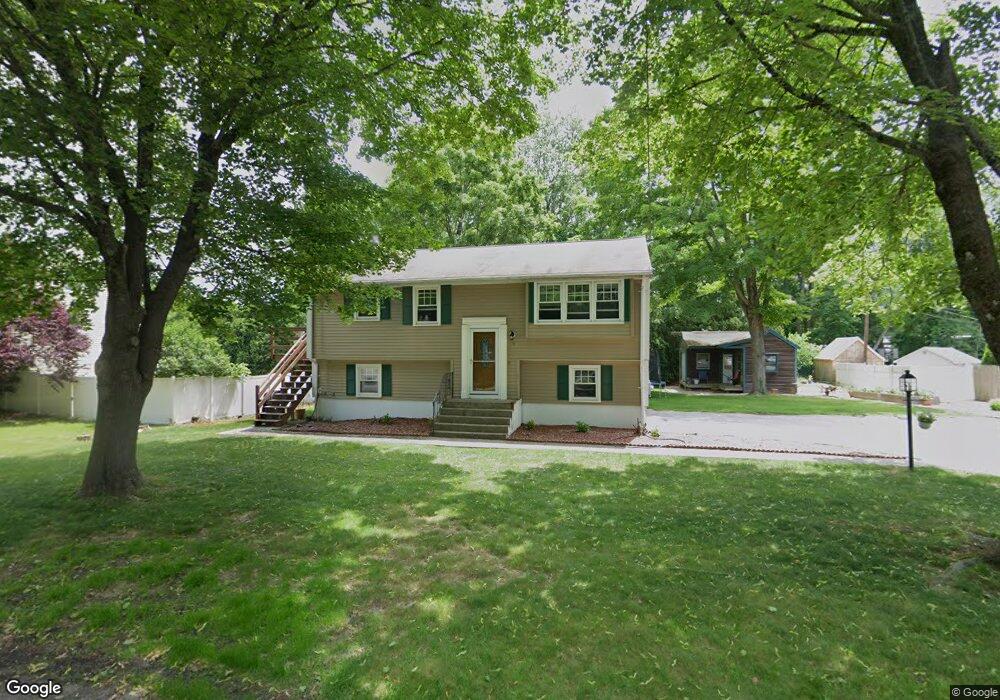
10 Gover Rd Millbury, MA 01527
Estimated Value: $434,000 - $614,000
3
Beds
2
Baths
1,596
Sq Ft
$318/Sq Ft
Est. Value
About This Home
This home is located at 10 Gover Rd, Millbury, MA 01527 and is currently estimated at $507,482, approximately $317 per square foot. 10 Gover Rd is a home located in Worcester County with nearby schools including Elmwood Street Elementary School, Raymond E. Shaw Elementary School, and Millbury Junior/Senior High School.
Ownership History
Date
Name
Owned For
Owner Type
Purchase Details
Closed on
Sep 1, 2009
Sold by
Puzar Lynne M
Bought by
Federici Bryan A and Federici Nicole M
Current Estimated Value
Home Financials for this Owner
Home Financials are based on the most recent Mortgage that was taken out on this home.
Original Mortgage
$232,707
Outstanding Balance
$148,916
Interest Rate
5.17%
Mortgage Type
Purchase Money Mortgage
Estimated Equity
$358,566
Purchase Details
Closed on
Apr 17, 1987
Sold by
Zecco Joseph A
Bought by
Pugliese Mark
Home Financials for this Owner
Home Financials are based on the most recent Mortgage that was taken out on this home.
Original Mortgage
$85,000
Interest Rate
8.97%
Mortgage Type
Purchase Money Mortgage
Create a Home Valuation Report for This Property
The Home Valuation Report is an in-depth analysis detailing your home's value as well as a comparison with similar homes in the area
Home Values in the Area
Average Home Value in this Area
Purchase History
| Date | Buyer | Sale Price | Title Company |
|---|---|---|---|
| Federici Bryan A | $238,500 | -- | |
| Federici Bryan A | $238,500 | -- | |
| Pugliese Mark | $132,000 | -- |
Source: Public Records
Mortgage History
| Date | Status | Borrower | Loan Amount |
|---|---|---|---|
| Open | Federici Bryan A | $232,707 | |
| Closed | Pugliese Mark | $232,707 | |
| Previous Owner | Pugliese Mark | $86,500 | |
| Previous Owner | Pugliese Mark | $14,000 | |
| Previous Owner | Pugliese Mark | $85,000 |
Source: Public Records
Tax History
| Year | Tax Paid | Tax Assessment Tax Assessment Total Assessment is a certain percentage of the fair market value that is determined by local assessors to be the total taxable value of land and additions on the property. | Land | Improvement |
|---|---|---|---|---|
| 2025 | $4,854 | $362,500 | $107,600 | $254,900 |
| 2024 | $4,431 | $334,900 | $99,700 | $235,200 |
| 2023 | $4,089 | $283,000 | $69,900 | $213,100 |
| 2022 | $3,827 | $255,100 | $69,900 | $185,200 |
| 2021 | $3,771 | $244,400 | $69,900 | $174,500 |
| 2020 | $6,154 | $252,000 | $69,900 | $182,100 |
| 2019 | $3,940 | $248,600 | $69,600 | $179,000 |
| 2018 | $3,895 | $238,400 | $69,600 | $168,800 |
| 2017 | $3,549 | $216,000 | $69,600 | $146,400 |
| 2016 | $3,330 | $202,300 | $69,600 | $132,700 |
| 2015 | $3,271 | $198,700 | $70,800 | $127,900 |
| 2014 | $3,189 | $186,500 | $74,000 | $112,500 |
Source: Public Records
Map
Nearby Homes
- 2 Riverlin Pkwy
- 2 Wilson Rd Unit B
- 2 Wilson Rd Unit A
- 8 Lincoln Ave
- 17 Lincoln Ave
- 7 Canal St
- 48 Macarthur Dr
- 37-39 Main St
- 25 Upton St
- 20 Woodridge Rd
- 46 Lexington Rd
- 2 Diane St
- Lot 1 Cooper Rd
- 0 Worcester Providence Turnpike
- 8 Sycamore Cir
- 8 Autumn Gate Cir
- 300 Millbury Ave
- 12 Irene Ct
- 8 Nightview Place
- 38 W Main St
Your Personal Tour Guide
Ask me questions while you tour the home.