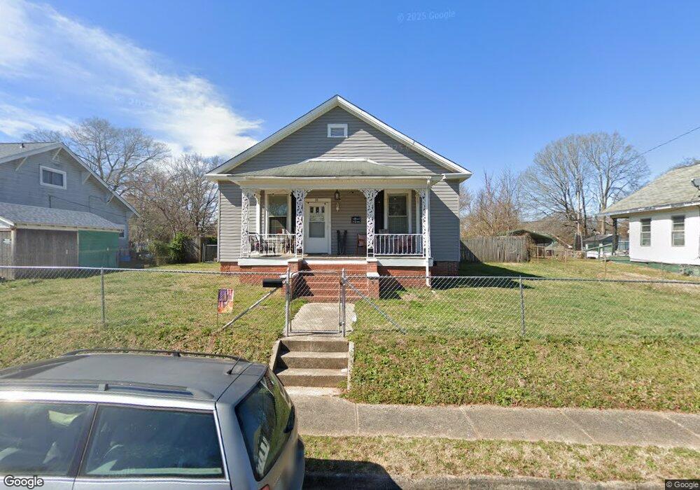
10 Graham St Rock Hill, SC 29730
Estimated Value: $153,000 - $220,000
--
Bed
--
Bath
1,130
Sq Ft
$173/Sq Ft
Est. Value
About This Home
This home is located at 10 Graham St, Rock Hill, SC 29730 and is currently estimated at $195,269, approximately $172 per square foot. 10 Graham St is a home located in York County with nearby schools including Northside Elementary School of The Arts, Castle Heights Middle School, and Rock Hill High School.
Ownership History
Date
Name
Owned For
Owner Type
Purchase Details
Closed on
Mar 11, 2022
Sold by
Edward Lee Raymond
Bought by
Bellmoore Llc
Current Estimated Value
Purchase Details
Closed on
Dec 14, 2010
Sold by
Federal National Mortgage Association
Bought by
Lee Raymond Edward
Purchase Details
Closed on
Jul 14, 2010
Sold by
Aubry Norma P
Bought by
Federal National Mortgage Association
Purchase Details
Closed on
Aug 21, 2007
Sold by
Mcneely Chaston
Bought by
Aubry Norma P
Home Financials for this Owner
Home Financials are based on the most recent Mortgage that was taken out on this home.
Original Mortgage
$68,000
Interest Rate
6.65%
Mortgage Type
New Conventional
Purchase Details
Closed on
May 2, 2002
Sold by
Sweatt Laura Rachel Mcguirt and Mcguirt Charles Andrew
Bought by
Mcneely Chaston
Create a Home Valuation Report for This Property
The Home Valuation Report is an in-depth analysis detailing your home's value as well as a comparison with similar homes in the area
Home Values in the Area
Average Home Value in this Area
Purchase History
| Date | Buyer | Sale Price | Title Company |
|---|---|---|---|
| Bellmoore Llc | $135,000 | None Listed On Document | |
| Lee Raymond Edward | $34,900 | -- | |
| Federal National Mortgage Association | $2,500 | -- | |
| Aubry Norma P | $68,000 | Attorney | |
| Mcneely Chaston | $67,900 | -- |
Source: Public Records
Mortgage History
| Date | Status | Borrower | Loan Amount |
|---|---|---|---|
| Previous Owner | Aubry Norma P | $68,000 |
Source: Public Records
Tax History Compared to Growth
Tax History
| Year | Tax Paid | Tax Assessment Tax Assessment Total Assessment is a certain percentage of the fair market value that is determined by local assessors to be the total taxable value of land and additions on the property. | Land | Improvement |
|---|---|---|---|---|
| 2024 | $3,435 | $7,761 | $960 | $6,801 |
| 2023 | $3,440 | $7,761 | $960 | $6,801 |
| 2022 | $179 | $2,806 | $616 | $2,190 |
| 2021 | -- | $2,806 | $616 | $2,190 |
| 2020 | $179 | $2,806 | $0 | $0 |
| 2019 | $101 | $2,440 | $0 | $0 |
| 2018 | $101 | $2,440 | $0 | $0 |
| 2017 | $97 | $2,440 | $0 | $0 |
| 2016 | $96 | $2,440 | $0 | $0 |
| 2014 | $112 | $2,440 | $640 | $1,800 |
| 2013 | $112 | $2,540 | $640 | $1,900 |
Source: Public Records
Map
Nearby Homes
- 744 Cauthen St
- 1032 Barrow Ct
- 621 Cauthen St
- 644 Annafrel St
- 659 Annafrel St
- 787 Colonial Dr
- 929 Willowbrook Ave
- 484 Willowspring Ln Unit B
- 484 Willowspring Ln Unit A
- 1033 Christopher Cir Unit 15
- 1066 Tremont Ave
- 462 Kimbrell St Unit 5
- 620 3rd St
- 630 N Confederate Ave
- 430 Stoneycreek Ln
- 1233 Pinewood Rd
- 405 Willowbrook Ave
- 309 Frayser St
- 315 High St
- 304 N Jones Ave
