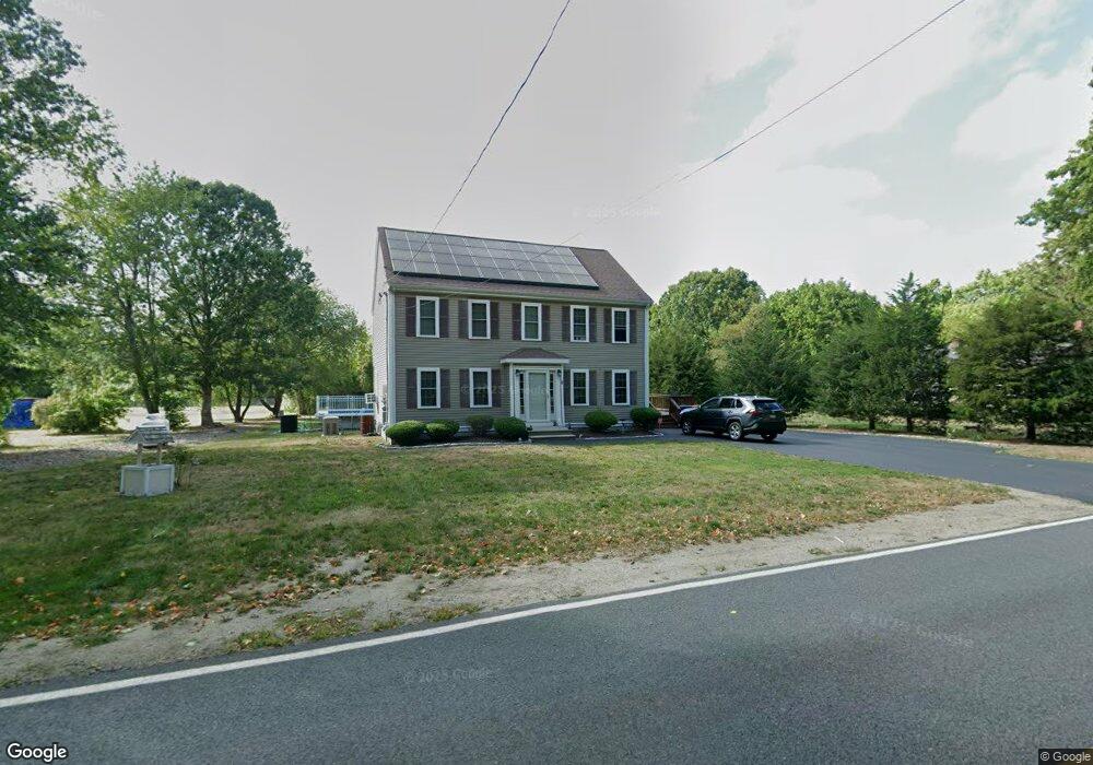
10 Green St Carver, MA 02330
Estimated Value: $381,000 - $425,000
2
Beds
1
Bath
834
Sq Ft
$484/Sq Ft
Est. Value
About This Home
This home is located at 10 Green St, Carver, MA 02330 and is currently estimated at $403,633, approximately $483 per square foot. 10 Green St is a home located in Plymouth County with nearby schools including Carver Elementary School.
Ownership History
Date
Name
Owned For
Owner Type
Purchase Details
Closed on
Jun 26, 2024
Sold by
Calodesu Llc
Bought by
Green Jesse and Green Kristy
Current Estimated Value
Purchase Details
Closed on
Dec 20, 2007
Sold by
Kahian Steven M
Bought by
West Light Dev
Home Financials for this Owner
Home Financials are based on the most recent Mortgage that was taken out on this home.
Original Mortgage
$242,000
Interest Rate
6.3%
Mortgage Type
Purchase Money Mortgage
Purchase Details
Closed on
Aug 16, 2007
Sold by
Ratner Lynn L
Bought by
Kahian Steven M
Purchase Details
Closed on
Dec 1, 1992
Sold by
Shawmut Mtg Co
Bought by
Benoit John and Benoit Annette
Purchase Details
Closed on
Oct 8, 1992
Sold by
Belcher Anthony A
Bought by
Shawmut Mtg Co
Create a Home Valuation Report for This Property
The Home Valuation Report is an in-depth analysis detailing your home's value as well as a comparison with similar homes in the area
Home Values in the Area
Average Home Value in this Area
Purchase History
| Date | Buyer | Sale Price | Title Company |
|---|---|---|---|
| Green Jesse | $385,000 | None Available | |
| Green Jesse | $385,000 | None Available | |
| Green Jesse | $385,000 | None Available | |
| West Light Dev | $85,000 | -- | |
| Kahian Steven M | $32,000 | -- | |
| Kahian Steven M | -- | -- | |
| Benoit John | $25,000 | -- | |
| Shawmut Mtg Co | $24,500 | -- | |
| Kahian Steven M | $32,000 | -- | |
| Kahian Steven M | -- | -- | |
| Benoit John | $25,000 | -- | |
| Shawmut Mtg Co | $24,500 | -- |
Source: Public Records
Mortgage History
| Date | Status | Borrower | Loan Amount |
|---|---|---|---|
| Previous Owner | Shawmut Mtg Co | $242,000 | |
| Previous Owner | Shawmut Mtg Co | $0 |
Source: Public Records
Tax History Compared to Growth
Tax History
| Year | Tax Paid | Tax Assessment Tax Assessment Total Assessment is a certain percentage of the fair market value that is determined by local assessors to be the total taxable value of land and additions on the property. | Land | Improvement |
|---|---|---|---|---|
| 2025 | $3,731 | $339,800 | $165,500 | $174,300 |
| 2024 | $3,520 | $301,400 | $121,300 | $180,100 |
| 2023 | $3,154 | $269,000 | $110,300 | $158,700 |
| 2022 | $3,154 | $231,600 | $110,300 | $121,300 |
| 2021 | $3,009 | $214,900 | $110,300 | $104,600 |
| 2020 | $2,856 | $208,300 | $110,300 | $98,000 |
| 2019 | $2,639 | $194,600 | $103,900 | $90,700 |
| 2018 | $2,508 | $178,600 | $103,900 | $74,700 |
| 2017 | $2,466 | $176,400 | $103,900 | $72,500 |
| 2016 | $2,143 | $152,100 | $89,400 | $62,700 |
| 2015 | $2,082 | $152,000 | $89,400 | $62,600 |
| 2014 | $1,431 | $107,700 | $76,600 | $31,100 |
Source: Public Records
Map
Nearby Homes
- 7 Green St
- 26 Santana Way Unit 26
- 11 Brockton Ave
- 135 Plymouth St
- 23 Shaw St
- 6 Susan Cir
- 35 Silva St
- Lot1 Elk Run Dr
- 81 Center St
- 122 High St
- 64 Wenham Rd
- 141 Rocky Meadow St
- 20 Spring St
- 6 Kestrel Way
- 162 Plympton St
- 759 Plymouth St
- 269 Purchase St
- 0 Spring St
- 5 Carver Square Blvd Unit 5
- 5 Carver Square Blvd
- 8 Green St
- 8 Green St
- 9 Green St
- 11 Green St
- 14 Green St
- 5 Green St
- 13 Green St
- 16 Green St
- 6 Green St
- 6 Green St Unit 1
- 6 Green St Unit 4
- 6 Green St Unit 3
- 6 Green St Unit 5
- 1 Braddock Way
- 3 Braddock Way Unit Route 58
- 3 Braddock Way (Rt58)
- 3 Braddock Way
- 3 Braddock Way Unit B
- 3 Braddock Way Unit A
- 15 Green St