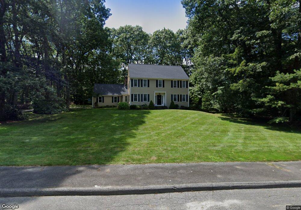
10 Grogan Path Marlborough, MA 01752
Estimated Value: $864,000 - $1,154,000
4
Beds
3
Baths
2,394
Sq Ft
$395/Sq Ft
Est. Value
About This Home
This home is located at 10 Grogan Path, Marlborough, MA 01752 and is currently estimated at $944,966, approximately $394 per square foot. 10 Grogan Path is a home located in Middlesex County with nearby schools including Marlborough High School, New Covenant Christian School, and Glenhaven Academy - JRI School.
Ownership History
Date
Name
Owned For
Owner Type
Purchase Details
Closed on
Dec 21, 2021
Sold by
Matchinski Elizabeth M
Bought by
E M Matchinski Ret
Current Estimated Value
Purchase Details
Closed on
Jul 24, 1995
Sold by
Leclerc Daniel and Therien Chantal
Bought by
Matchinski Donald J and Matchinski Elizabeth M
Home Financials for this Owner
Home Financials are based on the most recent Mortgage that was taken out on this home.
Original Mortgage
$203,150
Interest Rate
7.49%
Mortgage Type
Purchase Money Mortgage
Purchase Details
Closed on
Jun 1, 1993
Sold by
Lucas David G and Fedorshak Marion
Bought by
Leclerc Daniel and Therien Chantal
Home Financials for this Owner
Home Financials are based on the most recent Mortgage that was taken out on this home.
Original Mortgage
$198,400
Interest Rate
7.41%
Mortgage Type
Purchase Money Mortgage
Create a Home Valuation Report for This Property
The Home Valuation Report is an in-depth analysis detailing your home's value as well as a comparison with similar homes in the area
Home Values in the Area
Average Home Value in this Area
Purchase History
| Date | Buyer | Sale Price | Title Company |
|---|---|---|---|
| E M Matchinski Ret | -- | None Available | |
| Matchinski Donald J | $271,000 | -- | |
| Leclerc Daniel | $248,000 | -- |
Source: Public Records
Mortgage History
| Date | Status | Borrower | Loan Amount |
|---|---|---|---|
| Previous Owner | Leclerc Daniel | $203,150 | |
| Previous Owner | Leclerc Daniel | $198,400 |
Source: Public Records
Tax History Compared to Growth
Tax History
| Year | Tax Paid | Tax Assessment Tax Assessment Total Assessment is a certain percentage of the fair market value that is determined by local assessors to be the total taxable value of land and additions on the property. | Land | Improvement |
|---|---|---|---|---|
| 2025 | $7,778 | $788,800 | $250,200 | $538,600 |
| 2024 | $7,459 | $728,400 | $227,300 | $501,100 |
| 2023 | $7,728 | $669,700 | $187,300 | $482,400 |
| 2022 | $7,468 | $569,200 | $178,600 | $390,600 |
| 2021 | $8,669 | $537,500 | $149,000 | $388,500 |
| 2020 | $11,088 | $513,900 | $142,000 | $371,900 |
| 2019 | $7,039 | $500,300 | $139,400 | $360,900 |
| 2018 | $2,667 | $486,200 | $128,500 | $357,700 |
| 2017 | $7,066 | $461,200 | $130,700 | $330,500 |
| 2016 | $6,880 | $448,500 | $130,700 | $317,800 |
| 2015 | $7,057 | $447,800 | $140,900 | $306,900 |
Source: Public Records
Map
Nearby Homes
- 168 Blanchette Dr
- 618 Sudbury St
- 551 Sudbury St
- 17 Mcneil Cir
- 3 Stonehill Rd
- 28 Stetson Dr
- 38 Collins Dr
- 16 Minehan Ln
- 492 Stow Rd
- 114 Linda Cir
- 688 Boston Post Rd E Unit 202
- 688 Boston Post Rd E Unit 304
- 688 Boston Post Rd E Unit 100
- 688 Boston Post Rd E Unit 324
- 688 Boston Post Rd E Unit 228
- 274 Naugler Ave
- 624 Boston Post Rd E Unit 7
- 33A Russo Dr
- 608 Boston Post Rd E Unit 11
- 596 Boston Post Rd E Unit 13
- 27 Kinder Cir
- 29 Kinder Cir
- 15 Kinder Cir
- 5 Kinder Cir
- 22 Kinder Cir
- 24 Kinder Cir
- 26 Kinder Cir
- 28 Kinder Cir
- 23 Kinder Cir
- 25 Kinder Circle (Lot 25)
- 30 Grogan Path
- 612 Hemenway St
- 593 Hemenway St
- 23 Grogan Path
- 31 Kinder Cir
- 605 Hemenway St
- 579 Hemenway St
- 562 Hemenway St
- 39 Kinder Cir
- 621 Hemenway St