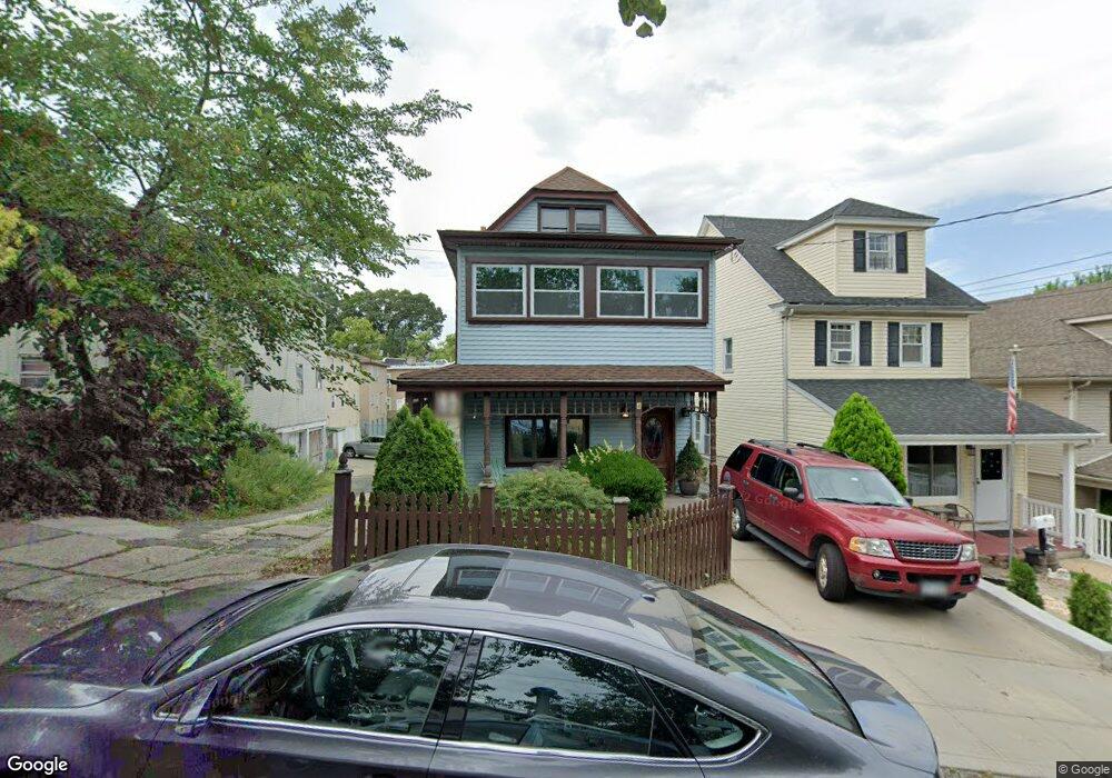
10 Harbor View Ct Staten Island, NY 10301
Tompkinsville NeighborhoodEstimated Value: $544,397 - $763,000
--
Bed
4
Baths
1,550
Sq Ft
$399/Sq Ft
Est. Value
About This Home
This home is located at 10 Harbor View Ct, Staten Island, NY 10301 and is currently estimated at $619,099, approximately $399 per square foot. 10 Harbor View Ct is a home located in Richmond County with nearby schools including P.S. 45 John Tyler, Is 61 William A Morris, and Curtis High School.
Ownership History
Date
Name
Owned For
Owner Type
Purchase Details
Closed on
Mar 18, 2013
Sold by
Edwards Robert J and Edwards William M
Bought by
Edwards Tiffany
Current Estimated Value
Home Financials for this Owner
Home Financials are based on the most recent Mortgage that was taken out on this home.
Original Mortgage
$140,000
Outstanding Balance
$98,884
Interest Rate
3.56%
Mortgage Type
New Conventional
Estimated Equity
$520,215
Purchase Details
Closed on
May 11, 2005
Sold by
Edwards Robert J and Edwards Margaret
Bought by
Edwards Robert J and Edwards William M
Create a Home Valuation Report for This Property
The Home Valuation Report is an in-depth analysis detailing your home's value as well as a comparison with similar homes in the area
Home Values in the Area
Average Home Value in this Area
Purchase History
| Date | Buyer | Sale Price | Title Company |
|---|---|---|---|
| Edwards Tiffany | $263,692 | None Available | |
| Edwards Robert J | -- | -- |
Source: Public Records
Mortgage History
| Date | Status | Borrower | Loan Amount |
|---|---|---|---|
| Open | Edwards Tiffany | $140,000 |
Source: Public Records
Tax History Compared to Growth
Tax History
| Year | Tax Paid | Tax Assessment Tax Assessment Total Assessment is a certain percentage of the fair market value that is determined by local assessors to be the total taxable value of land and additions on the property. | Land | Improvement |
|---|---|---|---|---|
| 2025 | $4,988 | $33,540 | $10,147 | $23,393 |
| 2024 | $5,000 | $35,820 | $8,964 | $26,856 |
| 2023 | $4,853 | $25,297 | $8,474 | $16,823 |
| 2022 | $4,477 | $29,700 | $12,240 | $17,460 |
| 2021 | $4,697 | $28,920 | $12,240 | $16,680 |
| 2020 | $4,609 | $28,260 | $12,240 | $16,020 |
| 2019 | $4,280 | $24,540 | $12,240 | $12,300 |
| 2018 | $4,000 | $21,081 | $9,708 | $11,373 |
| 2017 | $3,329 | $19,888 | $11,968 | $7,920 |
| 2016 | $3,226 | $19,800 | $12,240 | $7,560 |
| 2015 | $2,795 | $19,310 | $13,613 | $5,697 |
| 2014 | $2,795 | $18,218 | $11,087 | $7,131 |
Source: Public Records
Map
Nearby Homes
- 279 Stanley Ave
- 0 Stanley Ave
- 260 Brighton Ave
- 164 Brighton Ave
- 251 Castleton Ave
- 139 Brighton Ave
- 130 Brighton Ave
- 328 Stanley Ave
- 310 Brighton Ave
- 333 Lafayette Ave
- 24 Webster Ave
- 132 Alden Place
- 19 Webster Ave
- 414 Castleton Ave
- 435 Castleton Ave
- 16 Butler Terrace
- 3 Silver Lake Rd
- 12 Silver Lake Rd
- 171 Silver Lake Rd
- 293 Lafayette Ave
- 12 Harbor View Ct
- 297 Castleton Ave
- 297 Castleton Ave Unit 2
- 16 Harbor View Ct
- 303 Castleton Ave
- 307 Castleton Ave
- 7 Portland Place
- 311 Castleton Ave
- 11 Portland Place
- 5 Harbor View Ct
- 7 Harbor View Ct
- 13 Portland Place
- 9 Harbor View Ct
- 3 Portland Place
- 35 Portland Place
- 18 Harbor View Ct Unit 158
- 18 Harbor View Ct Unit A
- 248 Stanley Ave
- 258 Stanley Ave
- 18A Harbor View Ct