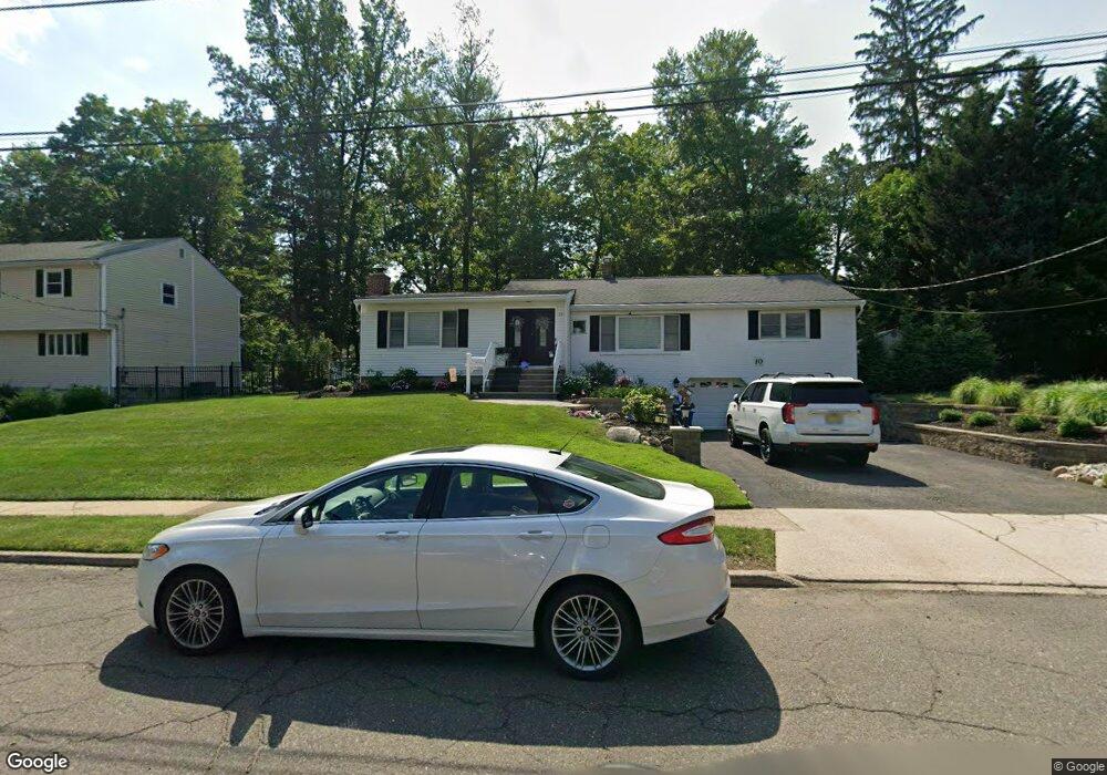
10 Harding Ct Park Ridge, NJ 07656
Estimated Value: $682,000 - $830,000
3
Beds
2
Baths
2,100
Sq Ft
$351/Sq Ft
Est. Value
About This Home
This home is located at 10 Harding Ct, Park Ridge, NJ 07656 and is currently estimated at $737,567, approximately $351 per square foot. 10 Harding Ct is a home located in Bergen County with nearby schools including Park Ridge High School and Our Lady of Mercy Academy.
Ownership History
Date
Name
Owned For
Owner Type
Purchase Details
Closed on
May 11, 2021
Sold by
Williams Robert A and Williams Marianne
Bought by
Perrone Chelsea and Czesniewski Thomas
Current Estimated Value
Home Financials for this Owner
Home Financials are based on the most recent Mortgage that was taken out on this home.
Original Mortgage
$532,610
Interest Rate
3%
Mortgage Type
FHA
Purchase Details
Closed on
Sep 19, 2005
Sold by
Snyder Robert
Bought by
Williams Marianne
Home Financials for this Owner
Home Financials are based on the most recent Mortgage that was taken out on this home.
Original Mortgage
$300,000
Interest Rate
5.81%
Create a Home Valuation Report for This Property
The Home Valuation Report is an in-depth analysis detailing your home's value as well as a comparison with similar homes in the area
Home Values in the Area
Average Home Value in this Area
Purchase History
| Date | Buyer | Sale Price | Title Company |
|---|---|---|---|
| Perrone Chelsea | $551,000 | Northern New Jesey Ttl Svcs | |
| Williams Marianne | $540,000 | -- |
Source: Public Records
Mortgage History
| Date | Status | Borrower | Loan Amount |
|---|---|---|---|
| Previous Owner | Perrone Chelsea | $532,610 | |
| Previous Owner | Williams Marianne | $300,000 |
Source: Public Records
Tax History Compared to Growth
Tax History
| Year | Tax Paid | Tax Assessment Tax Assessment Total Assessment is a certain percentage of the fair market value that is determined by local assessors to be the total taxable value of land and additions on the property. | Land | Improvement |
|---|---|---|---|---|
| 2025 | $12,732 | $392,000 | $257,500 | $134,500 |
| 2024 | $12,485 | $392,000 | $257,500 | $134,500 |
| 2023 | $12,109 | $392,000 | $257,500 | $134,500 |
| 2022 | $12,109 | $392,000 | $257,500 | $134,500 |
| 2021 | $11,838 | $392,000 | $257,500 | $134,500 |
| 2020 | $11,470 | $392,000 | $257,500 | $134,500 |
| 2019 | $11,148 | $392,000 | $257,500 | $134,500 |
| 2018 | $10,847 | $392,000 | $257,500 | $134,500 |
| 2017 | $10,592 | $392,000 | $257,500 | $134,500 |
| 2016 | $10,223 | $392,000 | $257,500 | $134,500 |
| 2015 | $9,812 | $392,000 | $257,500 | $134,500 |
| 2014 | $9,530 | $392,000 | $257,500 | $134,500 |
Source: Public Records
Map
Nearby Homes
- 271 Park Ave
- 230 Capri Terrace
- 153 Sibbald Dr
- 6 Queen Ct
- 710 Tulip Place
- 173 Park Ave
- 559 Stellman Dr
- 578 Colonial Rd
- 57A Fairview Ave
- 560 Barr Ct
- 47 Highview Ave
- 562 Baylor Ave
- 100 Highland St
- 70 Campbell Ave
- 105B S Maple Ave
- 1 Hawthorne Ave
- 54 Hawthorne Ave Unit D
- 70 Hawthorne Ave
- 23 Royal Birkdale Ln
- 188 Broadway Unit 5
- 12 Harding Ct
- 8 Harding Ct
- 7 Harding Ct
- 230 Homestead Place
- 14 Harding Ct
- 9 Harding Ct
- 6 Harding Ct
- 11 Harding Ct
- 13 Sturms Place
- 3 Harding Ct
- 11 Sturms Place
- 229 Shaw Place
- 4 Harding Ct
- 16 Harding Ct
- 9 Sturms Place
- 13 Harding Ct
- 15 Sturms Place
- 232 Homestead Place
- 234 Homestead Place
- 24 Grobel Place