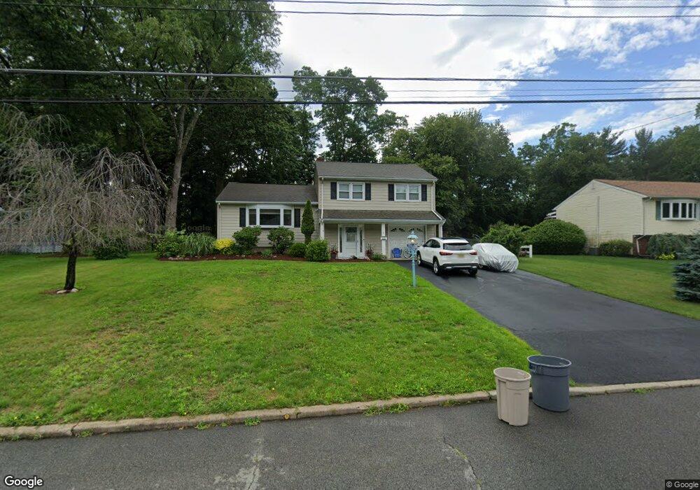
10 Hastings Rd Morris Plains, NJ 07950
Estimated Value: $641,237 - $706,000
--
Bed
--
Bath
1,669
Sq Ft
$410/Sq Ft
Est. Value
About This Home
This home is located at 10 Hastings Rd, Morris Plains, NJ 07950 and is currently estimated at $683,809, approximately $409 per square foot. 10 Hastings Rd is a home located in Morris County with nearby schools including Littleton Elementary School, Brooklawn Middle School, and Parsippany Hills High School.
Ownership History
Date
Name
Owned For
Owner Type
Purchase Details
Closed on
Jul 25, 2024
Sold by
Fila John and Grant Leslie A
Bought by
Grant Leslie A
Current Estimated Value
Purchase Details
Closed on
Mar 2, 2010
Sold by
Estler Leslie A and Grant Leslie A
Bought by
Fila John and Grant Leslie A
Home Financials for this Owner
Home Financials are based on the most recent Mortgage that was taken out on this home.
Original Mortgage
$265,000
Interest Rate
5.02%
Mortgage Type
New Conventional
Purchase Details
Closed on
Mar 14, 2003
Sold by
Estler James
Bought by
Estler Leslie
Purchase Details
Closed on
Sep 24, 1997
Sold by
Willis Aaron Duff and Willis Mavis
Bought by
Estler James E and Estler Leslie A
Home Financials for this Owner
Home Financials are based on the most recent Mortgage that was taken out on this home.
Original Mortgage
$136,000
Interest Rate
7.47%
Mortgage Type
Balloon
Create a Home Valuation Report for This Property
The Home Valuation Report is an in-depth analysis detailing your home's value as well as a comparison with similar homes in the area
Home Values in the Area
Average Home Value in this Area
Purchase History
| Date | Buyer | Sale Price | Title Company |
|---|---|---|---|
| Grant Leslie A | -- | None Listed On Document | |
| Grant Leslie A | -- | None Listed On Document | |
| Fila John | -- | None Available | |
| Estler Leslie | -- | -- | |
| Estler James E | $236,000 | -- |
Source: Public Records
Mortgage History
| Date | Status | Borrower | Loan Amount |
|---|---|---|---|
| Previous Owner | Fila John | $265,000 | |
| Previous Owner | Estler James E | $136,000 |
Source: Public Records
Tax History Compared to Growth
Tax History
| Year | Tax Paid | Tax Assessment Tax Assessment Total Assessment is a certain percentage of the fair market value that is determined by local assessors to be the total taxable value of land and additions on the property. | Land | Improvement |
|---|---|---|---|---|
| 2025 | $11,165 | $321,400 | $188,200 | $133,200 |
| 2024 | $10,953 | $321,400 | $188,200 | $133,200 |
| 2023 | $10,953 | $321,400 | $188,200 | $133,200 |
| 2022 | $10,192 | $321,400 | $188,200 | $133,200 |
| 2021 | $10,192 | $321,400 | $188,200 | $133,200 |
| 2020 | $9,912 | $321,400 | $188,200 | $133,200 |
| 2019 | $9,645 | $321,400 | $188,200 | $133,200 |
| 2018 | $9,372 | $321,400 | $188,200 | $133,200 |
| 2017 | $9,160 | $321,400 | $188,200 | $133,200 |
| 2016 | $9,002 | $321,400 | $188,200 | $133,200 |
| 2015 | $8,774 | $321,400 | $188,200 | $133,200 |
| 2014 | $8,646 | $321,400 | $188,200 | $133,200 |
Source: Public Records
Map
Nearby Homes
- 35 Ferncliff Rd
- 9 Craydon St
- 2 A Foxwood Dr Unit A
- 21 G Foxwood Dr
- 22 A Foxwood Dr Unit A
- 7 J Foxwood Dr Unit J
- 7 D Foxwood Dr Unit D
- 2350 State Route 10 Unit D11
- 62 Brookstone Cir
- 2467 Route 10 Unit 4A
- 21 Holly Dr
- 91 Farmingdale Dr
- 2467 New Jersey 10 Unit 6A
- 2467 New Jersey 10 Unit 1
- 2467 New Jersey 10 Unit 7A
- 2467 Route10 Unit 1A
- 2467 State Route 10 Unit 12-7A
- 2467 State Route 10 Unit 3B
- 2467 State Route 10 Unit 6-B
- 2467 State Route 10 Unit 5A
- 8 Hastings Rd
- 12 Hastings Rd
- 9 Crawford Rd
- 7 Crawford Rd
- 26 Robin Hood Rd
- 6 Hastings Rd
- 9 Hastings Rd
- 7 Hastings Rd
- 5 Hastings Rd
- 29 Robin Hood Rd
- 27 Robin Hood Rd
- 4 Hastings Rd
- 31 Robin Hood Rd
- 10 Crawford Rd
- 25 Robin Hood Rd
- 3 Crawford Rd
- 8 Crawford Rd
- 3 Hastings Rd
- 33 Robin Hood Rd
- 22 Robin Hood Rd