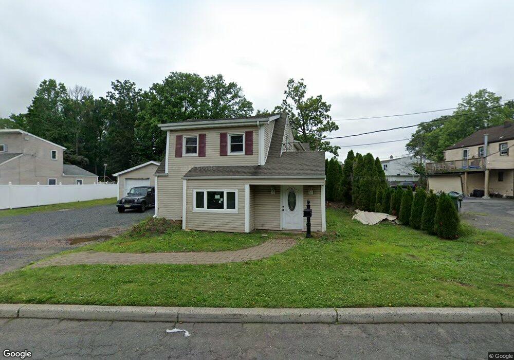
10 Hayes Ave Colonia, NJ 07067
Estimated Value: $544,370 - $653,000
2
Beds
2
Baths
2,128
Sq Ft
$287/Sq Ft
Est. Value
About This Home
This home is located at 10 Hayes Ave, Colonia, NJ 07067 and is currently estimated at $611,593, approximately $287 per square foot. 10 Hayes Ave is a home located in Middlesex County with nearby schools including Pennsylvania Ave School, Colonia Middle School, and Colonia High School.
Ownership History
Date
Name
Owned For
Owner Type
Purchase Details
Closed on
Aug 2, 2019
Sold by
Santander Bank Na
Bought by
Lewicki Dominika
Current Estimated Value
Home Financials for this Owner
Home Financials are based on the most recent Mortgage that was taken out on this home.
Original Mortgage
$271,256
Interest Rate
3.75%
Mortgage Type
FHA
Purchase Details
Closed on
Jan 26, 2018
Sold by
Burman Jaonne M and Burmanl Darryl
Bought by
Santender Bank Na
Purchase Details
Closed on
Dec 16, 1998
Sold by
Weller Huyler
Bought by
Burman Darryl and Burman Joanne
Home Financials for this Owner
Home Financials are based on the most recent Mortgage that was taken out on this home.
Original Mortgage
$122,250
Interest Rate
6.84%
Create a Home Valuation Report for This Property
The Home Valuation Report is an in-depth analysis detailing your home's value as well as a comparison with similar homes in the area
Home Values in the Area
Average Home Value in this Area
Purchase History
| Date | Buyer | Sale Price | Title Company |
|---|---|---|---|
| Lewicki Dominika | $260,205 | First Integrity Title | |
| Santender Bank Na | $164,100 | None Available | |
| Burman Darryl | $163,000 | -- |
Source: Public Records
Mortgage History
| Date | Status | Borrower | Loan Amount |
|---|---|---|---|
| Previous Owner | Lewicki Dominika | $271,256 | |
| Previous Owner | Burman Darryl | $122,250 |
Source: Public Records
Tax History Compared to Growth
Tax History
| Year | Tax Paid | Tax Assessment Tax Assessment Total Assessment is a certain percentage of the fair market value that is determined by local assessors to be the total taxable value of land and additions on the property. | Land | Improvement |
|---|---|---|---|---|
| 2025 | $11,350 | $109,700 | $31,200 | $78,500 |
| 2024 | $11,104 | $93,800 | $31,200 | $62,600 |
| 2023 | $11,104 | $93,800 | $31,200 | $62,600 |
| 2022 | $10,828 | $93,800 | $31,200 | $62,600 |
| 2021 | $10,739 | $93,800 | $31,200 | $62,600 |
| 2020 | $10,416 | $93,800 | $31,200 | $62,600 |
| 2019 | $10,169 | $93,800 | $31,200 | $62,600 |
| 2018 | $9,976 | $93,800 | $31,200 | $62,600 |
| 2017 | $9,800 | $93,800 | $31,200 | $62,600 |
| 2016 | $9,724 | $93,800 | $31,200 | $62,600 |
| 2015 | $9,554 | $93,800 | $31,200 | $62,600 |
| 2014 | $9,349 | $93,800 | $31,200 | $62,600 |
Source: Public Records
Map
Nearby Homes
- 19 State St
- 116 Arthur Ave
- 24 Frederick Ave
- 78 Patricia Ave
- 205 Patricia Ave
- 24 Savoy St
- 150 Carolyn Ave
- 442 Stalevicz Ln
- 3 Mckinley Ave
- 25 N Lincoln Ave
- 836 W Inman Ave
- 741 Brookside Rd
- 44 Post Rd
- 39 Mildred Terrace
- 478 Cornell Ave
- 49 Cleveland Ave
- 773 Grove St
- 992 Milton Blvd
- 20 Hilltop Ave
- 23 Westminster Rd