Estimated Value: $803,729 - $959,000
3
Beds
3
Baths
1,710
Sq Ft
$505/Sq Ft
Est. Value
About This Home
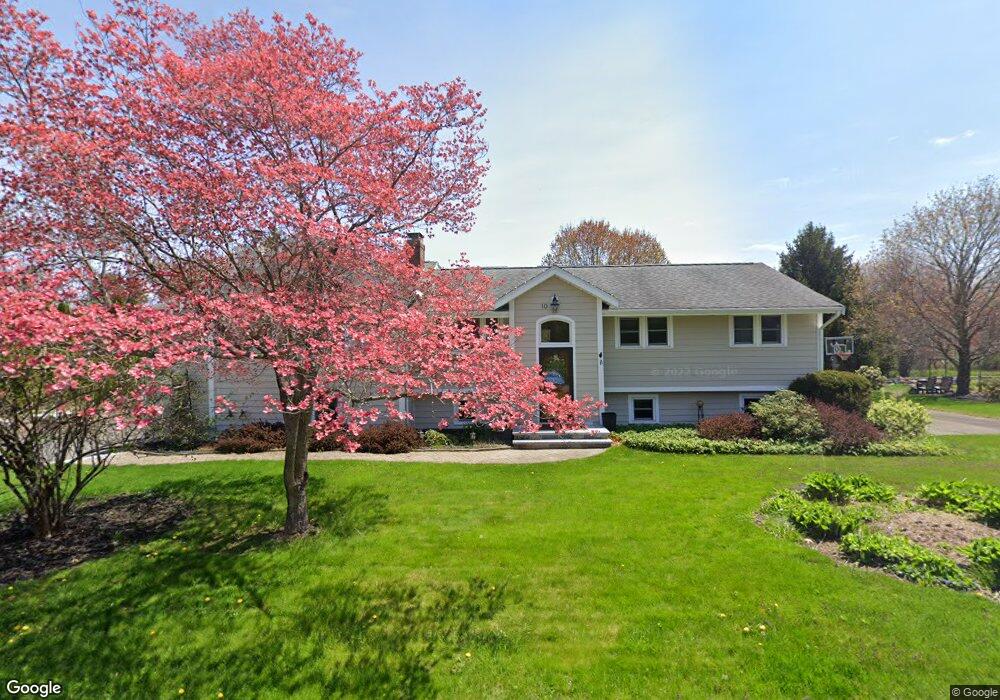
This home is located at 10 Heritage Rd, Acton, MA 01720 and is currently estimated at $864,182, approximately $505 per square foot. 10 Heritage Rd is a home located in Middlesex County with nearby schools including Acton-Boxborough Regional High School, Maynard Knowledge Beginnings, and The Imago School.
Ownership History
Date
Name
Owned For
Owner Type
Purchase Details
Closed on
Mar 26, 2024
Sold by
Brace Karl S and Sherburne Nancy E
Bought by
Brace Sherburne Lt and Brace
Current Estimated Value
Purchase Details
Closed on
Aug 19, 1993
Sold by
Tripp Stephen A and Tripp Denise E
Bought by
Brace Karl S and Sherburne Nancy E
Create a Home Valuation Report for This Property
The Home Valuation Report is an in-depth analysis detailing your home's value as well as a comparison with similar homes in the area
Home Values in the Area
Average Home Value in this Area
Purchase History
| Date | Buyer | Sale Price | Title Company |
|---|---|---|---|
| Brace Sherburne Lt | -- | None Available | |
| Brace Sherburne Lt | -- | None Available | |
| Brace Karl S | $197,500 | -- | |
| Brace Karl S | $197,500 | -- |
Source: Public Records
Mortgage History
| Date | Status | Borrower | Loan Amount |
|---|---|---|---|
| Previous Owner | Brace Karl S | $355,000 | |
| Previous Owner | Brace Karl S | $380,000 |
Source: Public Records
Tax History
| Year | Tax Paid | Tax Assessment Tax Assessment Total Assessment is a certain percentage of the fair market value that is determined by local assessors to be the total taxable value of land and additions on the property. | Land | Improvement |
|---|---|---|---|---|
| 2025 | $12,679 | $739,300 | $314,500 | $424,800 |
| 2024 | $11,976 | $718,400 | $314,500 | $403,900 |
| 2023 | $11,783 | $671,000 | $285,900 | $385,100 |
| 2022 | $11,425 | $587,400 | $248,400 | $339,000 |
| 2021 | $10,710 | $529,400 | $230,100 | $299,300 |
| 2020 | $10,351 | $538,000 | $230,100 | $307,900 |
| 2019 | $9,799 | $505,900 | $230,100 | $275,800 |
| 2018 | $9,219 | $475,700 | $230,100 | $245,600 |
| 2017 | $8,861 | $464,900 | $230,100 | $234,800 |
| 2016 | $8,567 | $445,500 | $230,100 | $215,400 |
| 2015 | $8,433 | $442,700 | $230,100 | $212,600 |
| 2014 | $8,179 | $420,500 | $230,100 | $190,400 |
Source: Public Records
Map
Nearby Homes
- 59 Lexington Dr
- 303 School St
- 7 Hillcrest Dr
- 65 Summit St
- 31 Drummer Rd Unit 31
- 128 Parker St Unit 3B
- 245 Oak Hill Cir
- 1 Drummer Rd Unit A5
- 1 Vanderbelt Rd
- 37 Water St
- 27 Water St
- 66 Old Stow Rd
- 1844 Main St Unit 1844
- 70 River St
- 20 Westvale Meadows Unit C
- 27 Forest Rd
- 30 Brewster Ln
- 95 Concord Rd
- 42 Sunnyside Ln
- 100 Harrington Ave
Your Personal Tour Guide
Ask me questions while you tour the home.