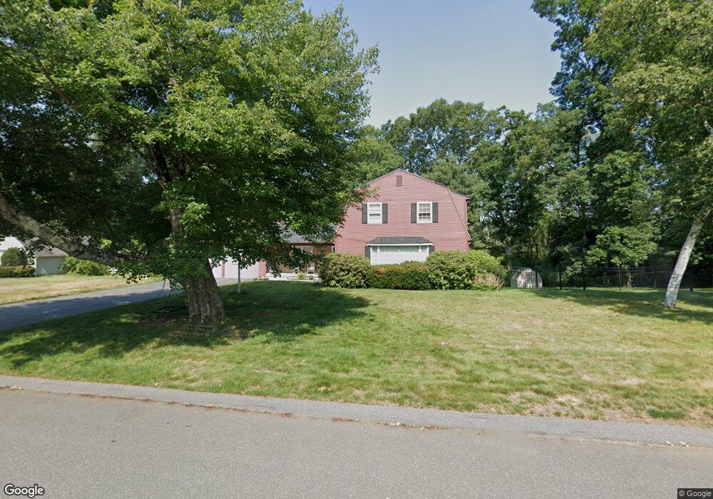
10 Herrick Place Wilbraham, MA 01095
Estimated Value: $472,239 - $570,000
4
Beds
2
Baths
2,186
Sq Ft
$241/Sq Ft
Est. Value
About This Home
This home is located at 10 Herrick Place, Wilbraham, MA 01095 and is currently estimated at $526,560, approximately $240 per square foot. 10 Herrick Place is a home located in Hampden County with nearby schools including Minnechaug Regional High School, Springfield International Charter School, and Wilbraham & Monson Academy.
Ownership History
Date
Name
Owned For
Owner Type
Purchase Details
Closed on
Nov 30, 2016
Sold by
Mell Frances K
Bought by
Falzone William M and Falzone Stefanie D
Current Estimated Value
Home Financials for this Owner
Home Financials are based on the most recent Mortgage that was taken out on this home.
Original Mortgage
$266,000
Outstanding Balance
$214,790
Interest Rate
3.52%
Mortgage Type
New Conventional
Estimated Equity
$311,770
Create a Home Valuation Report for This Property
The Home Valuation Report is an in-depth analysis detailing your home's value as well as a comparison with similar homes in the area
Home Values in the Area
Average Home Value in this Area
Purchase History
| Date | Buyer | Sale Price | Title Company |
|---|---|---|---|
| Falzone William M | $280,000 | -- |
Source: Public Records
Mortgage History
| Date | Status | Borrower | Loan Amount |
|---|---|---|---|
| Open | Falzone William M | $266,000 |
Source: Public Records
Tax History Compared to Growth
Tax History
| Year | Tax Paid | Tax Assessment Tax Assessment Total Assessment is a certain percentage of the fair market value that is determined by local assessors to be the total taxable value of land and additions on the property. | Land | Improvement |
|---|---|---|---|---|
| 2025 | $7,175 | $401,300 | $100,200 | $301,100 |
| 2024 | $7,209 | $389,700 | $100,200 | $289,500 |
| 2023 | $6,655 | $353,500 | $100,200 | $253,300 |
| 2022 | $6,655 | $324,800 | $100,200 | $224,600 |
| 2021 | $6,360 | $277,000 | $107,200 | $169,800 |
| 2020 | $6,199 | $277,000 | $107,200 | $169,800 |
| 2019 | $6,041 | $277,100 | $107,200 | $169,900 |
| 2018 | $6,052 | $267,300 | $107,200 | $160,100 |
| 2017 | $5,881 | $267,300 | $107,200 | $160,100 |
| 2016 | $5,787 | $267,900 | $119,100 | $148,800 |
| 2015 | $5,594 | $267,900 | $119,100 | $148,800 |
Source: Public Records
Map
Nearby Homes
- 8 Patriot Ridge Ln
- 2 Bayberry Dr Unit 51
- 28 Decorie Dr
- 20 Old Orchard Rd
- 79 High Pine Cir
- 69 High Pine Cir
- 474 Mountain Rd
- 54 High Pine Cir
- 68 Monson Rd
- 6 Hilltop Park
- 35 Lake Dr
- 46 Washington Rd
- 6 Teak Terrace Unit 24
- 4 Hillcrest Dr
- 99 Sandalwood Dr Unit site 00
- 474-480 Mountain Rd
- 103 Sandalwood Dr Unit site 00
- 57 Sandalwood Dr Unit site 61
- 2 Vista Rd
- 111 Sandalwood Dr Unit site 00
- 8 Herrick Place
- 19 Porter Dr
- 12 Herrick Place
- 6 Herrick Place
- 6 Herrick Place
- 17 Porter Dr
- 5 Herrick Place
- 4 Herrick Place
- 18 Porter Dr
- 15 Herrick Place
- 15 Porter Dr
- 14 Herrick Place
- 16 Porter Dr
- 21 Wright Place
- 1 Herrick Place
- 13 Porter Dr
- 19 Wright Place
- 2 Herrick Place
- 14 Porter Dr
- 17 Wright Place