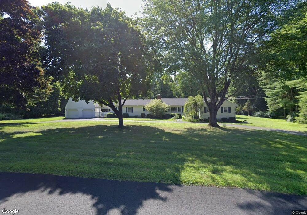
10 High Acre Rd Weston, CT 06883
Estimated Value: $1,233,000 - $1,315,000
4
Beds
3
Baths
2,680
Sq Ft
$478/Sq Ft
Est. Value
About This Home
This home is located at 10 High Acre Rd, Weston, CT 06883 and is currently estimated at $1,279,711, approximately $477 per square foot. 10 High Acre Rd is a home located in Fairfield County with nearby schools including Hurlbutt Elementary School, Weston Intermediate School, and Weston Middle School.
Ownership History
Date
Name
Owned For
Owner Type
Purchase Details
Closed on
Jun 18, 2004
Sold by
Ruiz Richard J and Ruiz Sandra L
Bought by
Veno Joseph L and Veno Anne F
Current Estimated Value
Purchase Details
Closed on
Apr 29, 1999
Sold by
Kennedy John and Kennedy Maria
Bought by
Ruiz Richard
Home Financials for this Owner
Home Financials are based on the most recent Mortgage that was taken out on this home.
Original Mortgage
$454,000
Interest Rate
5.75%
Create a Home Valuation Report for This Property
The Home Valuation Report is an in-depth analysis detailing your home's value as well as a comparison with similar homes in the area
Home Values in the Area
Average Home Value in this Area
Purchase History
| Date | Buyer | Sale Price | Title Company |
|---|---|---|---|
| Veno Joseph L | $890,000 | -- | |
| Ruiz Richard | $567,500 | -- |
Source: Public Records
Mortgage History
| Date | Status | Borrower | Loan Amount |
|---|---|---|---|
| Previous Owner | Ruiz Richard | $495,000 | |
| Previous Owner | Ruiz Richard | $488,000 | |
| Previous Owner | Ruiz Richard | $454,000 |
Source: Public Records
Tax History
| Year | Tax Paid | Tax Assessment Tax Assessment Total Assessment is a certain percentage of the fair market value that is determined by local assessors to be the total taxable value of land and additions on the property. | Land | Improvement |
|---|---|---|---|---|
| 2025 | $14,530 | $607,950 | $237,860 | $370,090 |
| 2024 | $14,269 | $607,950 | $237,860 | $370,090 |
| 2023 | $14,400 | $435,580 | $237,860 | $197,720 |
| 2022 | $14,361 | $435,580 | $237,860 | $197,720 |
| 2021 | $14,339 | $435,580 | $237,860 | $197,720 |
| 2020 | $14,100 | $435,580 | $237,860 | $197,720 |
| 2019 | $14,100 | $435,580 | $237,860 | $197,720 |
| 2018 | $12,935 | $440,100 | $265,000 | $175,100 |
| 2017 | $12,723 | $440,100 | $265,000 | $175,100 |
| 2016 | $12,569 | $440,100 | $265,000 | $175,100 |
| 2015 | $12,657 | $440,100 | $265,000 | $175,100 |
| 2014 | $12,428 | $440,100 | $265,000 | $175,100 |
Source: Public Records
Map
Nearby Homes
- 2 & 4 Old Weston Old Weston Rd
- 4 Good Hill Rd
- 35 Joanne Ln
- 253 Rivergate Dr
- 13 Riverfield Dr
- 117 Weston Rd
- 7 Fermily Ln
- 7 Homeward Ln
- 205 Weston Rd
- 30 Cavalry Rd
- 25 Hermit Ln
- 282 North Ave
- 278 North Ave
- 89 Chestnut Hill Rd
- 368B Wilton Rd
- 104 Newtown Turnpike
- 319 Bayberry Ln
- 76 Sturges Ridge Rd
- 6 Downe Ln
- 381 Chestnut Hill Rd
- 18 High Acre Rd
- 20 Old Weston Rd
- 4 James Ct
- 26 Old Weston Rd
- 20 High Acre Rd
- 21 High Acre Rd
- 11 High Acre Rd
- 4 Old Weston Rd
- 19 Old Weston Rd
- 1 Twin Oak Ln
- 16 Old Weston Rd
- 25 High Acre Rd
- 1 Pink Cloud Ln
- 9 High Acre Rd
- 26 High Acre Rd
- 12 James Ct
- 15 Twin Oak Ln
- 5 Old Weston Rd
- 9 Twin Oak Ln
- 103 Weston Rd
Your Personal Tour Guide
Ask me questions while you tour the home.