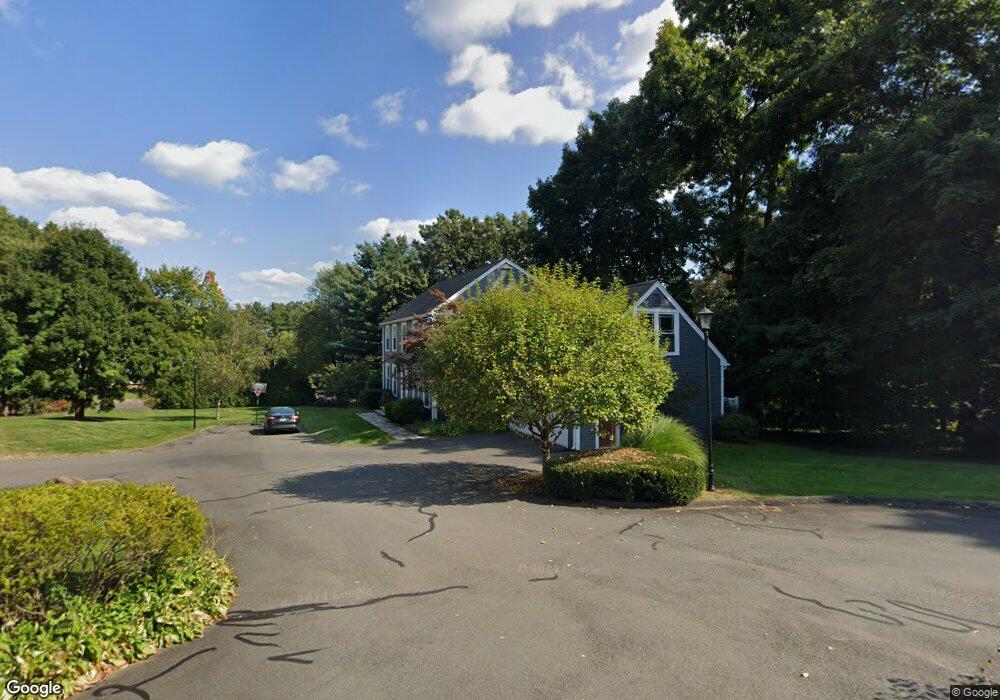
10 High Point Ln West Hartford, CT 06107
Estimated Value: $862,000 - $975,000
4
Beds
4
Baths
2,815
Sq Ft
$326/Sq Ft
Est. Value
About This Home
This home is located at 10 High Point Ln, West Hartford, CT 06107 and is currently estimated at $918,921, approximately $326 per square foot. 10 High Point Ln is a home located in Hartford County with nearby schools including Bugbee School, King Philip Middle School, and Hall High School.
Ownership History
Date
Name
Owned For
Owner Type
Purchase Details
Closed on
Jul 27, 2021
Sold by
Epstein-Jones Jill
Bought by
Epstein-Jones Jill and Jones Gary D
Current Estimated Value
Home Financials for this Owner
Home Financials are based on the most recent Mortgage that was taken out on this home.
Original Mortgage
$261,000
Outstanding Balance
$237,436
Interest Rate
2.93%
Mortgage Type
New Conventional
Estimated Equity
$681,485
Purchase Details
Closed on
Sep 25, 1990
Sold by
Fenton Stuart
Bought by
Jones Jill
Home Financials for this Owner
Home Financials are based on the most recent Mortgage that was taken out on this home.
Original Mortgage
$250,000
Interest Rate
9.89%
Mortgage Type
Purchase Money Mortgage
Purchase Details
Closed on
Jan 20, 1988
Sold by
Kenlin Homes Inc
Bought by
Fenton S W
Create a Home Valuation Report for This Property
The Home Valuation Report is an in-depth analysis detailing your home's value as well as a comparison with similar homes in the area
Home Values in the Area
Average Home Value in this Area
Purchase History
| Date | Buyer | Sale Price | Title Company |
|---|---|---|---|
| Epstein-Jones Jill | -- | None Available | |
| Epstein-Jones Jill | -- | None Available | |
| Epstein-Jones Jill | -- | None Available | |
| Jones Jill | $372,000 | -- | |
| Fenton S W | $340,000 | -- |
Source: Public Records
Mortgage History
| Date | Status | Borrower | Loan Amount |
|---|---|---|---|
| Open | Epstein-Jones Jill | $261,000 | |
| Closed | Epstein-Jones Jill | $261,000 | |
| Previous Owner | Fenton S W | $200,000 | |
| Previous Owner | Fenton S W | $220,000 | |
| Previous Owner | Fenton S W | $250,000 |
Source: Public Records
Tax History Compared to Growth
Tax History
| Year | Tax Paid | Tax Assessment Tax Assessment Total Assessment is a certain percentage of the fair market value that is determined by local assessors to be the total taxable value of land and additions on the property. | Land | Improvement |
|---|---|---|---|---|
| 2025 | $17,118 | $382,270 | $123,620 | $258,650 |
| 2024 | $16,189 | $382,270 | $123,620 | $258,650 |
| 2023 | $15,642 | $382,270 | $123,620 | $258,650 |
| 2022 | $15,528 | $381,710 | $123,620 | $258,090 |
| 2021 | $15,191 | $358,120 | $130,130 | $227,990 |
| 2020 | $14,566 | $348,460 | $121,660 | $226,800 |
| 2019 | $14,018 | $335,370 | $121,660 | $213,710 |
| 2018 | $13,750 | $335,370 | $121,660 | $213,710 |
| 2017 | $13,764 | $335,370 | $121,660 | $213,710 |
| 2016 | $13,740 | $347,760 | $125,650 | $222,110 |
| 2015 | $13,323 | $347,760 | $125,650 | $222,110 |
| 2014 | $12,996 | $347,760 | $125,650 | $222,110 |
Source: Public Records
Map
Nearby Homes
- 62 Blue Ridge Ln
- 1294 Trout Brook Dr
- 132 N Main St
- 47 Flagg Rd
- 129 Middlebrook Rd
- 1272 Trout Brook Dr
- 1268 Trout Brook Dr
- 2581 Albany Ave
- 56 Fox Chase Ln
- 30 Farmstead Ln
- 1196 Trout Brook Dr
- 11 Lawler Rd
- 50 Magnolia Hill
- 183 Loomis Dr Unit 109
- 1110 Trout Brook Dr
- 26 Berwyn Rd
- 11 Rye Ridge Pkwy
- 139 Mohawk Dr
- 105 Ardmore Rd
- 37 W Normandy Dr