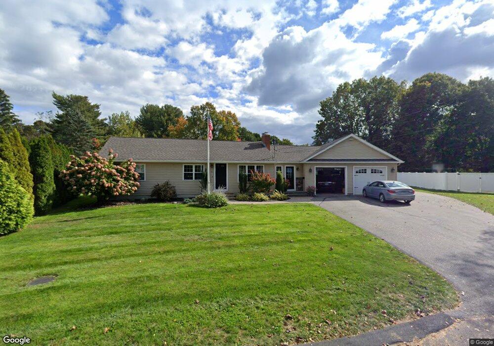
10 High Ridge Rd Ellington, CT 06029
Estimated Value: $354,000 - $458,000
3
Beds
4
Baths
2,056
Sq Ft
$201/Sq Ft
Est. Value
About This Home
This home is located at 10 High Ridge Rd, Ellington, CT 06029 and is currently estimated at $413,057, approximately $200 per square foot. 10 High Ridge Rd is a home located in Tolland County with nearby schools including Ellington High School.
Ownership History
Date
Name
Owned For
Owner Type
Purchase Details
Closed on
Nov 15, 2012
Sold by
Garrow John H
Bought by
Garrow Rhonda B
Current Estimated Value
Home Financials for this Owner
Home Financials are based on the most recent Mortgage that was taken out on this home.
Original Mortgage
$160,000
Outstanding Balance
$27,651
Interest Rate
3.57%
Mortgage Type
Stand Alone Refi Refinance Of Original Loan
Estimated Equity
$385,406
Purchase Details
Closed on
Sep 7, 1999
Sold by
Griswold Richard and Griswold Mary
Bought by
Garrow John and Garrow Rhonda
Home Financials for this Owner
Home Financials are based on the most recent Mortgage that was taken out on this home.
Original Mortgage
$94,000
Interest Rate
6.75%
Create a Home Valuation Report for This Property
The Home Valuation Report is an in-depth analysis detailing your home's value as well as a comparison with similar homes in the area
Home Values in the Area
Average Home Value in this Area
Purchase History
| Date | Buyer | Sale Price | Title Company |
|---|---|---|---|
| Garrow Rhonda B | -- | -- | |
| Garrow John | $118,000 | -- |
Source: Public Records
Mortgage History
| Date | Status | Borrower | Loan Amount |
|---|---|---|---|
| Open | Garrow John | $160,000 | |
| Previous Owner | Garrow John | $161,600 | |
| Previous Owner | Garrow John | $94,000 | |
| Previous Owner | Garrow John | $18,500 |
Source: Public Records
Tax History Compared to Growth
Tax History
| Year | Tax Paid | Tax Assessment Tax Assessment Total Assessment is a certain percentage of the fair market value that is determined by local assessors to be the total taxable value of land and additions on the property. | Land | Improvement |
|---|---|---|---|---|
| 2025 | $7,788 | $209,910 | $51,320 | $158,590 |
| 2024 | $7,557 | $209,910 | $51,320 | $158,590 |
| 2023 | $7,200 | $209,910 | $51,320 | $158,590 |
| 2022 | $6,822 | $209,910 | $51,320 | $158,590 |
| 2021 | $6,633 | $209,910 | $51,320 | $158,590 |
| 2020 | $5,369 | $164,700 | $52,400 | $112,300 |
| 2019 | $5,369 | $164,700 | $52,400 | $112,300 |
| 2016 | $5,023 | $164,700 | $52,400 | $112,300 |
| 2015 | $5,065 | $166,060 | $52,400 | $113,660 |
| 2014 | $4,766 | $166,060 | $52,400 | $113,660 |
Source: Public Records
Map
Nearby Homes
- 14 High Ridge Rd
- 24 West Rd Unit 44
- 34 Davis Ave
- 140 Union St
- 104 Union St
- 64 N Park St
- 16 Maple St Unit 11
- 43 Highland Ave
- 25 Chestnut St
- 4 Thompson Ct
- 67 West St
- 92 W Main St
- 4 Bellevue Ave
- 16 Vernon Ave Unit 21
- 19 Upper Butcher Rd
- 57 Grand Ave
- 45 Windermere Village Rd Unit 45
- 17 Spruce St
- 93 Vernon Ave
- 80 Country Ln Unit 40
- 12 High Ridge Rd
- 8 High Ridge Rd
- 143 Orchard St
- 6 High Ridge Rd
- 5 High Ridge Rd
- 147 Orchard St
- 149 Orchard St
- 7 High Ridge Rd
- 16 High Ridge Rd
- 4 High Ridge Rd
- 32 Charter Rd
- 9 High Ridge Rd
- 151 Orchard St
- 3 High Ridge Rd
- 18 High Ridge Rd
- 155 Orchard St
- 11 High Ridge Rd
- 30 Charter Rd
- 34 Charter Rd
- 2 High Ridge Rd