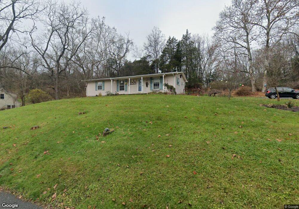
10 High St Blairstown, NJ 07825
Estimated Value: $296,938 - $401,000
--
Bed
--
Bath
1,200
Sq Ft
$289/Sq Ft
Est. Value
About This Home
This home is located at 10 High St, Blairstown, NJ 07825 and is currently estimated at $346,485, approximately $288 per square foot. 10 High St is a home located in Warren County with nearby schools including Blairstown Elementary School, North Warren Regional School, and Ridge & Valley Charter School.
Ownership History
Date
Name
Owned For
Owner Type
Purchase Details
Closed on
Jan 24, 2019
Sold by
Roth Betty Jean
Bought by
Roth Joshua
Current Estimated Value
Home Financials for this Owner
Home Financials are based on the most recent Mortgage that was taken out on this home.
Original Mortgage
$105,000
Outstanding Balance
$92,128
Interest Rate
4.5%
Mortgage Type
New Conventional
Estimated Equity
$254,357
Purchase Details
Closed on
Jan 28, 1987
Bought by
Roth Betty Jean
Create a Home Valuation Report for This Property
The Home Valuation Report is an in-depth analysis detailing your home's value as well as a comparison with similar homes in the area
Home Values in the Area
Average Home Value in this Area
Purchase History
| Date | Buyer | Sale Price | Title Company |
|---|---|---|---|
| Roth Joshua | $150,000 | Pls Title And Settlement | |
| Roth Betty Jean | -- | -- |
Source: Public Records
Mortgage History
| Date | Status | Borrower | Loan Amount |
|---|---|---|---|
| Open | Roth Joshua | $105,000 |
Source: Public Records
Tax History Compared to Growth
Tax History
| Year | Tax Paid | Tax Assessment Tax Assessment Total Assessment is a certain percentage of the fair market value that is determined by local assessors to be the total taxable value of land and additions on the property. | Land | Improvement |
|---|---|---|---|---|
| 2025 | $4,379 | $141,200 | $39,400 | $101,800 |
| 2024 | $4,069 | $141,200 | $39,400 | $101,800 |
| 2023 | $3,986 | $141,200 | $39,400 | $101,800 |
| 2022 | $3,986 | $141,200 | $39,400 | $101,800 |
| 2021 | $3,616 | $141,200 | $39,400 | $101,800 |
| 2020 | $3,490 | $141,200 | $39,400 | $101,800 |
| 2019 | $3,248 | $141,200 | $39,400 | $101,800 |
| 2018 | $3,248 | $141,200 | $39,400 | $101,800 |
| 2017 | $3,259 | $141,200 | $39,400 | $101,800 |
| 2016 | $3,270 | $141,200 | $39,400 | $101,800 |
| 2015 | $3,214 | $141,200 | $39,400 | $101,800 |
| 2014 | $3,152 | $141,200 | $39,400 | $101,800 |
Source: Public Records
Map
Nearby Homes
- 16 Stillwater Rd
- 17 High St
- 32 High St
- 6 Main St
- 12 Jones Ln
- 39 Stillwater Rd
- 18 New Jersey 94
- 14 Cedarville Rd
- 89 Millbrook Rd
- 76 Hope Rd
- 17 Bear Cave Rd
- 5 Ward Rd
- 82 Spring Valley Rd
- 42C Spring Valley Rd
- 5 Bingham Ln
- 49 Spring Valley Rd
- 1 Four Corners Rd
- 150 Silver Lake Rd
- 1054 Route94
- 80 Mohican Rd