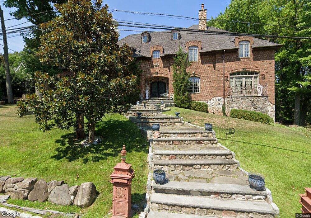
10 Highpoint Rd Staten Island, NY 10304
Todt Hill NeighborhoodEstimated Value: $2,579,000 - $3,808,409
3
Beds
1
Bath
896
Sq Ft
$3,710/Sq Ft
Est. Value
About This Home
This home is located at 10 Highpoint Rd, Staten Island, NY 10304 and is currently estimated at $3,323,852, approximately $3,709 per square foot. 10 Highpoint Rd is a home located in Richmond County with nearby schools including P.S. 11 Thomas Dongan School, Myra S. Barnes Intermediate School 24, and Susan E Wagner High School.
Ownership History
Date
Name
Owned For
Owner Type
Purchase Details
Closed on
Jun 21, 2004
Sold by
Francolino Joseph
Bought by
Francolino Joseph and Francolino Bari Lyn
Current Estimated Value
Home Financials for this Owner
Home Financials are based on the most recent Mortgage that was taken out on this home.
Original Mortgage
$200,000
Interest Rate
5.75%
Mortgage Type
Credit Line Revolving
Purchase Details
Closed on
Oct 22, 2001
Sold by
Gunther Frank M and Gunther Robert C
Bought by
Francolino Joseph
Create a Home Valuation Report for This Property
The Home Valuation Report is an in-depth analysis detailing your home's value as well as a comparison with similar homes in the area
Home Values in the Area
Average Home Value in this Area
Purchase History
| Date | Buyer | Sale Price | Title Company |
|---|---|---|---|
| Francolino Joseph | -- | United General Title Ins Co | |
| Francolino Joseph | $750,000 | Stewart Title Insurance Co |
Source: Public Records
Mortgage History
| Date | Status | Borrower | Loan Amount |
|---|---|---|---|
| Closed | Francolino Joseph | $200,000 |
Source: Public Records
Tax History
| Year | Tax Paid | Tax Assessment Tax Assessment Total Assessment is a certain percentage of the fair market value that is determined by local assessors to be the total taxable value of land and additions on the property. | Land | Improvement |
|---|---|---|---|---|
| 2025 | $31,002 | $149,100 | $53,816 | $95,284 |
| 2024 | $31,014 | $159,180 | $47,555 | $111,625 |
| 2023 | $29,558 | $146,940 | $51,979 | $94,961 |
| 2022 | $29,310 | $148,260 | $48,600 | $99,660 |
| 2021 | $31,959 | $153,300 | $48,600 | $104,700 |
| 2020 | $33,575 | $160,020 | $48,600 | $111,420 |
| 2019 | $24,649 | $173,640 | $48,600 | $125,040 |
| 2018 | $29,614 | $146,736 | $35,973 | $110,763 |
| 2017 | $29,612 | $146,736 | $37,154 | $109,582 |
| 2016 | $27,772 | $140,472 | $41,062 | $99,410 |
| 2015 | $24,570 | $137,392 | $31,598 | $105,794 |
| 2014 | $24,570 | $129,616 | $35,769 | $93,847 |
Source: Public Records
Map
Nearby Homes
- 26 Highpoint Rd
- 6 Hunt Ln
- 367 Ocean Terrace
- 289 Ocean Terrace
- 14 Merrick Ave
- 200 Ocean Terrace
- 62 Tiber Place
- 67 Tiber Place
- 25 Coverly Ave
- 68 Circle Rd
- 45 Old Farmers Ln
- 38 Whitlock Ave
- 107 Bolivar St
- 176 Benedict Rd
- 59 Bogert Ave
- 116 Browning Ave
- 97 Tillman St
- 724 Todt Hill Rd
- 153 Fine Blvd
- 75 Utopia Ct
- 16 Highpoint Rd
- 150 Merrick Ave
- 140 Merrick Ave
- 55 Westminster Ct
- 15 Highpoint Rd
- 71 Westminster Ct
- 130 Merrick Ave
- 32 Highpoint Rd
- 29 Highpoint Rd
- 83 Westminster Ct
- 44 Annfield Ct
- 64 Annfield Ct
- 135 Merrick Ave
- 114 Merrick Ave
- 0 Woodhaven Ave
- 40 Westminster Ct
- 115 Merrick Ave
- 125 Merrick Ave
- 47 Woodhaven Ave
Your Personal Tour Guide
Ask me questions while you tour the home.