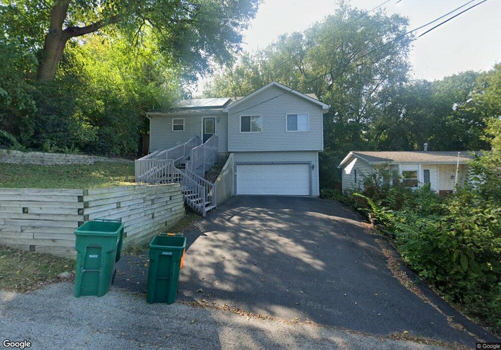
10 Highview Ave Fox Lake, IL 60020
Estimated Value: $214,269 - $300,000
Studio
2
Baths
1,064
Sq Ft
$241/Sq Ft
Est. Value
About This Home
This home is located at 10 Highview Ave, Fox Lake, IL 60020 and is currently estimated at $256,817, approximately $241 per square foot. 10 Highview Ave is a home located in Lake County with nearby schools including Lotus Elementary School, Stanton Middle School, and Grant Community High School.
Ownership History
Date
Name
Owned For
Owner Type
Purchase Details
Closed on
Feb 16, 2024
Sold by
Bown David and Bown Lisa Anne
Bought by
Troy And Bown Family Trust and Bown
Current Estimated Value
Purchase Details
Closed on
Nov 16, 2021
Sold by
Troy Bown Lisa and Troy David
Bought by
Brown Lisa Troy
Home Financials for this Owner
Home Financials are based on the most recent Mortgage that was taken out on this home.
Original Mortgage
$202,500
Interest Rate
2.25%
Mortgage Type
VA
Purchase Details
Closed on
Jun 11, 2007
Sold by
Trustee Of The Apps Land Trust #002
Bought by
Troy Lisa Anne
Home Financials for this Owner
Home Financials are based on the most recent Mortgage that was taken out on this home.
Original Mortgage
$144,450
Interest Rate
6.26%
Mortgage Type
Purchase Money Mortgage
Purchase Details
Closed on
May 30, 2007
Sold by
Mccoy William S and Mccoy Darlecia
Bought by
The Apps Land Trust 002 and Trust #002
Home Financials for this Owner
Home Financials are based on the most recent Mortgage that was taken out on this home.
Original Mortgage
$144,450
Interest Rate
6.26%
Mortgage Type
Purchase Money Mortgage
Purchase Details
Closed on
May 1, 2002
Sold by
Mccoy William S
Bought by
Mccoy William S and Mccoy Darlecia
Home Financials for this Owner
Home Financials are based on the most recent Mortgage that was taken out on this home.
Original Mortgage
$162,900
Interest Rate
6.87%
Purchase Details
Closed on
Dec 19, 1997
Sold by
Muehe William N and Muehe Jill A
Bought by
Mccoy William S
Home Financials for this Owner
Home Financials are based on the most recent Mortgage that was taken out on this home.
Original Mortgage
$125,400
Interest Rate
7.36%
Purchase Details
Closed on
Sep 5, 1995
Sold by
Maddock Willard Phillip and Maddock Jean Carol
Bought by
Muehe William N and Muehe Jill A
Create a Home Valuation Report for This Property
The Home Valuation Report is an in-depth analysis detailing your home's value as well as a comparison with similar homes in the area
Home Values in the Area
Average Home Value in this Area
Purchase History
| Date | Buyer | Sale Price | Title Company |
|---|---|---|---|
| Troy And Bown Family Trust | -- | None Listed On Document | |
| Brown Lisa Troy | -- | Pearl Law Offices Llc | |
| Troy Lisa Anne | $160,500 | None Available | |
| The Apps Land Trust 002 | $145,000 | None Available | |
| Mccoy William S | -- | Chicago Title Insurance Co | |
| Mccoy William S | $132,000 | Chicago Title Insurance Co | |
| Muehe William N | $20,000 | Blackhawk Title Services |
Source: Public Records
Mortgage History
| Date | Status | Borrower | Loan Amount |
|---|---|---|---|
| Previous Owner | Brown Lisa Troy | $202,500 | |
| Previous Owner | Troy Lisa Anne | $144,450 | |
| Previous Owner | Mccoy William S | $162,900 | |
| Previous Owner | Mccoy William S | $125,400 |
Source: Public Records
Tax History
| Year | Tax Paid | Tax Assessment Tax Assessment Total Assessment is a certain percentage of the fair market value that is determined by local assessors to be the total taxable value of land and additions on the property. | Land | Improvement |
|---|---|---|---|---|
| 2024 | $4,608 | $69,592 | $8,872 | $60,720 |
| 2023 | -- | $60,507 | $8,358 | $52,149 |
| 2022 | $0 | $54,156 | $6,187 | $47,969 |
| 2021 | $0 | $51,047 | $5,832 | $45,215 |
| 2020 | $0 | $51,406 | $5,749 | $45,657 |
| 2019 | $0 | $49,296 | $5,513 | $43,783 |
| 2018 | $0 | $48,147 | $6,918 | $41,229 |
| 2017 | $0 | $44,502 | $6,394 | $38,108 |
| 2016 | $0 | $40,701 | $5,848 | $34,853 |
| 2015 | $0 | $37,981 | $5,457 | $32,524 |
| 2014 | $2,412 | $32,015 | $8,763 | $23,252 |
| 2012 | $3,184 | $33,612 | $9,132 | $24,480 |
Source: Public Records
Map
Nearby Homes
- 11 Highview Ave
- 10 S Maple Ave
- 176 E Grand Ave
- 127 E Grand Ave
- 61 Highview Ave
- 34 Elm Ave
- 235 E Grand Ave
- 31 Lakeside Ln
- 21 Hillside Dr
- 35 Medinah Ave
- 50 N Lake Ave
- 49 N Lake Ave
- 38 Lippincott Rd
- 530 Foxridge Dr Unit 20C
- 67 Woodhills Bay Rd
- 91 Lippincott Rd
- 53 Mariner Ln Unit 11C
- 35828 N Marine Dr
- 97 Mark Ln
- 10 Matts Rd
- 8 Highview Ave
- 14 Highview Ave
- 6 Highview Ave
- 18 Highview Ave
- 11 Hillcrest Ave
- 13 Hillcrest Ave
- 9 Hillcrest Ave
- 9 Highview Ave
- 20 Highview Ave
- 20 Highview Ave
- 149 Cypress Ave
- 151 Cypress Ave
- 17 Hillcrest Ave
- 7 Highview Ave
- 15 Highview Ave
- 145 Cypress Ave
- 17 Highview Ave
- 163 E Grand Ave
- 19 Hillcrest Ave
- 7 Hillcrest Ave
Your Personal Tour Guide
Ask me questions while you tour the home.