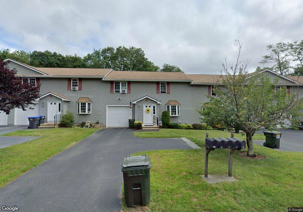
10 Hill Ct Dudley, MA 01571
Estimated Value: $334,000 - $381,000
3
Beds
2
Baths
1,488
Sq Ft
$240/Sq Ft
Est. Value
About This Home
This home is located at 10 Hill Ct, Dudley, MA 01571 and is currently estimated at $356,873, approximately $239 per square foot. 10 Hill Ct is a home located in Worcester County with nearby schools including Shepherd Hill Regional High School, All Saints Academy, and St Joseph School.
Ownership History
Date
Name
Owned For
Owner Type
Purchase Details
Closed on
Jul 28, 2010
Sold by
Us Bk
Bought by
Damelio Frank M
Current Estimated Value
Home Financials for this Owner
Home Financials are based on the most recent Mortgage that was taken out on this home.
Original Mortgage
$130,000
Outstanding Balance
$86,310
Interest Rate
4.78%
Mortgage Type
Purchase Money Mortgage
Estimated Equity
$270,563
Purchase Details
Closed on
Apr 16, 2010
Sold by
Ceccarini Nicole D
Bought by
Us Bk
Purchase Details
Closed on
Jul 21, 2006
Sold by
65 South Street Dev In
Bought by
Ceccarini Nicole D and Brown Robert T
Home Financials for this Owner
Home Financials are based on the most recent Mortgage that was taken out on this home.
Original Mortgage
$177,600
Interest Rate
6.67%
Mortgage Type
Purchase Money Mortgage
Create a Home Valuation Report for This Property
The Home Valuation Report is an in-depth analysis detailing your home's value as well as a comparison with similar homes in the area
Home Values in the Area
Average Home Value in this Area
Purchase History
| Date | Buyer | Sale Price | Title Company |
|---|---|---|---|
| Damelio Frank M | $130,900 | -- | |
| Us Bk | $145,930 | -- | |
| Ceccarini Nicole D | $222,000 | -- |
Source: Public Records
Mortgage History
| Date | Status | Borrower | Loan Amount |
|---|---|---|---|
| Open | Damelio Frank M | $130,000 | |
| Previous Owner | Ceccarini Nicole D | $177,600 | |
| Previous Owner | Ceccarini Nicole D | $44,400 |
Source: Public Records
Tax History Compared to Growth
Tax History
| Year | Tax Paid | Tax Assessment Tax Assessment Total Assessment is a certain percentage of the fair market value that is determined by local assessors to be the total taxable value of land and additions on the property. | Land | Improvement |
|---|---|---|---|---|
| 2025 | $31 | $292,500 | $0 | $292,500 |
| 2024 | $2,693 | $257,000 | $0 | $257,000 |
| 2023 | $2,611 | $257,000 | $0 | $257,000 |
| 2022 | $2,788 | $238,300 | $0 | $238,300 |
| 2021 | $2,498 | $203,100 | $0 | $203,100 |
| 2020 | $2,471 | $189,200 | $0 | $189,200 |
| 2019 | $2,611 | $193,400 | $0 | $193,400 |
| 2018 | $2,093 | $178,400 | $0 | $178,400 |
| 2017 | $1,920 | $160,800 | $0 | $160,800 |
| 2016 | $1,979 | $162,500 | $0 | $162,500 |
| 2015 | $1,948 | $158,900 | $0 | $158,900 |
Source: Public Records
Map
Nearby Homes
- 77 W Main St
- 11 Ardlock Place
- 14 Central Ave
- 8 Warsaw Ave Unit 1
- 21 Prospect Ave
- 18 Fairview Ave
- 110 Chase Ave
- 40 High St
- 418 High Street Extension
- 14 Hill St
- 19 Highcrest Park
- 17 Mount Pleasant St
- 30 Valley St
- 19 1st St
- 17 Crosby St Unit B
- 17 Crosby St Unit A
- 3 Delaney Ave
- 4 Charlton Rd
- 34-36 Park St
- 13 Oxford Ave
- 8 Hill Ct
- 6 Hill Ct
- 4 Hill Ct
- 12 Hill Ct
- 4 Hill Ct Unit 4
- 12 Hill Ct Unit 12
- 8 Hill Ct Unit 8
- 4 Hill Ct Unit 5
- 0 Hill Ct Unit 1,1 70045445
- 0 Hill Ct Unit 4,1
- 0 Hill Ct Unit 2,1
- 0 Hill Ct Unit 3,1
- 20 Williams St
- 7 Hill Ct
- 34 Brandon Rd
- 32 Brandon Rd
- 7 James St
- 30 Brandon Rd
- 16 Williams St
- 28 Brandon Rd