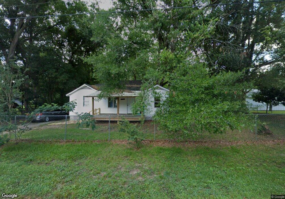
10 Holly St N Mobile, AL 36608
Estimated Value: $60,000 - $164,000
--
Bed
1
Bath
1,026
Sq Ft
$88/Sq Ft
Est. Value
About This Home
This home is located at 10 Holly St N, Mobile, AL 36608 and is currently estimated at $90,051, approximately $87 per square foot. 10 Holly St N is a home located in Mobile County with nearby schools including Taylor White Elementary School, Bernice J Causey Middle School, and Baker High School.
Ownership History
Date
Name
Owned For
Owner Type
Purchase Details
Closed on
Nov 6, 2024
Sold by
Al-Shaikh Omar and Al-Shaikh Deema
Bought by
Salo Alessandro Alberi and Gomez Gizeth Marcela
Current Estimated Value
Purchase Details
Closed on
Jul 31, 2024
Sold by
Hmidan Ghada
Bought by
Al-Shaikh Omar and Al-Shaikh Deema
Purchase Details
Closed on
Sep 21, 2020
Sold by
Hamid Ziad
Bought by
Hmidan Ghada
Purchase Details
Closed on
Feb 7, 2007
Sold by
Garron Michael Alan and Garron Tonya Renee
Bought by
Hamid Ziad
Purchase Details
Closed on
Feb 17, 2005
Sold by
Powell William C and Powell Elizabeth C
Bought by
Garron Michael Alan and Garron Tonya Renee
Home Financials for this Owner
Home Financials are based on the most recent Mortgage that was taken out on this home.
Original Mortgage
$7,800
Interest Rate
10%
Mortgage Type
Seller Take Back
Create a Home Valuation Report for This Property
The Home Valuation Report is an in-depth analysis detailing your home's value as well as a comparison with similar homes in the area
Home Values in the Area
Average Home Value in this Area
Purchase History
| Date | Buyer | Sale Price | Title Company |
|---|---|---|---|
| Salo Alessandro Alberi | $60,000 | None Listed On Document | |
| Salo Alessandro Alberi | $60,000 | None Listed On Document | |
| Al-Shaikh Omar | $13,000 | None Listed On Document | |
| Hmidan Ghada | $13,000 | None Available | |
| Hamid Ziad | $28,000 | None Available | |
| Garron Michael Alan | $7,800 | -- |
Source: Public Records
Mortgage History
| Date | Status | Borrower | Loan Amount |
|---|---|---|---|
| Previous Owner | Garron Michael Alan | $7,800 |
Source: Public Records
Tax History Compared to Growth
Tax History
| Year | Tax Paid | Tax Assessment Tax Assessment Total Assessment is a certain percentage of the fair market value that is determined by local assessors to be the total taxable value of land and additions on the property. | Land | Improvement |
|---|---|---|---|---|
| 2024 | $483 | $9,220 | $3,200 | $6,020 |
| 2023 | $447 | $8,980 | $2,800 | $6,180 |
| 2022 | $436 | $8,980 | $2,800 | $6,180 |
| 2021 | $436 | $8,980 | $2,800 | $6,180 |
| 2020 | $436 | $8,980 | $2,800 | $6,180 |
| 2019 | $428 | $8,820 | $2,800 | $6,020 |
| 2018 | $453 | $9,340 | $0 | $0 |
| 2017 | $453 | $9,340 | $0 | $0 |
| 2016 | $462 | $9,520 | $0 | $0 |
| 2013 | $533 | $10,600 | $0 | $0 |
Source: Public Records
Map
Nearby Homes
- 0 1st St
- 0 1st St Unit 7617566
- 12 Stonebridge Ct
- 22 Stonebridge Ct
- 0 2nd St Unit 7500313
- 0 2nd St Unit 7500310
- 7056 Stonebridge Ct
- 0 5th St Unit 9/47-48-49 385342
- 0 5th St Unit 7649910
- 275 Bishop Phillips Ave
- 0 Lincoln Blvd
- 230 Portside Cir W
- 0 Barnes Ave
- 77 Oklahoma Dr
- 25 Breydon Ct
- 0 4th Ave Unit 7681281
- 7400 10th St
- 6928 Cobblestone Way N
- 390 Lakeview Dr W
- 404 Lakeview Dr W