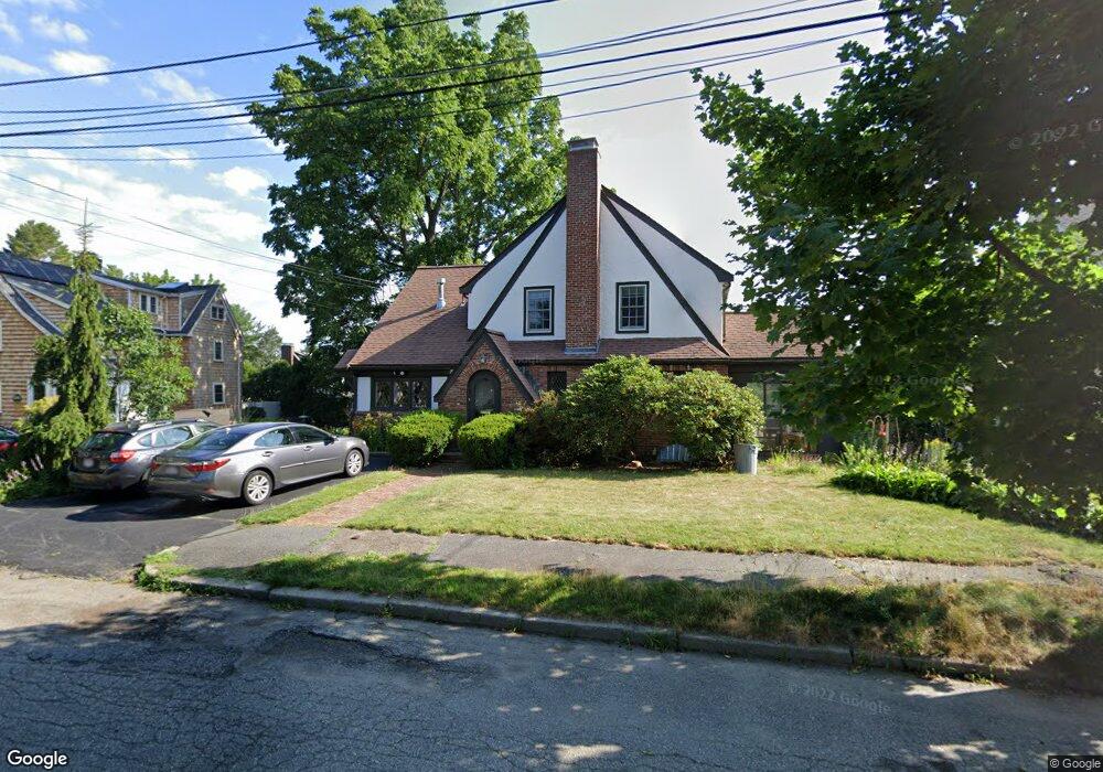
10 Howe Rd Newton Center, MA 02459
Oak Hill NeighborhoodEstimated Value: $1,560,000 - $1,781,000
4
Beds
3
Baths
1,900
Sq Ft
$852/Sq Ft
Est. Value
About This Home
This home is located at 10 Howe Rd, Newton Center, MA 02459 and is currently estimated at $1,619,508, approximately $852 per square foot. 10 Howe Rd is a home located in Middlesex County with nearby schools including Countryside Elementary School, Charles E Brown Middle School, and Newton South High School.
Ownership History
Date
Name
Owned For
Owner Type
Purchase Details
Closed on
Dec 19, 1997
Sold by
Sorkin Steven and Sorkin Kate H
Bought by
Granot Amit
Current Estimated Value
Home Financials for this Owner
Home Financials are based on the most recent Mortgage that was taken out on this home.
Original Mortgage
$250,000
Interest Rate
7.14%
Mortgage Type
Purchase Money Mortgage
Create a Home Valuation Report for This Property
The Home Valuation Report is an in-depth analysis detailing your home's value as well as a comparison with similar homes in the area
Home Values in the Area
Average Home Value in this Area
Purchase History
| Date | Buyer | Sale Price | Title Company |
|---|---|---|---|
| Granot Amit | $428,050 | -- |
Source: Public Records
Mortgage History
| Date | Status | Borrower | Loan Amount |
|---|---|---|---|
| Open | Granot Amit | $235,000 | |
| Closed | Granot Amit | $250,000 |
Source: Public Records
Tax History Compared to Growth
Tax History
| Year | Tax Paid | Tax Assessment Tax Assessment Total Assessment is a certain percentage of the fair market value that is determined by local assessors to be the total taxable value of land and additions on the property. | Land | Improvement |
|---|---|---|---|---|
| 2025 | $12,583 | $1,284,000 | $995,700 | $288,300 |
| 2024 | $12,167 | $1,246,600 | $966,700 | $279,900 |
| 2023 | $11,632 | $1,142,600 | $740,200 | $402,400 |
| 2022 | $11,130 | $1,058,000 | $685,400 | $372,600 |
| 2021 | $10,740 | $998,100 | $646,600 | $351,500 |
| 2020 | $10,420 | $998,100 | $646,600 | $351,500 |
| 2019 | $10,126 | $969,000 | $627,800 | $341,200 |
| 2018 | $9,742 | $900,400 | $576,100 | $324,300 |
| 2017 | $9,445 | $849,400 | $543,500 | $305,900 |
| 2016 | $9,033 | $793,800 | $507,900 | $285,900 |
| 2015 | $8,613 | $741,900 | $474,700 | $267,200 |
Source: Public Records
Map
Nearby Homes
- 15 Buff Cir
- 415 Dedham St Unit D
- 36 Cannon St
- 58 Country Club Rd
- 250 Woodcliff Rd
- 45 Brandeis Rd
- 65 Levbert Rd
- 19 Selwyn Rd
- 35 Haynes Rd
- 21 Philbrick Rd
- 628 Boylston St
- 1308 Walnut St
- 41 Juniper Ln
- 125 Oakdale Rd
- 51 Carl St
- 135 Hartman Rd
- 671 Boylston St
- 1292 Walnut St
- 116 Upland Ave
- 625 Boylston St