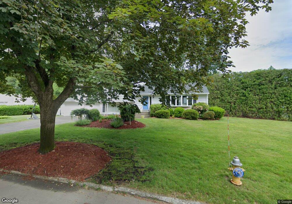
10 Jay Cir Fairfield, CT 06825
Fairfield Woods NeighborhoodEstimated Value: $754,000 - $838,000
3
Beds
3
Baths
1,560
Sq Ft
$511/Sq Ft
Est. Value
About This Home
This home is located at 10 Jay Cir, Fairfield, CT 06825 and is currently estimated at $797,451, approximately $511 per square foot. 10 Jay Cir is a home located in Fairfield County with nearby schools including Jennings Elementary School, Fairfield Woods Middle School, and Fairfield Warde High School.
Ownership History
Date
Name
Owned For
Owner Type
Purchase Details
Closed on
Aug 31, 2006
Sold by
Conner Charles J and Conner Emily G
Bought by
Robilotto Stephen J
Current Estimated Value
Home Financials for this Owner
Home Financials are based on the most recent Mortgage that was taken out on this home.
Original Mortgage
$305,000
Interest Rate
6.83%
Create a Home Valuation Report for This Property
The Home Valuation Report is an in-depth analysis detailing your home's value as well as a comparison with similar homes in the area
Home Values in the Area
Average Home Value in this Area
Purchase History
| Date | Buyer | Sale Price | Title Company |
|---|---|---|---|
| Robilotto Stephen J | $605,000 | -- | |
| Robilotto Stephen J | $605,000 | -- |
Source: Public Records
Mortgage History
| Date | Status | Borrower | Loan Amount |
|---|---|---|---|
| Open | Robilotto Stephen J | $287,500 | |
| Closed | Robilotto Stephen J | $50,000 | |
| Closed | Robilotto Stephen J | $304,600 | |
| Closed | Robilotto Stephen J | $305,000 |
Source: Public Records
Tax History Compared to Growth
Tax History
| Year | Tax Paid | Tax Assessment Tax Assessment Total Assessment is a certain percentage of the fair market value that is determined by local assessors to be the total taxable value of land and additions on the property. | Land | Improvement |
|---|---|---|---|---|
| 2025 | $9,805 | $345,380 | $241,430 | $103,950 |
| 2024 | $9,636 | $345,380 | $241,430 | $103,950 |
| 2023 | $9,501 | $345,380 | $241,430 | $103,950 |
| 2022 | $9,408 | $345,380 | $241,430 | $103,950 |
| 2021 | $9,318 | $345,380 | $241,430 | $103,950 |
| 2020 | $8,191 | $305,760 | $207,480 | $98,280 |
| 2019 | $8,191 | $305,760 | $207,480 | $98,280 |
| 2018 | $8,060 | $305,760 | $207,480 | $98,280 |
| 2017 | $7,895 | $305,760 | $207,480 | $98,280 |
| 2016 | $7,782 | $305,760 | $207,480 | $98,280 |
| 2015 | $7,637 | $308,070 | $218,400 | $89,670 |
| 2014 | $7,517 | $308,070 | $218,400 | $89,670 |
Source: Public Records
Map
Nearby Homes
- 31 High Ridge Rd
- 28 Stillson Place
- 210 Pansy Rd
- 706 Judd St
- 115 Mayfair Rd
- 79 Mayfair Rd
- 67 Campfield Dr
- 251 Winnepoge Dr
- 2107 N Benson Rd
- 1137 Stillson Rd
- 180 Oakwood Dr
- 41 Pepperbush Ln
- 1165 Stillson Rd
- 376 Knapps Hwy
- 342 Fairfield Woods Rd
- 359 Reid St
- 279 Knapps Hwy
- 1207 Stillson Rd
- 1335 Black Rock Turnpike
- 197 Vesper St
- 25 Jay Cir
- 111 Shelter Rock Rd
- 88 Shelter Rock Rd
- 38 Jay Cir
- 31 Shelter Rock Rd
- 40 Shelter Rock Rd
- 110 Shelter Rock Rd
- 57 Jay Cir
- 1380 Wood Ave
- 1340 Fairfield Woods Rd
- 132 Shelter Rock Rd
- 1400 Fairfield Woods Rd
- 47 Woodridge Ave
- 1318 Fairfield Woods Rd
- 57 Woodridge Ave
- 237 Steiner St
- 77 Woodridge Ave
- 1380 Fairfield Woods Rd
- 291 Steiner St
- 91 Woodridge Ave