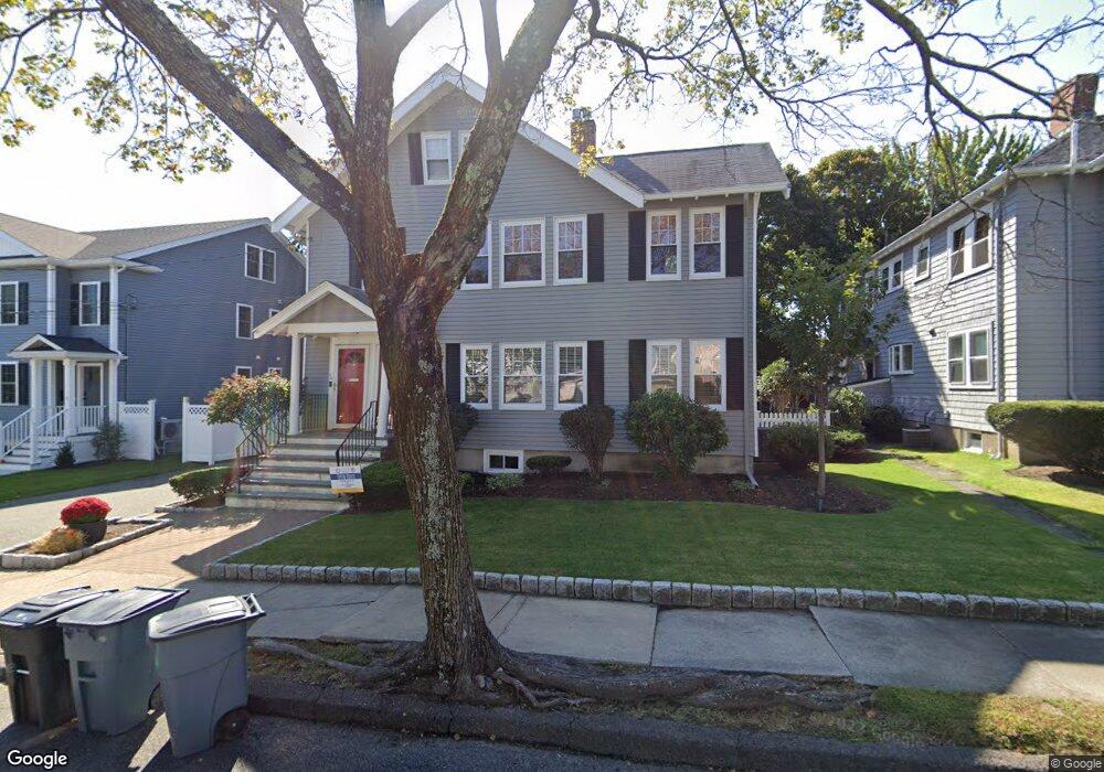
10 Johnson Rd Unit 12 Arlington, MA 02474
Arlington Center NeighborhoodEstimated Value: $1,520,000 - $1,815,000
5
Beds
4
Baths
3,821
Sq Ft
$453/Sq Ft
Est. Value
About This Home
This home is located at 10 Johnson Rd Unit 12, Arlington, MA 02474 and is currently estimated at $1,729,680, approximately $452 per square foot. 10 Johnson Rd Unit 12 is a home located in Middlesex County with nearby schools including Bishop Elementary School, Ottoson Middle School, and Arlington High School.
Ownership History
Date
Name
Owned For
Owner Type
Purchase Details
Closed on
Jul 28, 2000
Sold by
Toppi Lorraine A and Toppi William F
Bought by
Murphy Kathleen B and Mcenaney Doris B
Current Estimated Value
Home Financials for this Owner
Home Financials are based on the most recent Mortgage that was taken out on this home.
Original Mortgage
$350,000
Interest Rate
8.18%
Mortgage Type
Purchase Money Mortgage
Create a Home Valuation Report for This Property
The Home Valuation Report is an in-depth analysis detailing your home's value as well as a comparison with similar homes in the area
Home Values in the Area
Average Home Value in this Area
Purchase History
| Date | Buyer | Sale Price | Title Company |
|---|---|---|---|
| Murphy Kathleen B | $450,000 | -- |
Source: Public Records
Mortgage History
| Date | Status | Borrower | Loan Amount |
|---|---|---|---|
| Open | Murphy Kathleen B | $350,000 | |
| Closed | Murphy Kathleen B | $350,000 | |
| Previous Owner | Murphy Kathleen B | $127,000 | |
| Previous Owner | Murphy Kathleen B | $258,000 |
Source: Public Records
Tax History Compared to Growth
Tax History
| Year | Tax Paid | Tax Assessment Tax Assessment Total Assessment is a certain percentage of the fair market value that is determined by local assessors to be the total taxable value of land and additions on the property. | Land | Improvement |
|---|---|---|---|---|
| 2025 | $15,482 | $1,437,500 | $526,300 | $911,200 |
| 2024 | $13,960 | $1,318,200 | $489,600 | $828,600 |
| 2023 | $15,155 | $1,351,900 | $471,200 | $880,700 |
| 2022 | $14,865 | $1,301,700 | $428,400 | $873,300 |
| 2021 | $14,339 | $1,264,500 | $428,400 | $836,100 |
| 2020 | $13,988 | $1,264,700 | $428,400 | $836,300 |
| 2019 | $11,555 | $1,026,200 | $397,800 | $628,400 |
| 2018 | $12,448 | $1,026,200 | $397,800 | $628,400 |
| 2017 | $11,819 | $941,000 | $348,800 | $592,200 |
| 2016 | $10,519 | $821,800 | $318,200 | $503,600 |
| 2015 | $9,954 | $734,600 | $281,500 | $453,100 |
Source: Public Records
Map
Nearby Homes
- 3 Victoria Rd Unit 3
- 3 Victoria Rd Unit 5
- 97 Mystic St Unit B
- 7 Court Street Place Unit 7
- 7 Mill St Unit 7
- 167 Franklin St Unit 167
- 334 Mystic St
- 36 Churchill Ave Unit 1
- 335 Mystic St
- 41 Palmer St Unit 43
- 0 Jerome St Unit 72734260
- 52-56 Dudley St
- 10 Plymouth St Unit 10
- 975 Mass Ave Unit 106
- 975 Massachusetts Ave Unit 307
- 69 Arlington St
- 94 Rawson Rd Unit 94
- 37 Pine St
- 132 Rawson Rd Unit 132
- 995 Massachusetts Ave Unit 404
- 6 Johnson Rd Unit 6
- 68 Johnson Rd
- 8 Johnson Rd Unit 8
- 10-12 Johnson Rd
- 6 Brookdale Rd Unit 2
- 6 Brookdale Rd Unit 1
- 9 Johnson Rd Unit 11
- 7 Victoria Rd Unit 2
- 7 Victoria Rd Unit 1
- 4 Brookdale Rd
- 4 Brookdale Rd Unit 2
- 5 Johnson Rd
- 2 Brookdale Rd
- 2 Brookdale Rd Unit 1
- 29 Summer St
- 57 Johnson Rd
- 35 Summer St Unit 37
- 15 Johnson Rd
- 15 Johnson Rd Unit 2
- 7 Johnson Rd Unit 7