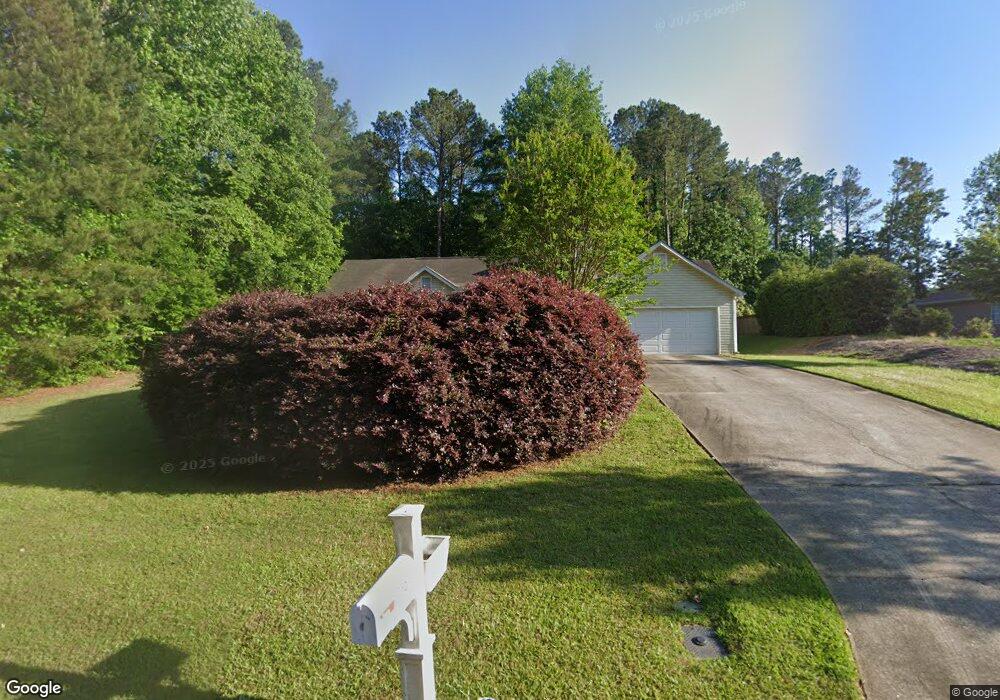
10 Kates Bridge Newnan, GA 30263
Estimated Value: $289,788 - $334,000
3
Beds
2
Baths
1,353
Sq Ft
$229/Sq Ft
Est. Value
About This Home
This home is located at 10 Kates Bridge, Newnan, GA 30263 and is currently estimated at $309,447, approximately $228 per square foot. 10 Kates Bridge is a home located in Coweta County with nearby schools including Northside Elementary School, Madras Middle School, and Newnan High School.
Ownership History
Date
Name
Owned For
Owner Type
Purchase Details
Closed on
Mar 16, 2007
Sold by
Auman Patricia L and Auman A
Bought by
Auman Patricia L
Current Estimated Value
Purchase Details
Closed on
May 30, 1997
Sold by
Heartland Properties
Bought by
Auman Patricia L and Auman Arthur J
Home Financials for this Owner
Home Financials are based on the most recent Mortgage that was taken out on this home.
Original Mortgage
$96,483
Interest Rate
8.13%
Mortgage Type
FHA
Purchase Details
Closed on
Nov 8, 1996
Bought by
Heartland Properties
Purchase Details
Closed on
Mar 21, 1995
Bought by
The Player Group Inc
Purchase Details
Closed on
Nov 30, 1994
Bought by
Bell Larmar A and Bell Esth
Purchase Details
Closed on
Nov 18, 1994
Bought by
East Coast Trading C
Create a Home Valuation Report for This Property
The Home Valuation Report is an in-depth analysis detailing your home's value as well as a comparison with similar homes in the area
Home Values in the Area
Average Home Value in this Area
Purchase History
| Date | Buyer | Sale Price | Title Company |
|---|---|---|---|
| Auman Patricia L | -- | -- | |
| Auman Patricia L | $98,800 | -- | |
| Heartland Properties | $365,200 | -- | |
| The Player Group Inc | $184,100 | -- | |
| Bell Larmar A | $1,110,200 | -- | |
| East Coast Trading C | $2,145,000 | -- |
Source: Public Records
Mortgage History
| Date | Status | Borrower | Loan Amount |
|---|---|---|---|
| Previous Owner | Auman Patricia L | $96,483 |
Source: Public Records
Tax History Compared to Growth
Tax History
| Year | Tax Paid | Tax Assessment Tax Assessment Total Assessment is a certain percentage of the fair market value that is determined by local assessors to be the total taxable value of land and additions on the property. | Land | Improvement |
|---|---|---|---|---|
| 2024 | $2,083 | $92,266 | $26,000 | $66,266 |
| 2023 | $2,083 | $95,772 | $22,000 | $73,772 |
| 2022 | $1,870 | $78,670 | $22,000 | $56,670 |
| 2021 | $1,581 | $62,920 | $18,000 | $44,920 |
| 2020 | $1,590 | $62,920 | $18,000 | $44,920 |
| 2019 | $1,443 | $52,482 | $10,000 | $42,482 |
| 2018 | $1,447 | $52,482 | $10,000 | $42,482 |
| 2017 | $1,446 | $52,482 | $10,000 | $42,482 |
| 2016 | $1,432 | $52,482 | $10,000 | $42,482 |
| 2015 | $1,287 | $48,124 | $10,000 | $38,124 |
| 2014 | $1,279 | $48,124 | $10,000 | $38,124 |
Source: Public Records
Map
Nearby Homes
- 252 Happy Valley Cir
- 34 Maggie Place
- 894 Happy Valley Cir
- 264 Kendall St
- 237 Kory Dr
- 64 Redwine Overlook
- 72 W Cove Dr
- 440 Kory Dr
- 132 Haven Ridge
- 50 Peninsula Cir
- 285 Peninsula Cir
- 7 Harris Ct
- 90 Westwind Dr
- 10 Cove Dr
- 44 Fendley Trace
- 25 The Terrace
- 571 Kory Dr
- 14 W Shore Ct
- 212 Westwind Dr
- 100 Bay Dr
- 532 Happy Valley Cir Unit A
- 20 Kates Bridge
- 5 Kates Bridge
- 522 Happy Valley Cir
- 10 Lyndseys Pass
- 15 Kates Bridge
- 20 Lyndseys Pass
- 25 Kates Bridge
- 500 Happy Valley Cir
- 573 Happy Valley Cir
- 5 Wrens Nest
- 30 Lyndseys Pass
- 586 Happy Valley Cir
- 0 Lyndseys Pass Unit 3227154
- 0 Lyndseys Pass
- 0 Wrens Nest Unit 7228496
- 0 Wrens Nest Unit 7245707
- 0 Wrens Nest
- 15 Wrens Nest
- 35 Lyndseys Pass Unit 10